**An Arctic front arrives on Sunday...much colder early next week...big-time warmup begins late next week/weekend with a taste of spring on the way**
Paul Dorian

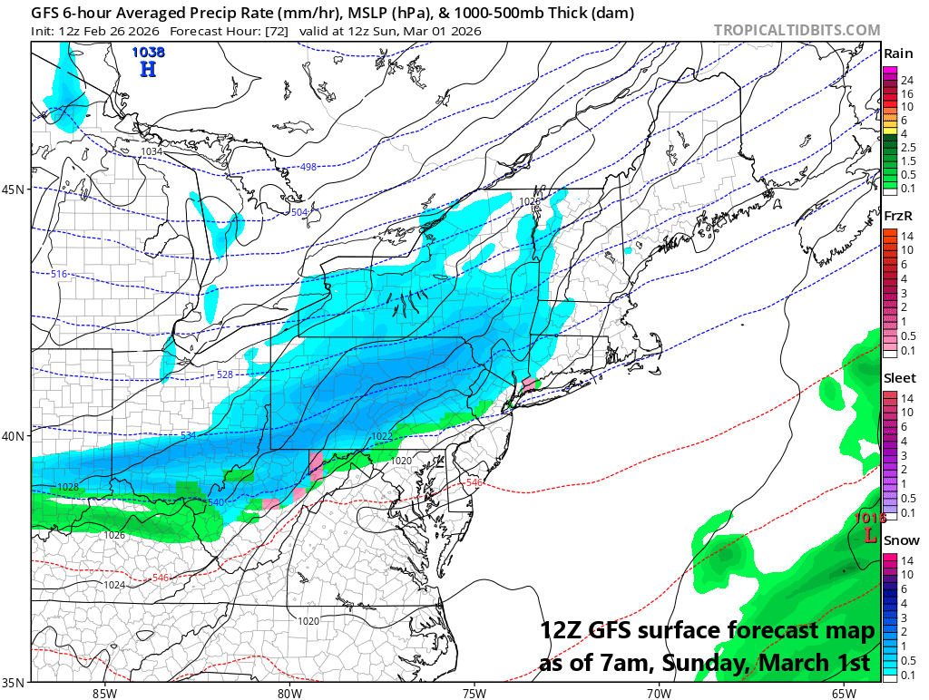
A strong Arctic cold front arrives in the Mid-Atlantic region on Sunday and it may be accompanied by snow shower activity; especially, in areas to the north of the PA/MD border. After a very mild Saturday, temperatures will begin to trend downward on Sunday, and by the time Monday rolls around, Arctic air will be fully entrenched in the Mid-Atlantic region. Map courtesy NOAA, tropicaltidbits.com
Overview
An active weather pattern brought a clipper system to the north of the Mid-Atlantic on Wednesday and another low-pressure is sliding to the south of the region today with little or no impact. A strong Arctic cold front will arrive in the Mid-Atlantic region on Sunday, and it can produce some snow shower activity; especially, to the north of the PA/MD border. Weak low-pressure will push into the Mid-Atlantic region on Monday and it could produce some snow with fresh Arctic air in place. Yet another low pressure could quickly follow on Monday night and Tuesday with some rain, ice and/or snow possible. Once that early week Arctic air mass retreats to the north, a big-time warmup should begin late next week/weekend in the Mid-Atlantic region with a taste of spring on the way.
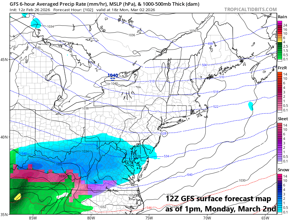
Weak low pressure heads to the Mid-Atlantic region on Monday and with Arctic air in place, any precipitation from this system is very likely to be in the form of snow. Map courtesy NOAA, tropicaltidbits.com
Next Arctic front arrives on Sunday…much colder early next week
It’ll turn slightly milder on Friday in the Mid-Atlantic region and then noticeably milder on Saturday ahead of the next strong cold front. This next cold front should come through on Sunday – potentially with some snow shower activity especially across the northern Mid-Atlantic region – and it’ll usher in a fresh Arctic air mass for the early part of next week. By Monday, weak low-pressure will push eastward towards the Mid-Atlantic region and with Arctic air in place, any precipitation associated with this system is likely to be in the form of snow, but a significant amount is not expected. Another low pressure system may quickly follow on Monday night and Tuesday and it can produce some rain, ice and/or snow in the region.
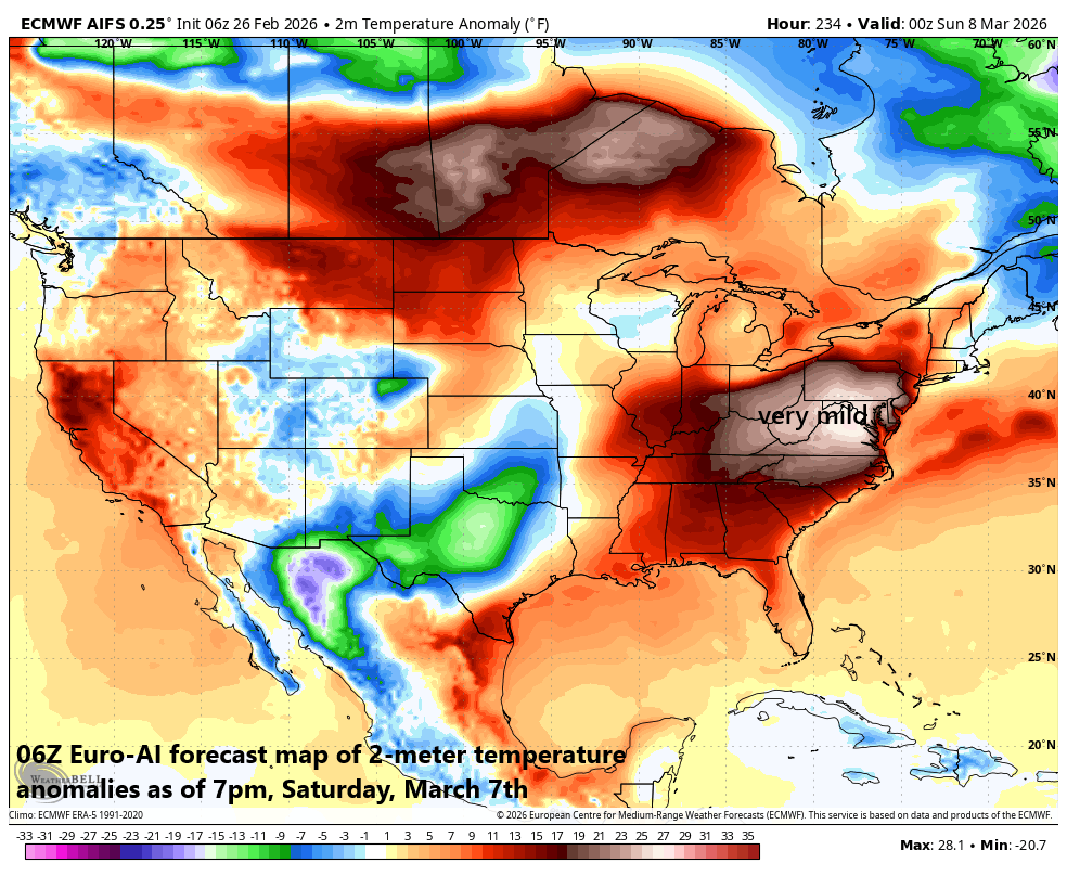
A big-time warm up is coming to the northeastern states…at least it looks that way from this vantage point (many prior attempts have failed). In fact, the warm-up that is likely to begin late next week may intensify dramatically during the weekend of the 7th and 8th with 70+ degree temperatures on the table in some areas (unless a dreaded backdoor cold front ruins the day). Map courtesy ECMWF, Weather Bell
Big-time warmup on the way
By later next week, the Arctic air mass will have fully retreated to the north, and this will open the door for much milder air in the middle of the country to push to the northeastern states. A big-time warmup should begin late next week and weekend, and it could last well into the second week of March with a taste of spring. The one caveat this time of year will be the possibility of the dreaded backdoor cold front which could change a warm outlook in hurry across the northeastern part of the country.
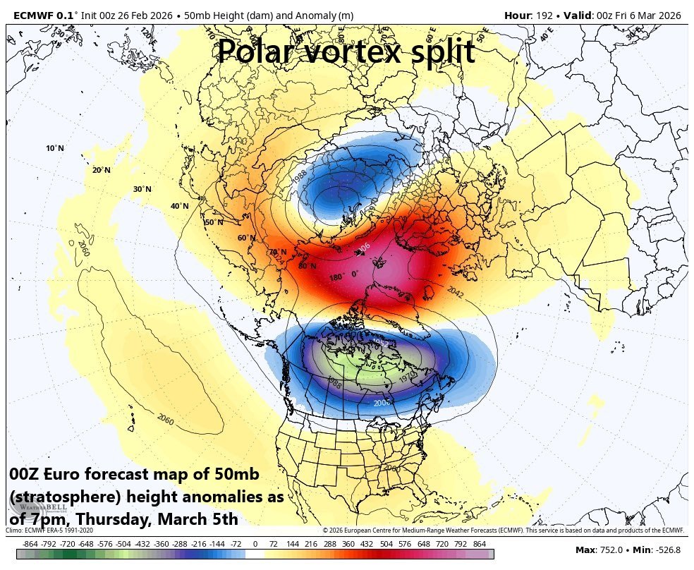
A stratospheric polar vortex split is likely to take place later next week with one piece headed to the North American side of the North Pole and a second part re-positioned to over Asian continent. Map courtesy ECMWF, Weather Bell
Stratospheric polar vortex split
Looking ahead to the middle of March and beyond, we’ll have to watch for possible implications of a stratospheric polar vortex split that likely takes place later next week. This could have an impact on the overall temperature pattern in the eastern states as recent events of this nature resulted in a general colder-than-normal period from the middle of March to early April...we’ll just have to wait and see how this one plays out.
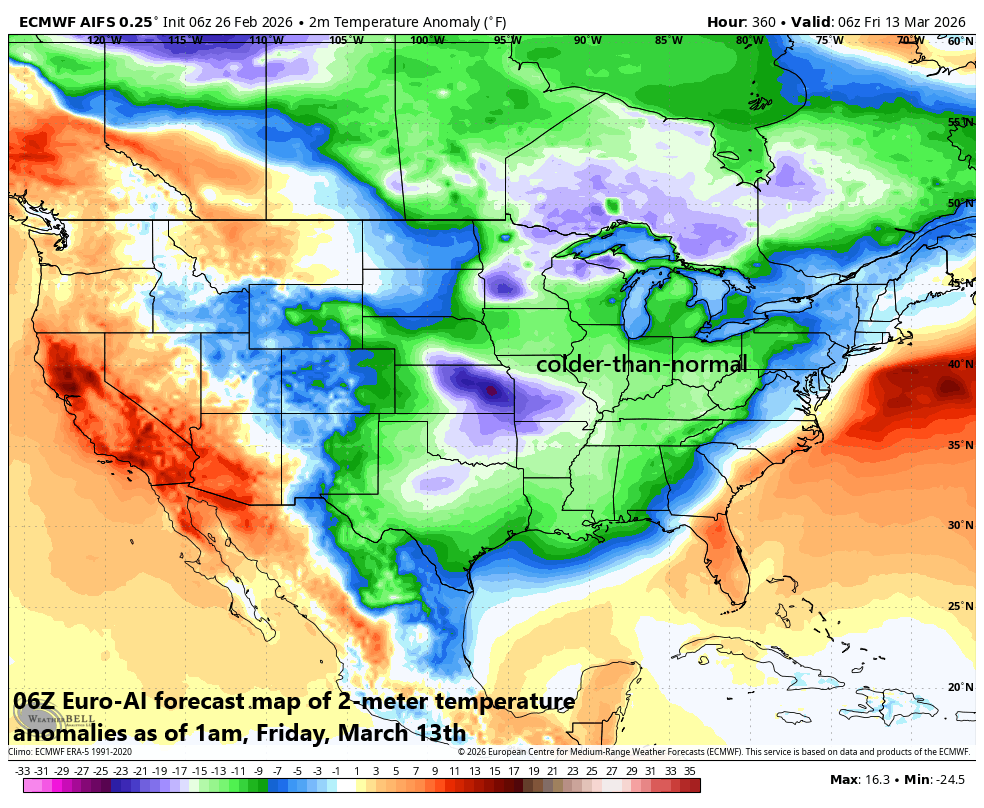
After a big-time warmup in the eastern states, there is the chance for a return to colder-than-normal conditions by the middle of March. If this were indeed to take place, a major contributing factor could be the stratospheric polar vortex split that is likely to take place later next week with downstream implications to the overall temperature pattern. Map courtesy ECMWF, Weather Bell
Meteorologist Paul Dorian
Arcfield
arcfieldweather.com
Follow us on Facebook, Twitter, YouTube
Video discussion: