
**Finally, a moderation in temperatures...monitoring yet another late weekend storm threat for the Mid-Atlantic region**
Paul Dorian
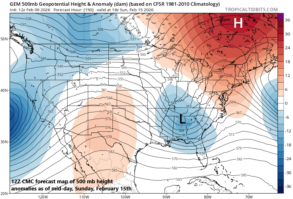
A key player in the upper part of the atmosphere by the weekend will be strong high pressure ridging centered over the Hudson Bay region of Canada (shown in orange; upper right). This system will influence the ultimate track of a low pressure system that will pull out of the south-central states and eventually end up near the eastern seaboard by the end of the weekend. Map courtesy Canadian Met Centre, tropicaltidbits.com
Overview
The polar jet has dominated the scene in recent weeks typically extending all the way from western Canada into the northeastern US, but the sub-tropical jet is starting to show some life. This change in the overall weather pattern raises the prospects for moderation in temperatures across the northeastern states, some well-needed precipitation across many of the western states, and for the formation of storm systems that take a southern route across the southern states. By mid-week, a storm will head into California with some rainfall in low-lying areas and snow for mountainous areas, and then this low pressure system will re-emerge over the south-central states by the early part of the weekend...all of which will be aided by an activated sub-tropical jet stream.
The southern storm system will take a turn to the northeast later in the weekend and head towards the Ohio Valley, but it will become increasingly influenced by strong ridging centered over the Hudson Bay region of Canada. As such, the northward progression of the surface low will grind to a halt over the Ohio Valley and the action will shift to the east so that by the end of the weekend, strong low pressure is liable to be located somewhere near the eastern seaboard. Temperatures may be borderline later this weekend in the I-95 corridor so this region could become a “battle zone” with respect to precipitation type with snow favored to the north and west and rain to the south and east.
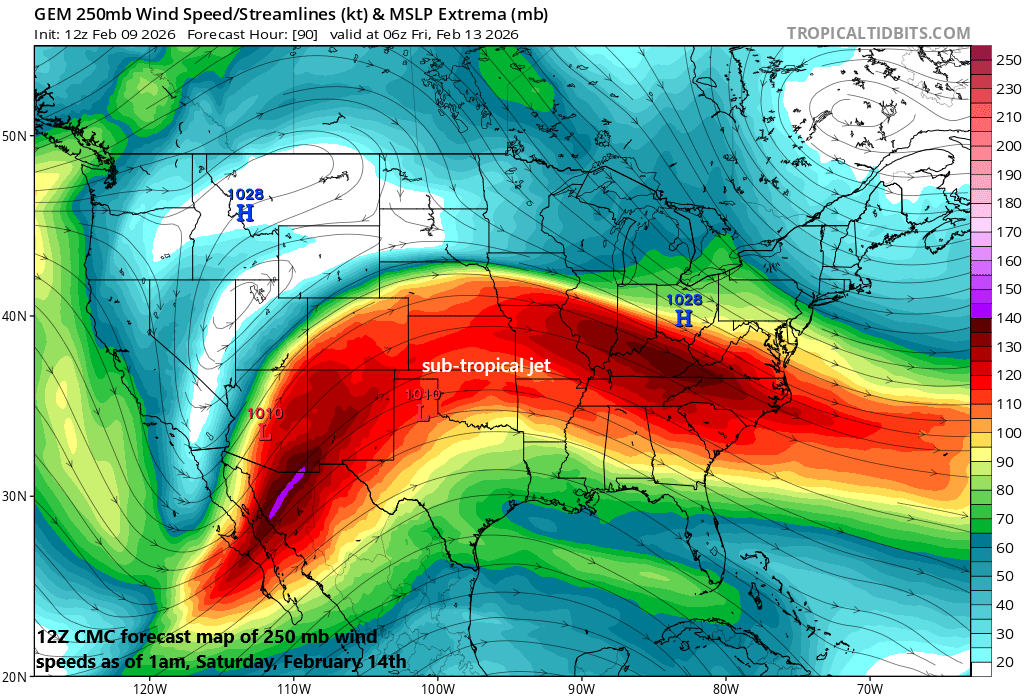
The polar jet has dominated the scene across North America in recent weeks, but the sub-tropical jet is coming to life as La Nina fades across the equatorial part of the Pacific. In fact, a storm system will ride along the sub-tropical jet stream during this week first impacting California at mid-week and then likely the Mid-Atlantic region by the latter part of the upcoming weekend. Map courtesy Canadian Met Centre, tropicaltidbits.com
Details
Temperatures will moderate some in the Mid-Atlantic region on Tuesday, but a couple of cold frontal passages at mid-week will ensure that the second half of the week and upcoming weekend remain on the chilly side for this time of year though not extreme as just experienced this past weekend. Meanwhile, the mid-week will feature low pressure heading into California with some much-needed rainfall and snow in the higher elevations and then this system should re-emerge over the south-central states by the beginning of the upcoming weekend. The moderation in temperatures this week across the northeastern states is one by-product of a changing weather pattern with an activation of the sub-tropical jet and relaxation of the polar jet…and it may turn even warmer next week.
Low pressure will pull out of the south-central states this weekend and make a move to the northeast and into the Ohio Valley. However, it is at this time that the low will become increasingly influenced by strong ridging aloft centered near the Hudson Bay region of Canada. The result is likely to be a turn to the east by the low pressure system, ultimately leading to a strong storm somewhere near the eastern seaboard by the latter part of the upcoming weekend. Map courtesy Canadian Met Centre, tropicaltidbits.com
In the upper part of the atmosphere, high pressure will dominate the scene over Canada as we approach the end of the week and weekend, and this “high latitude blocking” setup will play a big role in the ultimate track of the southern US storm system. Low pressure will push out of the south-central states on Saturday and head in a northeastward direction towards the Ohio Valley. It is at this point that the low-pressure system will become increasingly influenced by strong ridging centered over the Hudson Bay region of Canada and this “high-latitude blocking” will likely result in the low-pressure system turning to the east and ultimately intensifying somewhere near the eastern seaboard by later Sunday.
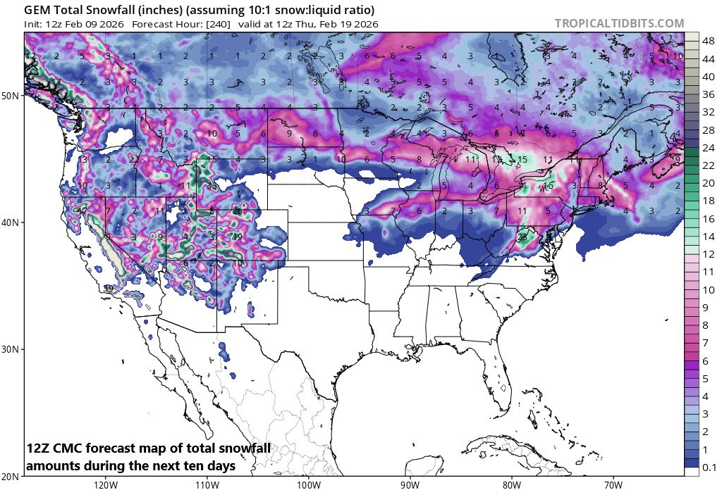
The western states have largely missed out on snowfall in recent weeks, but a change in the overall pattern will bring significant snow during the next ten days from the Sierra Nevada Mountains of eastern California to the Colorado Rockies. Meanwhile, back to the east, there can be some accumulating snow during the latter half of the upcoming weekend; especially, in the higher elevation locations to the north and west of Route I-95. Map courtesy Canadian Met Centre, tropicaltidbits.com
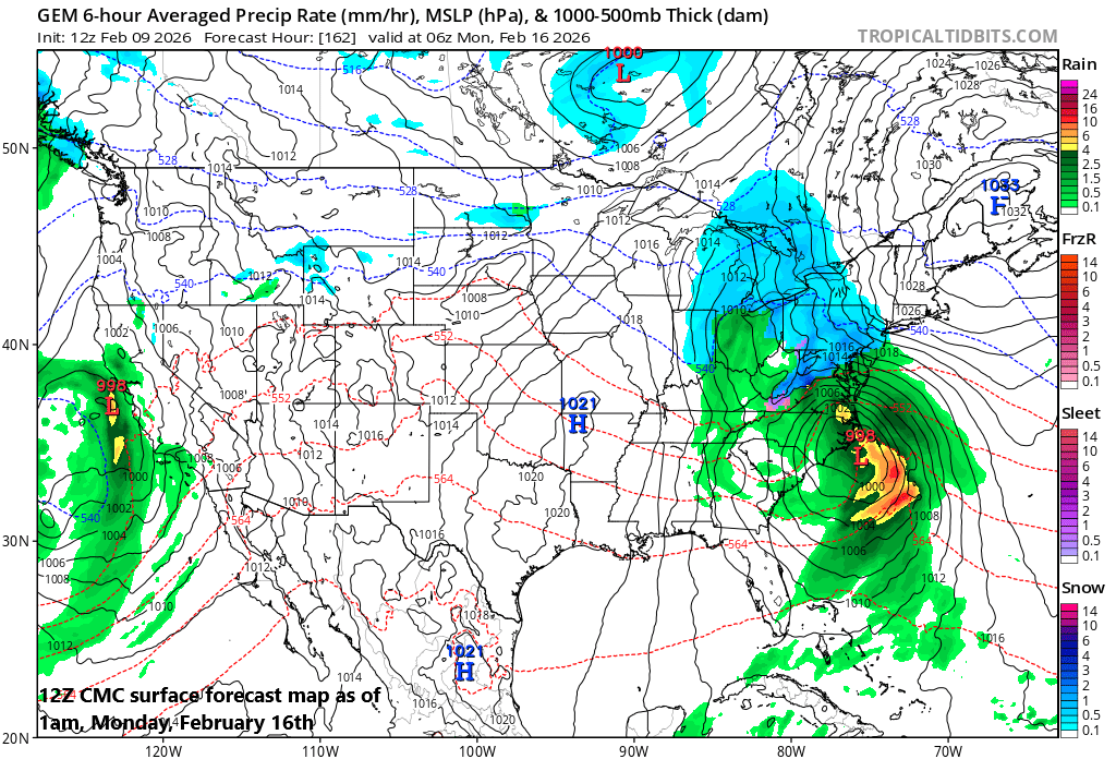
This “Miller B” type of storm track in which an initial low-pressure system heads towards the Ohio Valley and then transfers to the east coast often comes with mixed precipitation in the immediate I-95 corridor region with snow more likely on the northwest side and rain to the south and east. It is way too early to determine the amount of frozen precipitation that could fall on Sunday/Monday in the DC-to-Philly-to-NYC corridor, but certainly some accumulations of snow and/or ice are on the table, and some plain rain cannot be ruled out either....so stay tuned...yet another weekend storm threat to monitor for the Mid-Atlantic region despite the moderation of temperatures.
Meteorologist Paul Dorian
Arcfield
arcfieldweather.com
Follow us on Facebook, Twitter, YouTube
Video discussion: