
****Intense storm system to have an impact on a large part of the nation ranging from blizzard conditions to severe weather...unusually high risk of severe weather on Monday in the Mid-Atlantic****
Paul Dorian
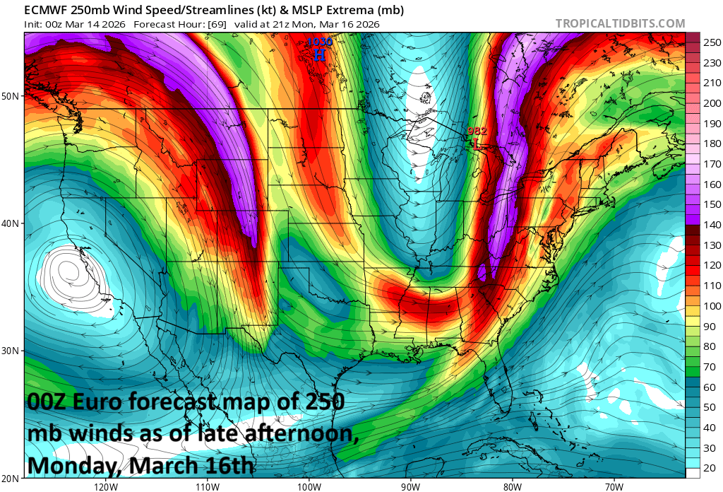
A vigorous upper-level jet will enhance upward motion later Monday in the Mid-Atlantic region leading to the good chance for severe weather and this will include a risk of tornadic activity. Map courtesy ECMWF, tropicaltidbits.com
Overview
An intense storm system will develop later this weekend, and it will have an impact over a large part of the nation in the Sunday/Monday/Tuesday time period ranging from blizzard conditions to severe weather including the risk of tornadoes. The risk of severe weather in the Mid-Atlantic region will be unusually high from Monday into Monday night. The heaviest snow band is likely to extend from Minnesota to Wisconsin to the upper part of Michigan where 1-2 feet can fall and the severe weather threat will exist on Sunday/Sunday night across the MS, TN, Ohio Valleys and then shift east on Monday/Monday night from the Mid-Atlantic region to the Carolinas. Arctic air with well below-normal temperatures will pour into the northeastern states by Tuesday and lake-effect snow bands are likely to set up just downstream of the Great Lakes.
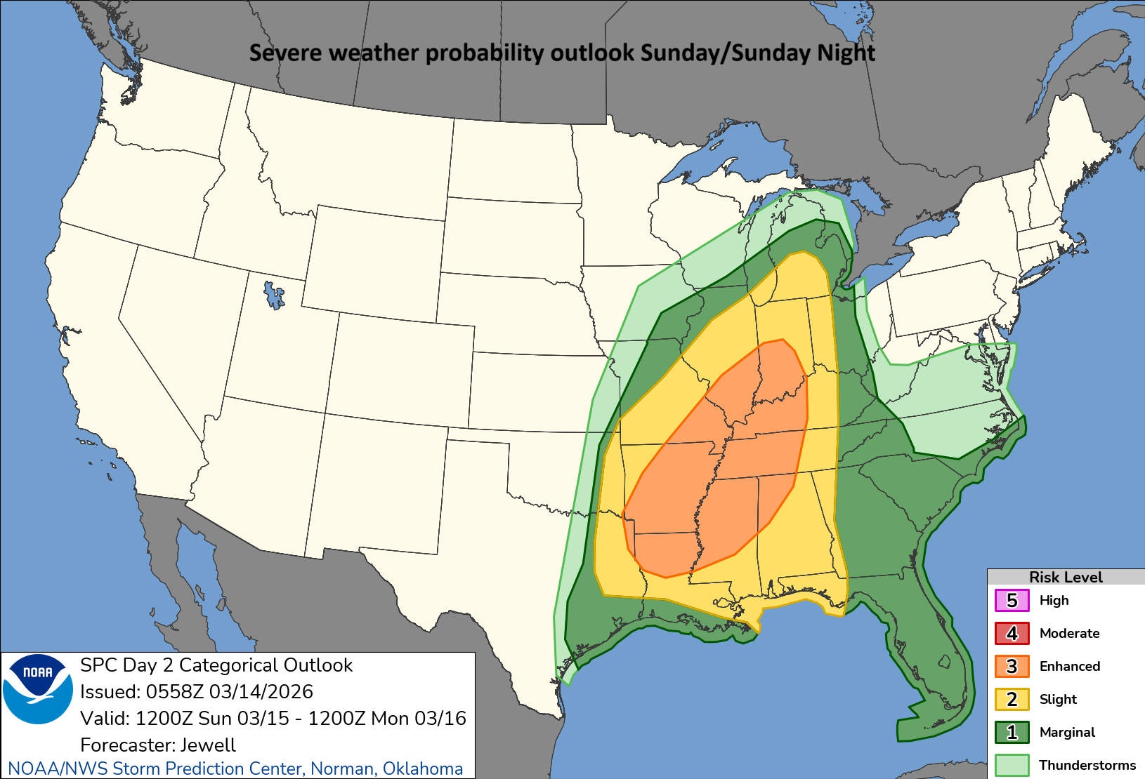
There is an enhanced risk of severe weather later Sunday and Sunday night across much of the Mississippi Valley and portions of the Tennessee and Ohio Valleys. Map courtesy NOAA/SPC
Details
Numerous ingredients including a strong surface cold front will come together by the end of the weekend for surface low pressure to intensify dramatically, and by early Monday, an intense storm will be located over Michigan with blizzard conditions in its cold sector to the north and west of the center. Snow will be heavy in places like Minnesota, Wisconsin and the upper part of Michigan and the winds will be powerful in those areas as well thanks to a very tight pressure gradient…true blizzard conditions.
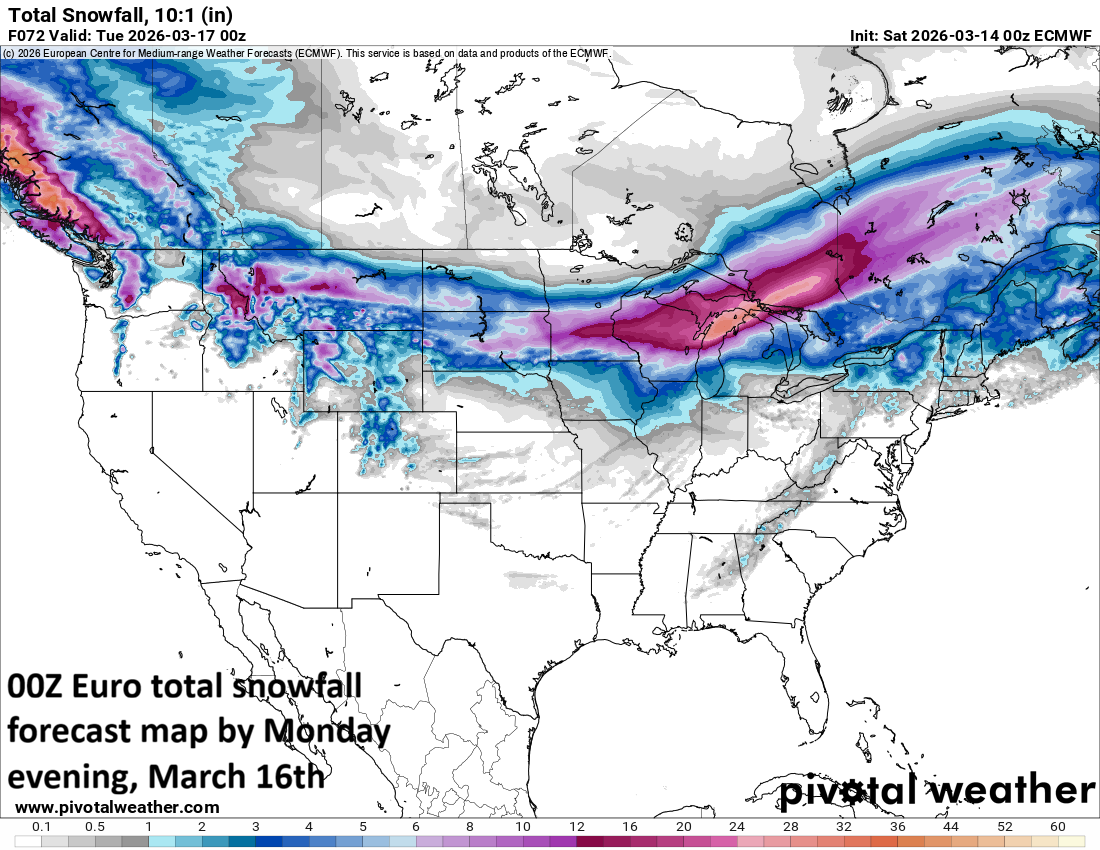
Substantial snow is likely to fall from Sunday night into Monday across the region from Minnesota to Wisconsin to the upper part of Michigan. Map courtesy ECMWF, Pivotal Weather
On the front side of an incoming Arctic front, severe weather will be an enhanced risk later Sunday and Sunday night with warm, humid air in place and much colder-than-normal spreading to the south and east. Combine this clash of temperatures will strong upper-level jet streaks, vorticity, and the stage will be set for an unstable atmosphere…one that can produce severe weather including the risk of numerous tornadoes.
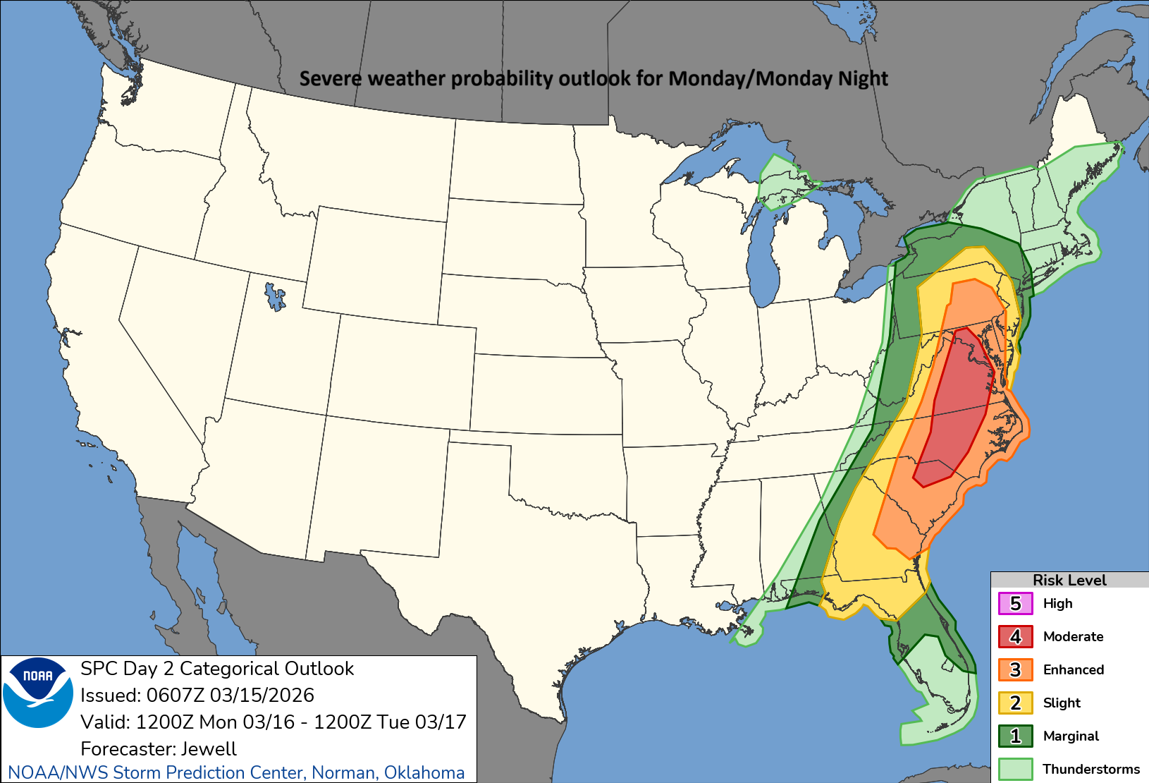
A “moderate” risk of severe weather is in place for Monday in the zone from the Mid-Atlantic to the Carolinas and this is unusually high in cities such as Washington, D.C., Baltimore, and Philadelphia. Map courtesy NOAA/SPC
By late Sunday night and early Monday, the frontal boundary zone will slide east and winds will become very strong ahead of the front from a southerly direction across the eastern states…pumping in very mild and humid air. Rain can come down heavy at times on Sunday night and Monday and there is an enhanced risk for severe thunderstorm development during Monday all the way from the Mid-Atlantic region to the Carolinas. This severe weather risk will contain the risk of damaging wind gusts and tornadic activity is certainly on the table, including in the big cities along the I-95 corridor.
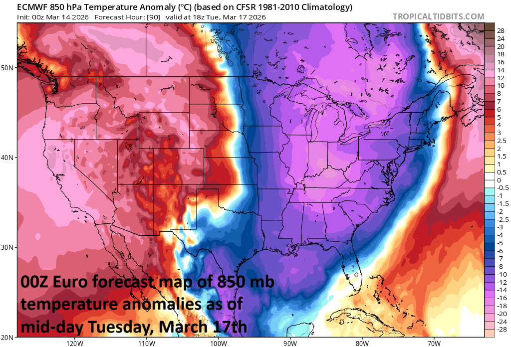
Arctic air will pour into the Mid-Atlantic region and Northeast US by Tuesday with temperatures far below-normal for this time of year. Map courtesy ECMWF, tropicaltidbits.com
On Monday night and Tuesday, Arctic cold will pour into the Mid-Atlantic region and Northeast US and temperatures will be way below-normal for this time of year. As with the passage of the last strong cold front, some areas will see a changeover to snow as the cold air arrives; especially, across interior higher elevation locations of the northeastern states (e.g., upstate PA, upstate NY). During the day on Tuesday, the Great Lakes snow machine will get turned on and lake-effect snow bands are likely to impact many areas just downstream of the lakes and a few snow showers can make their way into the I-95 corridor. The below-normal chill will stick around through the middle of next week and then milder weather returns by week’s end, but there may be some suffering to get through before we get to that point in time.
Meteorologist Paul Dorian
Arcfield
arcfieldweather.com
Follow us on Facebook, Twitter, YouTube
Video discussion: