
*Cool and unsettled weather dominates this week across the northeastern states...overall pattern flips by early next week with 90+ degrees on the table for Sunday, Monday and Tuesday*
Paul Dorian
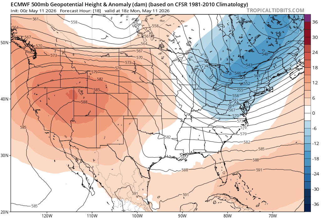
Upper-level trough will dominate the scene this week across the northeastern states, but it will be replaced by high-pressure ridging by early next week. In fact, the ridge is likely to intensify markedly early next week and this, in turn, can produce 90+ degrees in portions of the I-95 corridor. Maps courtesy ECMWF, tropcialtidbits.com
Overview
Much of the week ahead will be rather cool and unsettled across the northeastern part of the nation with a persistent upper-level trough of low pressure sitting nearby. This upper air pattern will keep temperatures generally suppressed to below-normal levels in the Great Lakes, Mid-Atlantic and Northeast US and there will be a shower threat from time-to-time. By the weekend, important changes will take place as the upper-level trough over the northeastern US retreats off to the northeast and an upper-level ridge of high pressure edges its way into the area from the western states. This ridge will intensify early next week, and the result could be 90+ degrees in the Sunday/Monday/Tuesday time period in places along the I-95 corridor. Looking beyond, it appears that the big-time warm up early next week will not last too much longer as a frontal system next mid-week is likely to return temperatures to more seasonal levels.
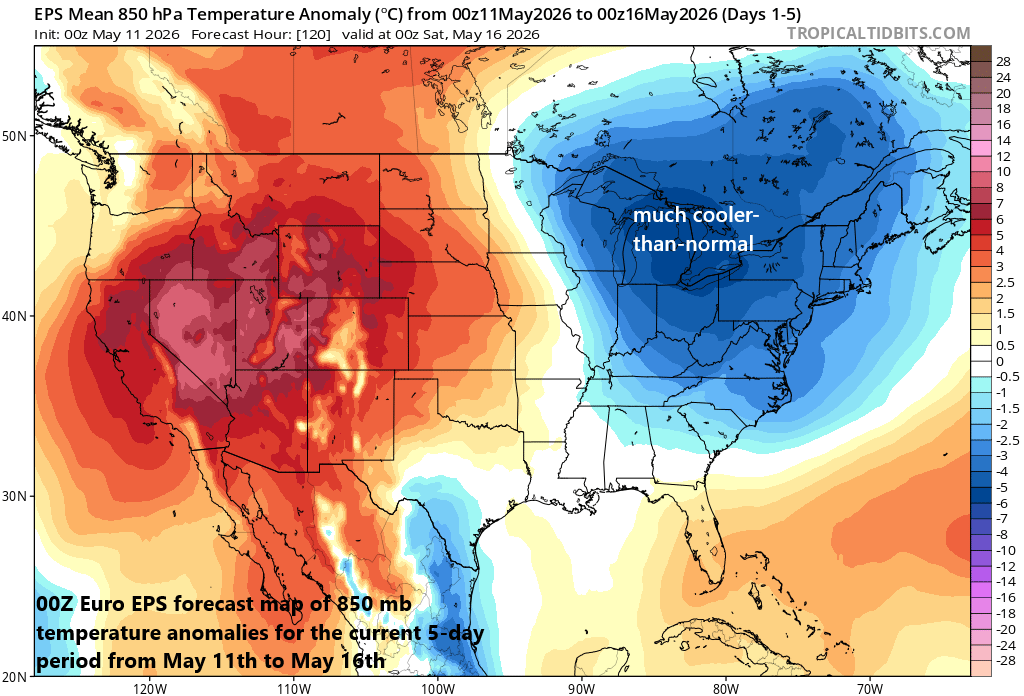
The current 5-day period will feature an upper-level trough over the northeastern part of the nation and generally cooler-than-normal temperatures in the Great Lakes, Mid-Atlantic and Northeast US. Map courtesy ECMWF, tropicaltidbits.com
Details
The week begins with an upper-level trough of low pressure centered over the Northeast US and a surface front is producing showers across the southern Mid-Atlantic region. This trough will retreat to the north and east on Tuesday allowing for a nice day across the area, but a second upper-level low pressure system will quickly follow at mid-week bringing another batch of showers and generally cooler-than-normal temperatures. This second upper-level trough will stick around in the Northeast US into the late week, but then it’ll retreat to the northeast this weekend as high-pressure ridging builds into the area. This upper-level ridge is currently stuck over the western states, but a pattern change will not only allow for it to push eastward, but it’ll also intensify early next week.
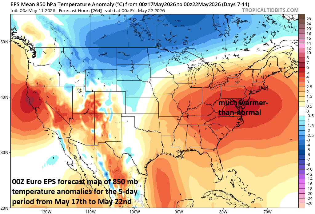
The 5-day period from Sunday, May 17th to May 22nd will feature an upper-level ridge over the northeastern part of the nation and generally warmer-than-normal temperatures in the Great Lakes, Mid-Atlantic and Northeast US. In some places, 90+ degrees will be on the table for afternoon highs in the Sunday, Monday, Tuesday time frame including along the I-95 corridor from D.C. to Baltimore to Philly. Map courtesy ECMWF, tropicaltidbits.com
As a result of the intensifying upper-level ridge, temperatures in the northeastern part of the nation will climb noticeably on Saturday with 80+ degrees likely in places like Washington, D.C. Temperatures will then soar in the Sunday/Monday/Tuesday time period of next week with 90+ degrees on the table across much of the I-95 corridor....well above normal for mid-May. Looking ahead, it appears that this big-time warmup will be a 3-day affair, but then likely come to an end in the middle of next week as a frontal system passes through the eastern states and brings more seasonal temperatures. The cold front could be quite an active system during the middle of next week with strong thunderstorms a possibility.
Meteorologist Paul Dorian
Arcfield
arcfieldweather.com
Follow us on Facebook, Twitter, YouTube
Video discussion: