***Severe weather/heavy rain threat for the Mid-Atlantic region...damaging wind gusts, downpours, localized flash flooding, isolated tornadoes on the table***
Paul Dorian
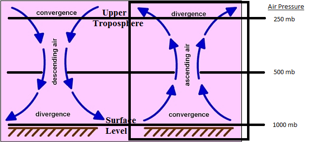
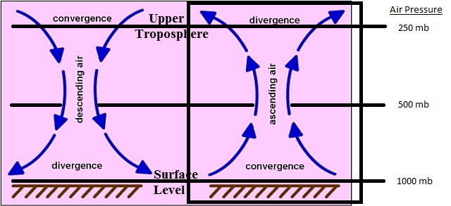
The right part of the plot indicates the environment expected later today in the Mid-Atlantic region with “diffluence” aloft and “confluence” in lower levels of the atmosphere all of which will enhance upward motion leading to the risk of severe thunderstorm activity.
Overview
There is high risk of severe weather later today in the Mid-Atlantic region as several ingredients come together to enhance upward motion and destabilize the atmosphere. There were some showers around earlier today, but the late afternoon and evening hours will present the greatest risk for the severe weather. The primary hazards on the table include damaging wind gusts and heavy rainfall, but isolated tornadoes cannot be ruled out. Showers and thunderstorms can linger on Wednesday; especially, along and to the south and east of the I-95 corridor as the cold front pushes towards the eastern seaboard. Refreshing air will follow the frontal passage on Wednesday night and great weather is destined for the Mid-Atlantic region on Thursday and Friday.
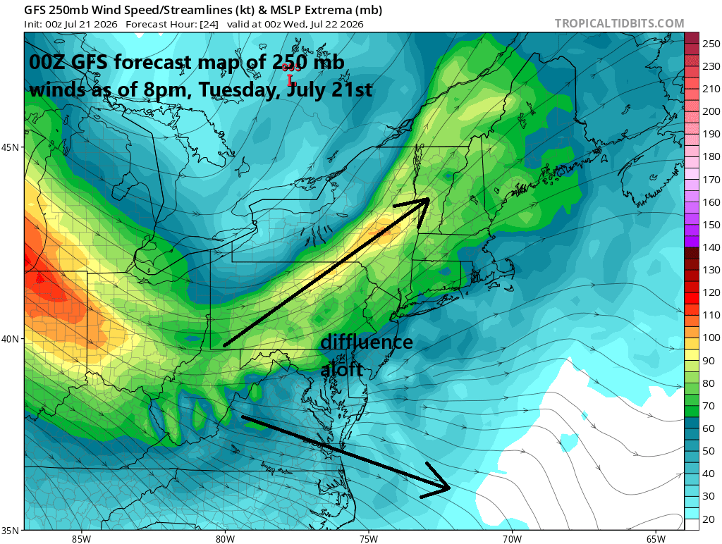
An upper-level jet streak will set the stage for severe weather later today as it helps to enhance upward motion and destabilize the atmosphere. Map courtesy NOAA< tropicaltidbits.com
Severe weather/heavy rain threat later today/early tonight
Several ingredients are coming together to bring us the risk of severe weather later today and early tonight including an impressive upper-level jet streak that is pushing across the northern states. This jet stream will result in a “diffluent” flow of air over the Mid-Atlantic region which will be balanced by “confluence” in the lower levels of the atmosphere...all of which will enhance upward motion and destabilize the atmosphere.
In addition to the jet streak, an upper-level trough of low pressure will slide into the northeastern US, and a surface cold front will head towards the region with low-level moisture amounts rising sharply on its front side. Dew point temperatures – a true measure of overall atmospheric moisture – were in the 50’s on Monday but have climbed dramatically into the 70’s today indicative of a substantial increase in overall moisture levels.
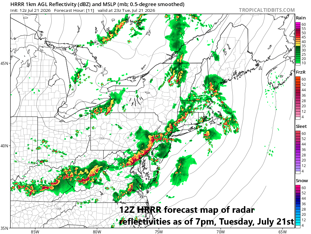
The greatest chance for severe thunderstorm activity in the Mid-Atlantic region will likely come in the 3pm-9pm time period as a cold front slowly works its way towards the coast. Map courtesy NOAA, tropicaltidbits.com
As with the weekend severe weather event, there will be multiple rounds of showers and thunderstorms including one that took place in eastern parts of the area during the early morning hours. Activity in the late afternoon and evening hours will likely be more widespread and appears to pose the greatest risk of severe weather with the primary hazard being damaging wind gusts and isolated tornadoes are on the table. There were hundreds of damaging wind gusts on Saturday in the Mid-Atlantic; hopefully, we won’t have a repeat performance, but that risk is on the table. As far as heavy rainfall is concerned, given the rapid rise in low-level moisture (as indicated by dew point increase), the threat of downpours will be there and localized flash flooding cannot be ruled out.
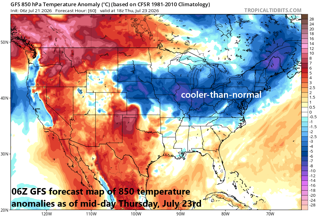
A refreshing air mass for late July will arrive on Wednesday night in the Mid-Atlantic region and great weather is in store for Thursday and Friday. Map courtesy NOAA, tropicaltidbits.com
Showers/storms linger on Wednesday...refreshing air mass to follow
Showers and thunderstorms could linger on Wednesday; especially, along and to the south and east of the I-95 corridor as the cold front inches towards the east coast. In fact, severe thunderstorm activity is quite possible later tomorrow in the region from the southeast side of DC to the southern half of the Delmarva Peninsula. By tomorrow night, the cold front should push off the eastern seaboard, and a refreshing air mass will arrive in the Mid-Atlantic region and last into the upcoming weekend. Temperatures should be in the comfortable range on Thursday and Friday, dew points as well, and overnight lows can bottom out in the 50’s in many spots later in the week...something to look forward to, but there may be a price to pay before we get there.
Meteorologist Paul Dorian
Arcfield
arcfieldweather.com
Follow us on Facebook, Twitter, YouTube
Video discussion: