****Volatile pattern to lead to severe storms/heavy rainfall in the Mid-Atlantic region during the next couple of days****
Paul Dorian
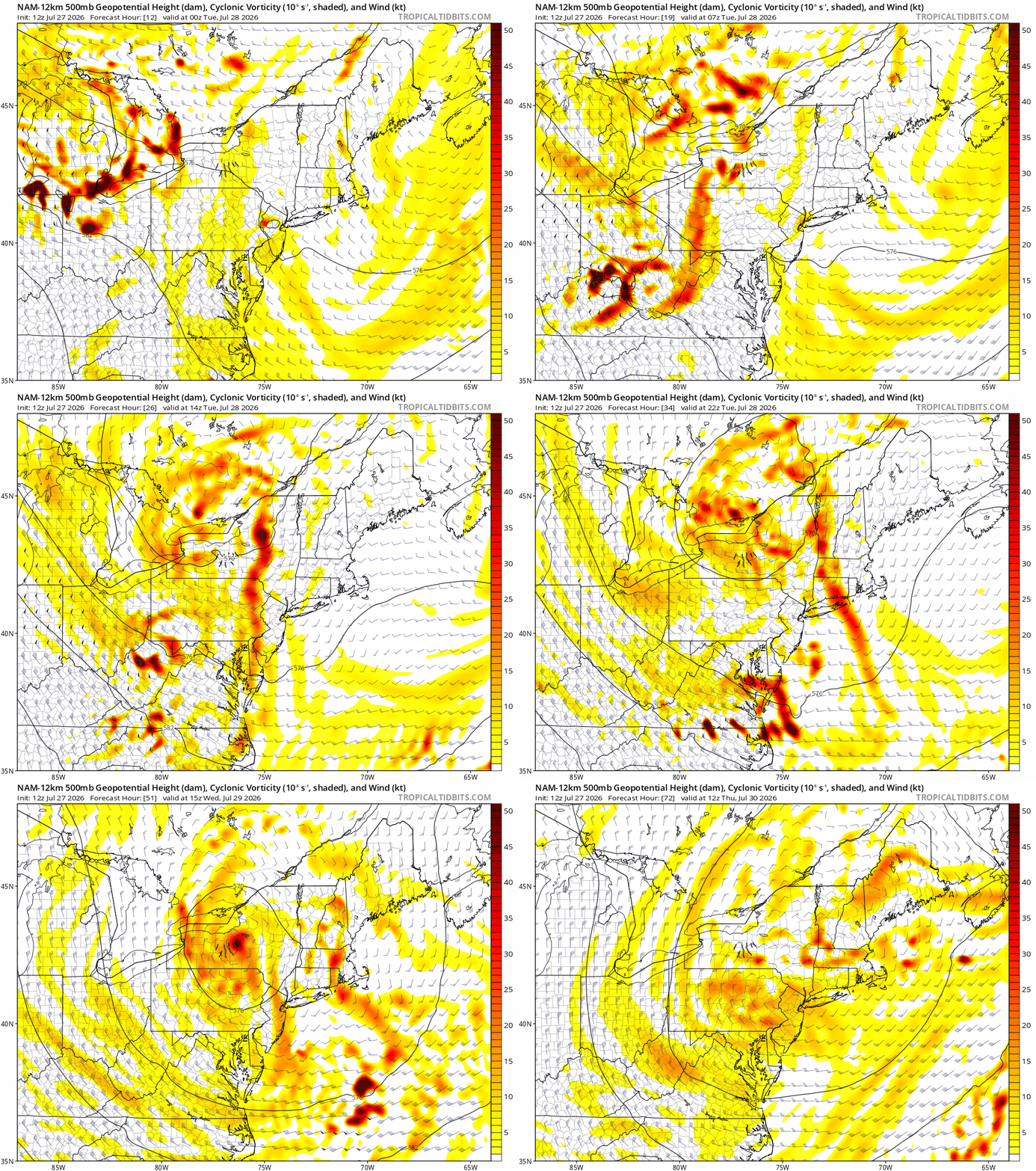
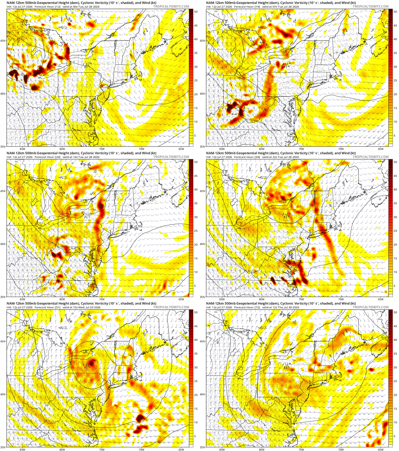
Upper-level vorticity will rotate into the northeastern states on Tuesday adding to the volatility in the atmosphere which, in turn, can lead to severe weather and heavy rainfall. Maps courtesy NOAA, tropicaltidbits.com
Overview
Numerous ingredients will come together during the next couple of days to raise the possibility of severe thunderstorms and heavy rainfall in the Mid-Atlantic region. In an overall pattern quite similar to a week ago, strong upper-level ridging is currently centered over the Rocky Mountain States, and the outer periphery of this system features northwesterly flow over the Great Lakes. Embedded within this northwesterly flow will be an intensifying upper-level jet streak on Tuesday that’ll drop to the south and east enhancing upper motion in the Mid-Atlantic region. Meanwhile, an upper-level trough of low pressure is currently positioned over the southeastern part of Canada, and it will add fuel to the fire by sending spokes of energy into the northeastern states during the next couple of days. Finally, not to be outdone by its upper-level counterparts, the surface level will get involved as low pressure will deepen over the Delmarva Peninsula on Tuesday and there will be a secondary surface low unfolding over western NY State.
All of these ingredients can result in severe thunderstorm activity during the next couple of days with a focus on Tuesday afternoon and evening and there can be torrential rainfall in portions of the Mid-Atlantic region with 3+ inches on the table. The best chance of severe weather on Tuesday will likely be across the southern Mid-Atlantic (e.g., DC, Delmarva), and the best chance of soaking rainfall will likely be across the northern Mid-Atlantic (e.g., eastern PA, NJ, NYC), but some of these details still have to be worked out.
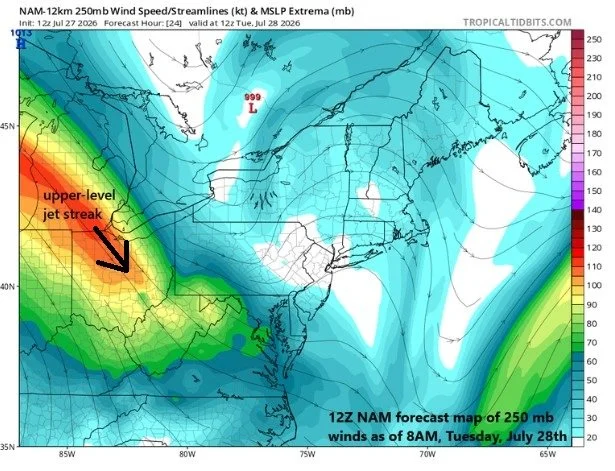
A key player in this upcoming volatile weather pattern for the Mid-Atlantic will be an upper-level jet streak that will dive to the south and east on Tuesday from the Great Lakes to the Mid-Atlantic/Ohio Valley…all of which will enhance upward motion. Map courtesy NOAA, tropicaltidbits.com
Discussion
The potential exists for severe thunderstorm activity and torrential rainfall in the Mid-Atlantic region between this evening and Wednesday night with a likely focus on the Tuesday afternoon and evening time periods. Multiple ingredients will come together that will produce an atmosphere full of potential for the generation of severe weather and heavy rainfall in portions of the Mid-Atlantic region. The primary severe weather risks will include damaging wind gusts, hail, and downpours which can result in 3+ inches in some areas, and even isolated tornadoes can develop depending on how everything unfolds.
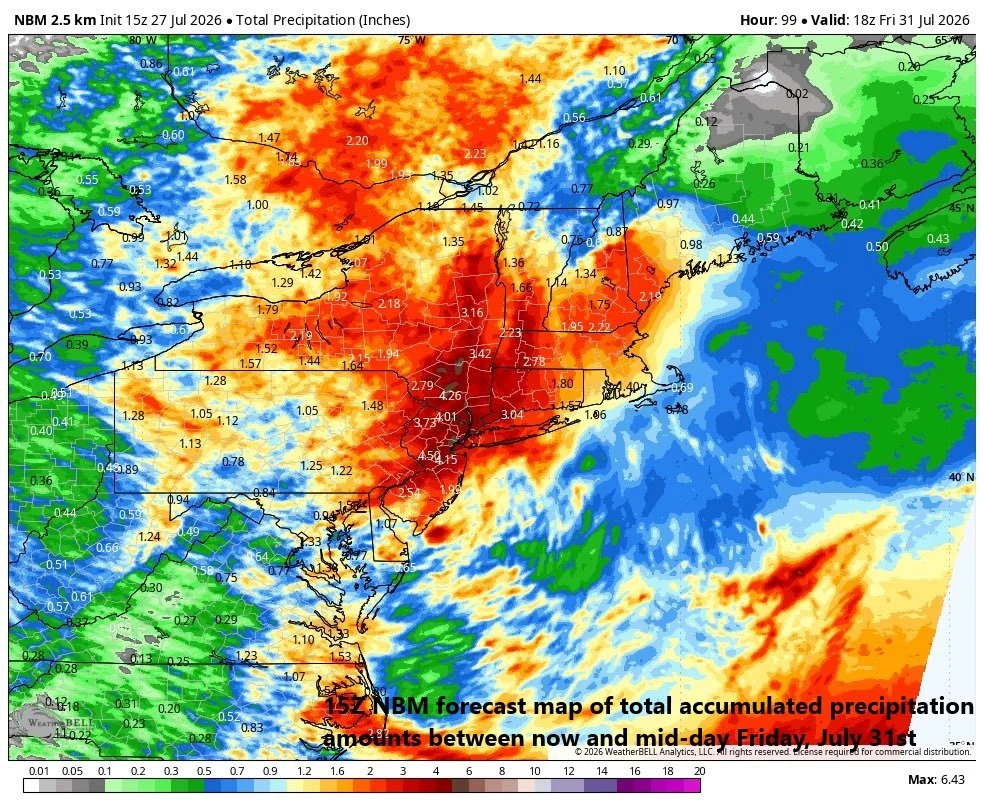
The potential exists for some serious rainfall during the next couple of days across portions of the Mid-Atlantic with highest likelihood of 3+ inches in the northern half of the region (e.g., eastern PA, NJ, NYC). Map courtesy NOAA, Weather Bell
The numerous ingredients that will act to destabilize the atmosphere during the next couple of days will include an upper-level jet streak that will dive south and east into the northeastern states from the Great Lakes riding along northwesterly flow located on the northeastern fringes of an upper-level ridge. In addition, an influx of upper-level vorticity will enhance upward motion in the region and low-level moisture should rise noticeably (watch those dew points) adding fuel to the fire. Finally, and somewhat unusual for late July, surface low pressure will form on Tuesday and become rather potent and there will likely be a secondary surface low as well. All of these ingredients will enhance upward motion in the Mid-Atlantic region that will have an impact from later today into late Wednesday.
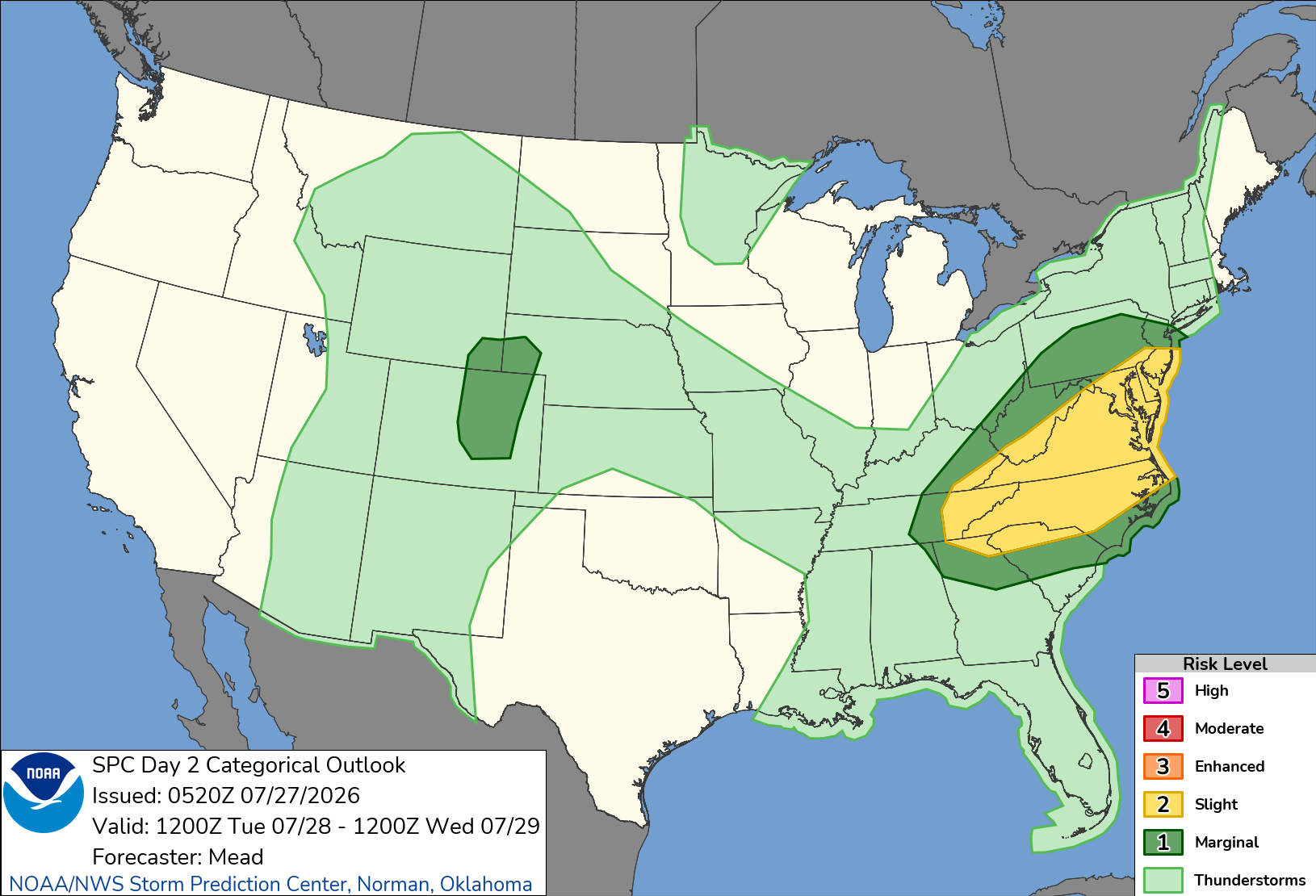
NOAA’s Storm Prediction Center has placed the Mid-Atlantic region in a “slight risk” zone (yellow) for severe weather on Tuesday/Tuesday night. Map courtesy NOAA/SPC
Scattered showers and thunderstorms are possible later today and tonight – some of the storms can be strong-to-severe and some of the rain can be heavy. However, a more widespread outbreak is likely to come on Tuesday afternoon and evening ahead of a cold frontal system and in the “left exit” quadrant of the upper-level jet streak (i.e., an area with strong upward motion). The wind shear will tend to increase later tomorrow and - at the same time - the upper atmosphere should cool down...this combination should lead to an enhanced risk of hail and isolated tornadoes; especially, across the southern Mid-Atlantic region. The pattern stays volatile into the mid-week with additional showers and storms possible on Wednesday as the secondary surface low spins slowly from the NE US into the Mid-Atlantic and - similar to last week - a comfortable air mass should for the latter part of the week following the volatility of the next couple of days.
Stay tuned...this is an explosive pattern with severe weather and torrential rainfall on the table, but some of the details still have to be ironed out.
Meteorologist Paul Dorian
Arcfield
arcfieldweather.com
Follow us on Facebook, Twitter, YouTube
Video discussion: