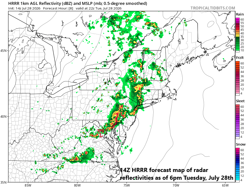
***An active afternoon and evening in the Mid-Atlantic region...heavy rain/flash flooding, strong-to-severe thunderstorms all on the table***
Paul Dorian
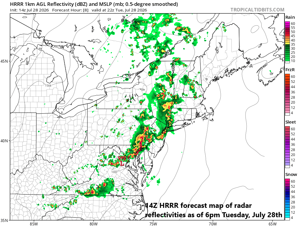
While there can be shower and thunderstorm activity at just about anytime on Tuesday, the greatest chance is likely to come during the late afternoon and evening hours in the DC and Philly metro regions. Map courtesy NOAA, tropicaltidbits.com
Overview
While not everyone will get hit, the atmosphere is fueling up to produce numerous showers and thunderstorms during the afternoon and evening hours in the Mid-Atlantic region. Strong-to-severe thunderstorms are on the table as well as torrential rainfall from this significant system with the greatest chance of flash flooding likely in the northern Mid-Atlantic (e.g., E PA, N NJ, NYC) and the greatest chance of severe weather likely in the southern Mid-Atlantic (e.g., DC, Delmarva). Multiple ingredients are coming together to raise the likelihood of this very active weather pattern for later today and tonight.
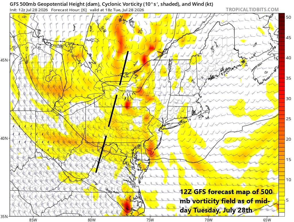
Numerous ingredients are coming together to destabilize the atmosphere today including an upper-level short-wave of energy dropping south and east from the Great Lakes to the northeastern states. Map courtesy NOAA, tropicaltidbits.com
Details
In an overall pattern quite similar to a week ago, strong upper-level ridging is positioned over the Rocky Mountain States, and the outer periphery of this system features northwesterly flow over the Great Lakes. Embedded within this northwesterly flow is an intensifying upper-level jet streak that is dropping to the south and east from the Great Lakes and it is enhancing upper motion in the Mid-Atlantic region. Meanwhile, an upper-level trough of low pressure is currently positioned over the southeastern part of Canada, and it will add fuel to the fire by sending spokes of energy into the northeastern states. Finally, not to be outdone by its upper-level counterparts, the surface level is getting involved as low pressure will deepen later today over the Delmarva Peninsula on Tuesday and there will be a secondary surface low unfolding over western NY State.
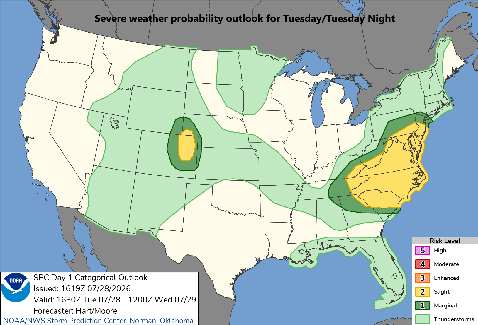
Severe thunderstorms are a possibility later today in the Mid-Atlantic with the highest probability from around Route I-80 and points to the south. Map courtesy NOAA/SPC
All of these ingredients can result in severe thunderstorm activity at just about any time during the next several hours with a focus on the late afternoon and evening hours and there can be torrential rainfall in portions of the Mid-Atlantic region with 3+ inches on the table. The best chance of the torrential rainfall and flash flooding will likely come across the northern Mid-Atlantic (e.g., eastern PA, northern NJ, New York City) and the greatest chance for severe weather likely to be in the southern Mid-Atlantic (e.g., DC, Delmarva). The pattern stays volatile into the day on Wednesday with additional showers and thunderstorms possible as the surface low continues to spin around the northeastern states. And, similar to last week, a pretty comfortable air mass should follow the volatility for the latter part of the week.
Meteorologist Paul Dorian
Arcfield
arcfieldweather.com