***Another round of downpours and severe thunderstorms for the Mid-Atlantic region as active weather pattern continues***
Paul Dorian
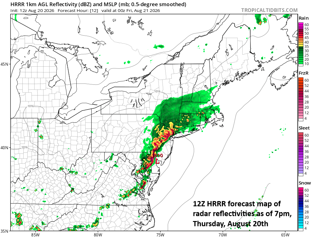
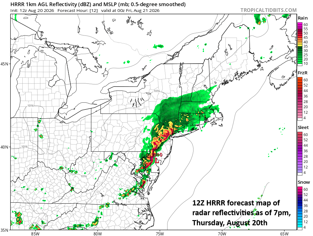
A rather solid line of storms is likely to form by later today/early tonight extending all along the I-95 corridor from NYC-to-DC. Map courtesy NOAA, tropicaltidbits.com
Overview
Our active weather pattern in the Mid-Atlantic region continues for the next several days with multiple chances of heavy showers and severe thunderstorms that can produce damaging wind gusts and even isolated tornadoes. In a similar pattern to recent severe weather outbreaks, a strong wave of energy will drop southeastward into the Mid-Atlantic region later today riding along a northwesterly flow of air on the peripheral of strong high pressure centered over the western states.
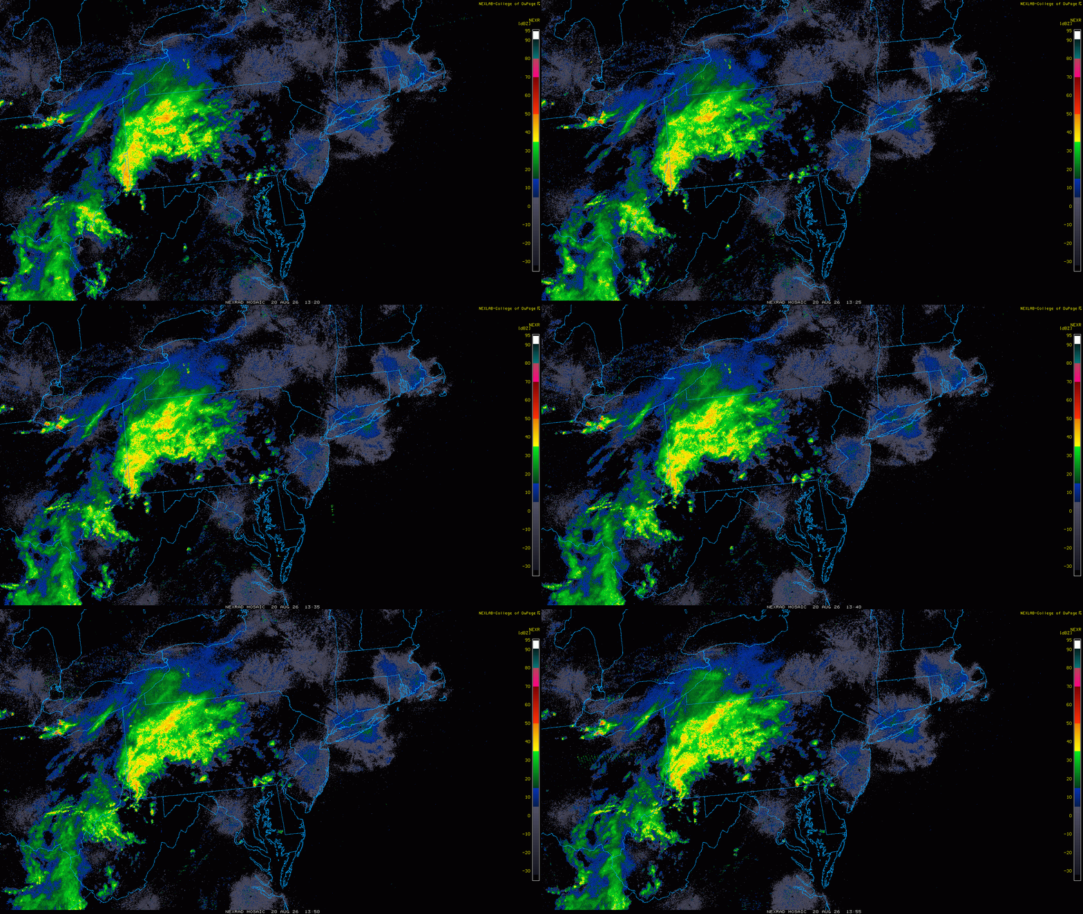
The main area of interest for shower and thunderstorm activity is currently across upstate PA, eastern OH and West Virginia. A solid line of storms is likely to evolve from this batch of rain and move into the I-95 corridor by the late afternoon or early evening hours. Radar images courtesy NOAA, College of DuPage
Discussion
Numerous ingredients will come together later today to produce downpours in the Mid-Atlantic region and thunderstorms that can reach severe levels with damaging wind gusts and even isolated tornadoes. Some of the ingredients include a surface cold front, a strong wave of energy aloft that will enhance upward motion in the area, and some very moist air now pushing northward through the southern Mid-Atlantic region (dew points in the middle 70’s from DC-to-Delmarva). An increase in low-level wind shear combined with the high moisture content will raise the chance of isolated tornadoes later today; especially, in the southern Mid-Atlantic region from DC-to-Baltimore-to-the Delmarva Peninsula.
The likelihood of some heavy rainfall has prompted numerous flash flood watches to be posted by the National Weather Service in the Mid-Atlantic region with localized flash flooding a risk given the already saturated grounds in many spots from recent heavy rain events. While there can be showers later this morning and into the early afternoon, the best chance for severe weather will be in the 3-10pm time period after which the expected solid line of storms should push off the eastern seaboard.
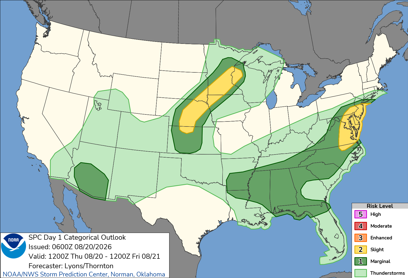
NOAA’s Storm Prediction Center has placed much of the Mid-Atlantic region in a “slight” risk zone for severe weather later today and tonight. Map courtesy NOAA/SPC
Once today’s threat plays itself out, the overall active weather pattern will continue in the Mid-Atlantic region at least through the upcoming weekend. Another strong system in the upper atmosphere will drop south and east by the weekend in the persistent northwesterly flow of air on the northeastern side of high pressure and there can be additional showers and thunderstorms from late Friday through the weekend. As far as temperatures are concerned, the abundance of clouds in the area will help to prevent any sustained heat during the next several days and the waning days of August should feature plenty of comfortable weather days.
Meteorologist Paul Dorian
Arcfield
arcfieldweather.com
Follow us on Facebook, Twitter, YouTube
Video discussion: