**An active period from Tuesday through Thursday...”ring of fire” region of upper-level ridge to bring multiple strong thunderstorms to the Mid-Atlantic**
Paul Dorian
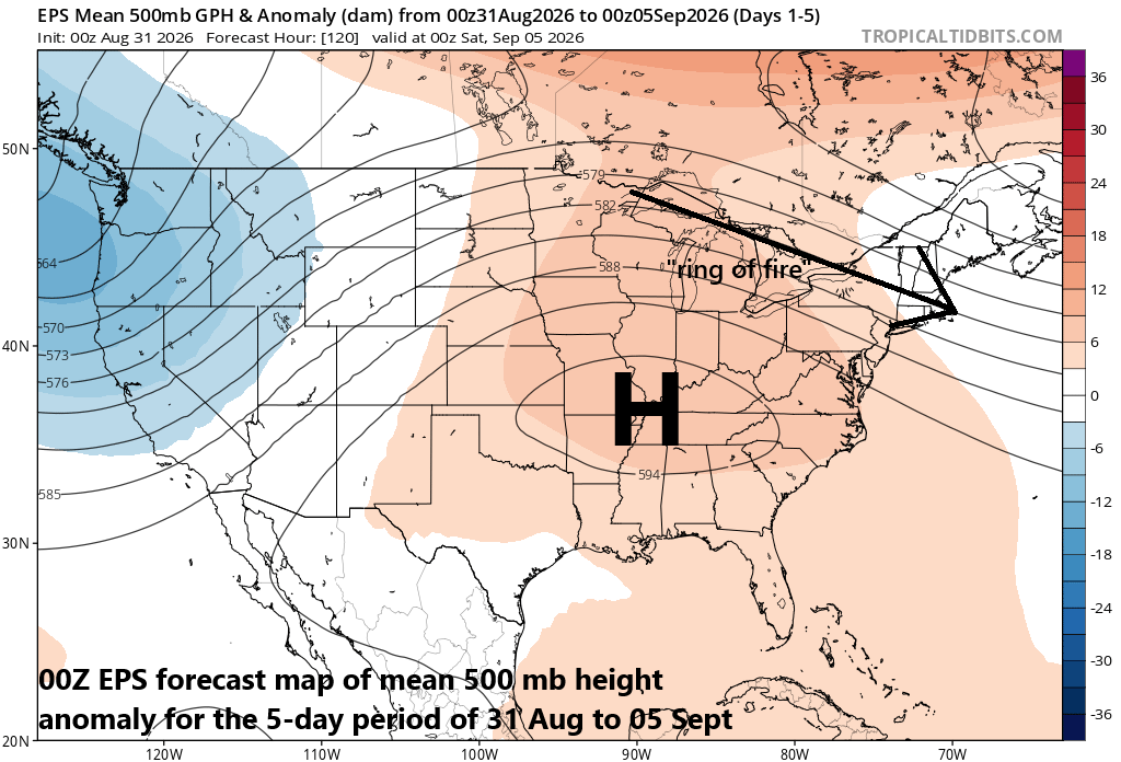
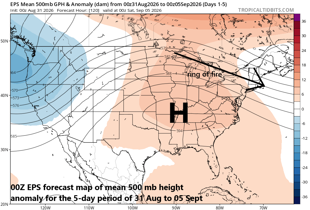
A repeating pattern this summer has featured intense high pressure ridging centered over the middle of the country and northwesterly flow of air from the Great Lakes to the Mid-Atlantic in the anticyclones northeastern quadrant. This “ring of fire” region in the outer peripheral of the upper-level ridge is often quite active with multiple bands of strong-to-severe thunderstorms and that is in store for the DC-to-Philly-to-NYC corridor during the Tuesday-Thursday period. Map courtesy ECMWF, tropicaltidbits.com
Overview
The peripheral region of an intense upper-level ridge can often be quite an active area for thunderstorms this time of year and this summer has been no exception. Specifically, the northeastern quadrant of an intense upper-level ridge where northwesterly flow dominates in the overall clockwise circulation around high pressure can often contain numerous bands of thunderstorms, complexes of thunderstorms and even long-lasting lines known as derechos. This “ring of fire” region in the outer peripheral of high pressure with northwesterly flow aloft has been repeatedly showing up this summer extending from the Great Lakes to the Mid-Atlantic and numerous severe weather outbreaks have been the result. A repeat performance is on the table during the next few days with Tuesday, Wednesday and Thursday likely to feature numerous bands of strong-to-severe thunderstorms that will potentially impact the DC-to-Philly-to-NYC corridor.
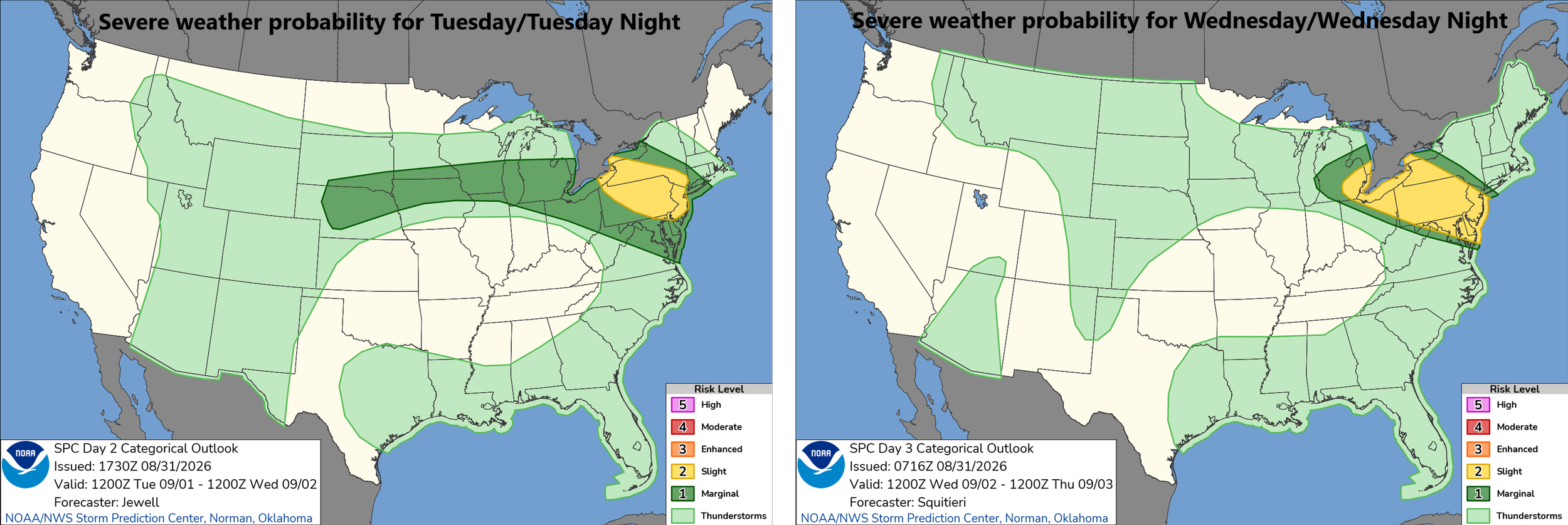
The threat of strong-to-severe thunderstorms will exist on Tuesday and Wednesday in much of the Mid-Atlantic region and a similar outlook is likely for Thursday. Maps courtesy NOAA/SPC
Details
Broad upper-level ridging has returned to the eastern half of the nation this week and its northeastern quadrant has the familiar northwesterly flow of air in the upper part of the atmosphere extending from the Great Lakes to the Mid-Atlantic region. In this “ring of fire” outer peripheral part of an intense upper-level ridge, there will be numerous short-wave of energy pushing along in the northwesterly flow and combine that with a frontal boundary zone and the result will the chance of strong-to-severe on each day from Tuesday through Thursday in the DC-to-Philly-to-NYC corridor.
The exact details of the severe weather threats will have to be ironed out as this frontal boundary zone will meander during these next few days and a movement to the south and west at mid-week, for example, could allow for a low-level flow of easterly winds to develop in NYC and maybe Philadelphia which would reduce severe weather threats on Wednesday – but is far from certain. In the big picture, this “ring of fire” type of pattern will raise the chance in the I-95 corridor for such severe weather parameters as damaging winds, large hail, flash-flooding rains and even isolated tornadoes...stay tuned.
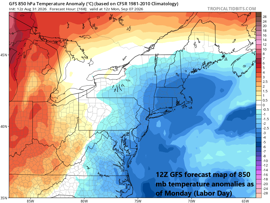
The Labor Day weekend has a chance to turn out quite nice in the Mid-Atlantic/NE US with comfortable temperatures and lower humidity levels compared to the next few days. Map courtesy NOAA, tropicaltidbits.com
Looking ahead, it appears likely that this “meandering” frontal boundary zone will push to the south and west of the DC-to-Philly-to-NYC by the weekend paving the way for a much more comfortable air mass to arrive in time for the Labor Day weekend. Canadian high pressure to the north should take control of the weather for the upcoming weekend and the timing couldn’t be better to enjoy below-normal temperatures and lower humidity values.
Meteorologist Paul Dorian
Arcfield
arcfieldweather.com
Follow us on Facebook, Twitter, YouTube
Today’s video discussion (focused on El Nino, Arctic temperatures, Greenland snow cover):