***Moderate-to-high impact weather event to affect coastal sections from Delmarva to New England...prolonged period of onshore flow leads to tidal flooding***
Paul Dorian
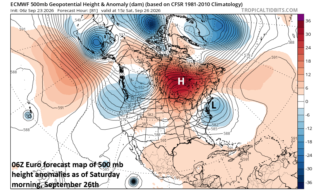
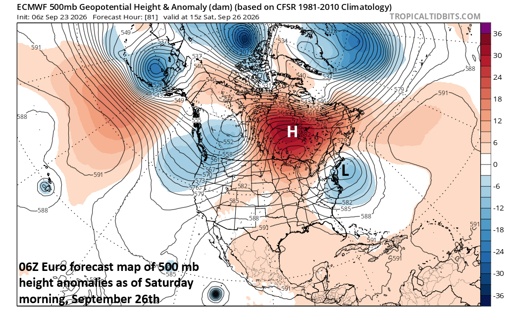
A strong storm over the western Atlantic will grind to a halt in its northward advance this weekend as it runs into deep high pressure centered over eastern Canada and the NW Atlantic. In addition, this “roadblock” in the atmosphere could cause the strong surface low pressure system to loop back around this weekend to coastal sections of southern New England. Map courtesy ECMWF, tropicaltidbits.com
Overview
The combination of strong high pressure to the north and multiple low-pressure systems to the east will result in a prolonged period of onshore flow along coastal sections from the Delmarva Peninsula to New England. This extended period of onshore flow will increase the chance for tidal flooding at times of high tide right through the upcoming weekend and a full moon on Saturday will not help the situation. Low pressure will intensify over the weekend as it climbs northward over the western Atlantic Ocean and then it’ll run into a brick wall in the atmosphere with strong riding to its north. As a result, the strong low will slow down, perhaps loop back around towards the coast, and produce rain and wind along coastal sections into early next week.
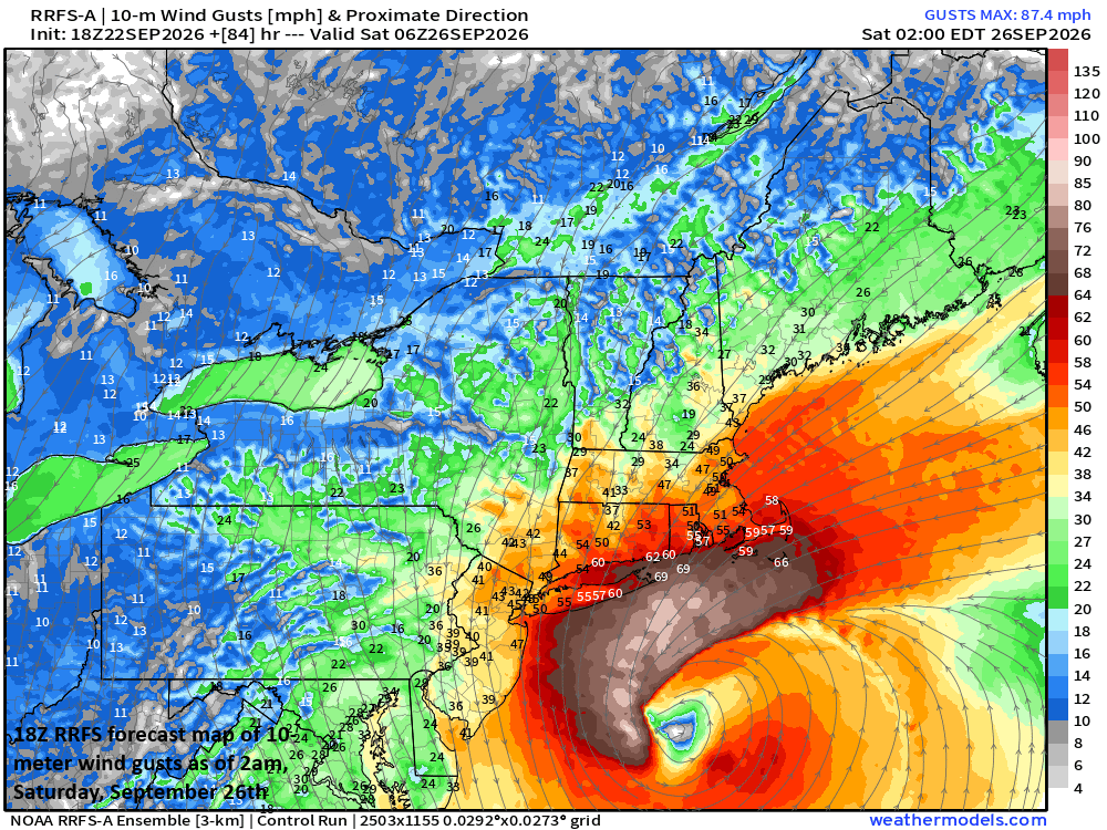
If strong low pressure loops back towards the coast, wind gusts could climb markedly coastal sections of southern New England as well as Long Island and possibly New Jersey as well. Map courtesy NOAA, Dr. Ryan Maue, weathermodels.com
Details
Winds have already strengthened from a northeasterly direction in the Mid-Atlantic region and Northeast US and will persist through the upcoming weekend as high pressure remains parked over eastern Canada and multiple low-pressure systems over the Atlantic Ocean consolidate into one strong storm system this weekend. Given the expected lengthy period of northeast winds, tidal flooding will become an increasing concern at times of high tide and especially this weekend when the moon becomes full (Saturday) and the oceanic low peaks in intensity. Rip currents and rough surf are a given all along the coastal sections from the Delmarva Peninsula to New England due to the persistent and strong onshore flow of air. Waves of 10 feet or higher are likely to be commonplace in these coastal sections, raising the prospects of beach erosion in many locations.
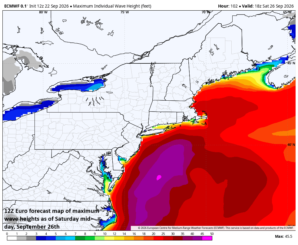
Waves of 10 feet or higher are possible this weekend all along the Mid-Atlantic and Northeast US coastlines raising the likelihood of tidal flooding and beach erosion in many spots. Map courtesy ECMWF, Weather Bell Analytics
As the oceanic storm strengthens and moves northward this weekend, it will run into strong high pressure ridging to its northwest, north, and northeast. This scenario will likely result in a slowing down of the surface storm in its northward push, and its ultimate path may include a loop back to the coast which would enhance the rain and wind in some areas with highest chance for impact likely along coastal New Jersey, Long Island, and coastal southern New England. With the expected slowdown, this storm system may, in fact, linger into the early part of next week along the eastern New England coastline.
Stay tuned...still a few days to go and the ultimate storm track is not set in stone.
Meteorologist Paul Dorian
Arcfield
arcfieldweather.com
Follow us on Facebook, Twitter, YouTube
Video discussion: