****High impact event by early season nor’easter along coastal sections from the Carolinas to New England****
Paul Dorian
Overview
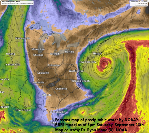
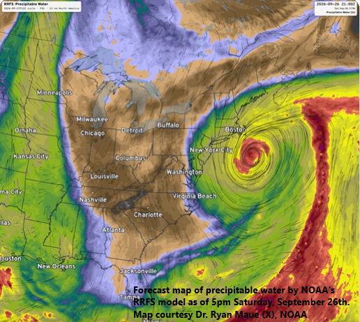
This forecast map by NOAAs RRFS computer forecast model of precipitable water for late Saturday afternoon clearly defines the circulation center location and “moisture” extends inland back to the I-95 corridor. Map courtesy Dr. Ryan Maue (X), NOAA
An early season nor’easter will likely have a high impact along coastal sections from the Carolinas to New England during the Friday, Saturday, and Sunday time period. The combination of strong high pressure centered over southeastern Canada and intensifying low-pressure over the western Atlantic Ocean will result in a prolonged period of onshore flow along coastal sections leading to tidal flooding at times of high tide and a full moon on Saturday won’t help the situation. Beach erosion, rip currents and rough surf are on the agenda as well for many coastal locations in this 3-day period. As the Atlantic low intensifies and slowly pushes to the north, it will become increasingly under the influence of the strong high pressure ridging to its north, and this will lead to a slowdown and then likely a loop back towards the coast. Rain and wind can have an impact inland back to the I-95 corridor at least from around Baltimore north and east and perhaps as far south and west as the DC metro.
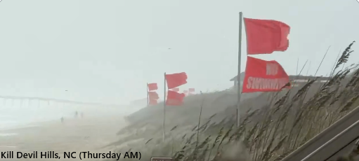
Impact has already begun today along the Carolina coastline with intensifying low pressure over the western Atlantic Ocean bringing high (onshore) winds to the Outer Banks (Kill Devil Hills photo).
Details
Low pressure over the western Atlantic Ocean is intensifying and already having an impact on the Outer Banks of North Carolina with water rises being felt as a result of persistent strong northeast winds. The next several high tide cycles along the Carolina coast and Chesapeake Bay will likely bring gauges close to major flood stage in some locations and problems will then spread farther to the north during the day on Friday.
On Friday, low pressure will continue to intensify as it pushes slowly to the north and will become increasingly under the influence of strong high-pressure ridging centered over southeastern Canada...a key player in this overall pattern. As such, the surface low pressure system will slow down in its northward progression and eventually will likely be “forced” to loop back around to coastal sections of the Mid-Atlantic and/or Northeast US.
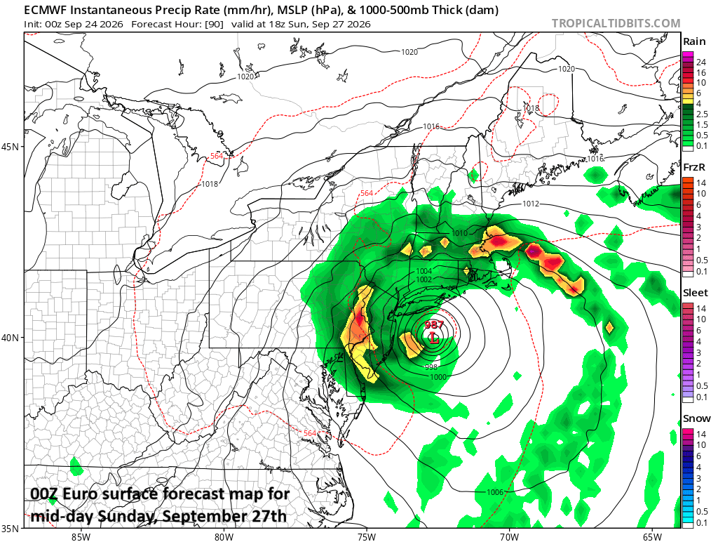
Low pressure over the western Atlantic Ocean will run into an “atmospheric roadblock” this weekend as deep high pressure over southeastern Canada will halt its northward progress. As such, the storm will slow down and likely loop back towards the coast with impact possibly lasting all the way into early next week in some of the northeastern coastal sections. This forecast map comes from last night’s run of the “synoptic-scale” European model and verifies at mid-day on Sunday. Map courtesy ECMWF, tropcialtdibits.com
Given the expected lengthy period of northeast winds in the Mid-Atlantic and Northeast US, tidal flooding will become an increasing concern at times of high tide similar to what is already taking place along the Carolina coastline and the full moon on Saturday will only exacerbate problems. Look for rip currents and rough surf through the weekend at all of the beaches along the Mid-Atlantic and Northeast US coastlines. Waves of 10 feet or higher are likely to be commonplace in these coastal sections, raising the prospects of beach erosion in many locations.
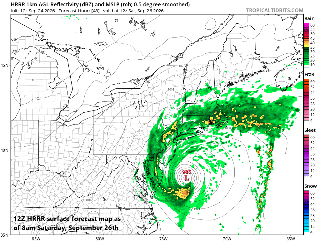
Some of the most recent “meso-scale” computer forecast models have shifted westward with their positioning of the surface low pressure system. This forecast map by NOAA’s HRRR model features quite a strong storm system just off the Mid-Atlantic coastline as of Saturday morning. Map courtesy NOAA, tropicaltidbits.com
Impact will likely be greatest along coastal sections during this prolonged weather event; however, rain and wind can certainly make its way inland back to the I-95 corridor at least from around Baltimore points and north and east of there...even the DC metro is in play though less likely to have much impact depending, of course, on the ultimate path of the storm. With the expected slowdown and potential loop, this storm system may linger all the way into the early part of next week with some impact continuing on Monday in portions of the Mid-Atlantic and Northeast US.
Stay tuned...still a day or two to go and the ultimate storm track is not yet set in stone. One final note, if this early season nor’easter is a harbinger of things to come in the upcoming winter season then buckle up, it’ll be quite an interesting ride.
Meteorologist Paul Dorian
Arcfield
arcfieldweather.com
Follow us on Facebook, Twitter, YouTube
Video discussion: