11:50 AM Saturday | **Monday snow threat continues for DC, Philly, NYC**
Paul Dorian
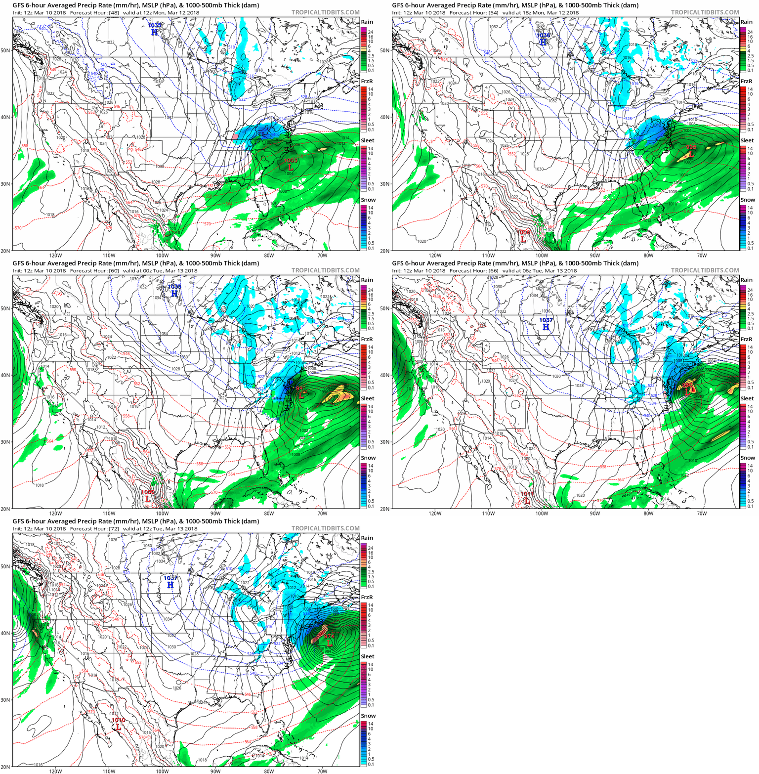
12Z GFS loop of surface forecast maps from 48-60 hours in 6-hour increments: maps courtesy NOAA, tropicaltidbits.com
Strong low pressure will head towards the Mid-Atlantic coastline on Monday and it could result in accumulating snowfall for the DC-to-Philly-to-NYC corridor. In addition to the persistent high-latitude blocking to our north, two key players in the upcoming storm threat will be separate waves of energy in the northern and southern branches of the jet stream. These waves will ultimately consolidate into one deep upper-level trough and if the phasing takes place quick enough then a strong storm would indeed impact the DC-to-Philly-to-NYC corridor.
12Z GFS loop of 500 mb forecast maps from 48-60 hours in 6-hour increments: maps courtesy NOAA, tropicaltidbits.com
The latest (12Z) GFS computer forecast model does now phase these upper-level systems together in time to produce accumulating snow in the big cities along I-95 on Monday, but this is still no guarantee with a couple days to go before event time and other models are not in agreement. Given the cold air mass in place, if this storm does come up this far north then snow would likely be the favored precipitation type in areas N and W of Route I-95, but rain would likely be involved in areas to the south and east of I-95. The snow would likely begin in the DC metro region during the morning hours on Monday and during the afternoon hours in Philly and NYC.
Meteorologist Paul Dorian
Vencore, Inc.
vencoreweather.com


