
12:30 PM (Saturday) | **Snow and/or ice from next storm on Monday/Monday night can have an impact on travel conditions**
Paul Dorian

Especially worrisome is the threat of ice accumulations on Monday and Monday night as depicted here by the 00Z Euro; map courtesy ECMWF
Overview
One storm system continues to impact the Mid-Atlantic/NE US today and another one will impact the same area from Monday into Tuesday. The next storm will intensify over the Lower Mississippi Valley early Monday and it will take a track to the Mid-Atlantic coastline by Tuesday afternoon. As the storm intensifies on Monday, it will generate a west-to-east swath of precipitation that will push into the Mid-Atlantic region during the morning or mid-day hours on Monday. The air is likely to be cold enough for a period of snow and/or ice at the onset and there are likely to be some accumulations before any changeover to rain; especially, from the northern and western suburbs of DC to areas near and north of the PA/MD border.
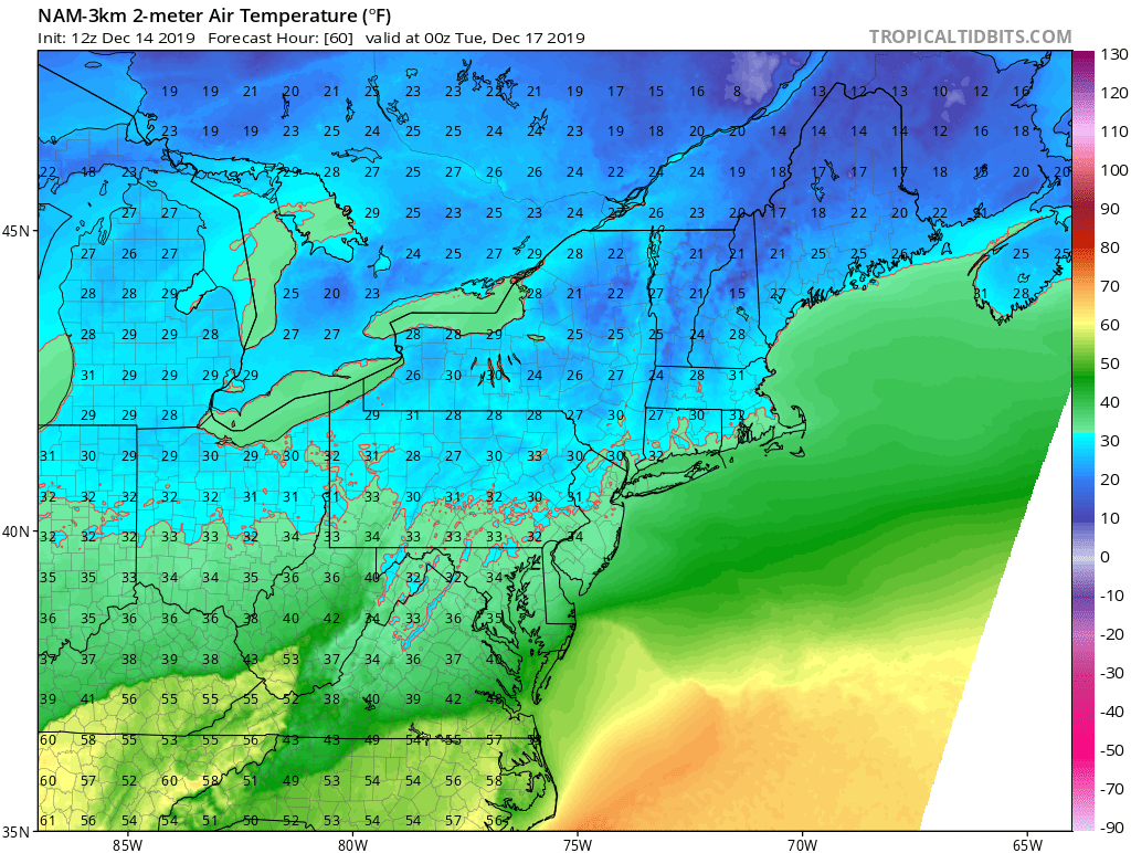
Surface temperatures on Monday evening as depicted by the 12Z NAM (3-km) with many spots near the freezing mark; map courtesy NOAA, tropicaltidbits.com
Details
Low pressure will intensify over the Lower Mississippi Valley on Monday morning with a cold air mass in place across the Mid-Atlantic and NE US. This system is likely to take a track from around Arkansas on Monday morning to West Virginia and then to the New Jersey coastline by Tuesday afternoon. A narrow swath of precipitation will extend quite far to the east of the low pressure system on Monday and it will likely reach the DC metro early on Monday and then into Philly and NYC by mid-day or early afternoon. With the cold air in place, this initial shot of precipitation is likely to result in snow north of the PA/MD border and snow and/or ice south of there across northern Maryland, Virginia and the DC metro region.

Snow accumulations on Monday and Monday night as depicted by the 00Z Euro; map courtesy ECMWF
Some light accumulations of snow and/or ice are possible on Monday in the DC metro area before any changeover to ‘plain’ rain takes place later in the day and there can be up to a few inches of snow and ice across PA, NJ and New York City. The snow and ice expected on Monday can have an impact on travel conditions; especially, to the north and west of the DC and near and north of the PA/MD border where a buildup of ice is probably the biggest concern. The cold front associated with this low pressure system will slide through the region on Tuesday and this will shut off the precipitation. Another cold air mass will push into the Mid-Atlantic region/NE US and it’ll remain cold and dry for the second half of the week.
Meteorologist Paul Dorian
Perspecta, Inc.
perspectaweather.com