10:30 AM (Monday) | ****A major mid-week mess is coming to the Mid-Atlantic region with significant accumulating snow on the front end in many areas before a changeover to ice, rain****
Paul Dorian

12Z NAM surface forecast maps from 7AM Wednesday (forecast hour 48) to 1AM Thursday (forecast hour 66); courtesy NOAA/EMC, tropicaltidbits.com
Overview
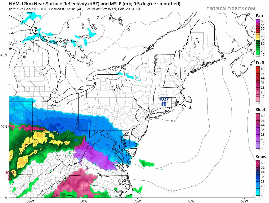
A major winter storm will impact the Mid-Atlantic region on Wednesday with significant accumulating snow on the front end in many areas before a changeover to ice and rain. An initial low pressure system will head towards the Great Lakes on Wednesday and a secondary low pressure will form near the Mid-Atlantic coastline. Another key player will be strong cold high pressure that will be situated to our north on Wednesday and it will lock-in cold, dense low-level air - at least at the onset of this mid-week event. Snow should break out in the early morning hours on Wednesday in the DC metro region, then by the mid-to-late morning hours in Philly, and finally during the mid-day or early afternoon hours in NYC.

12Z NAM surface forecast map for 7AM Wednesday with strong high pressure situated over New England anchoring in a low-level cold air mass for the beginning of this event; courtesy NOAA/EMC, tropicaltidbits.com
Mid-week storm
By late Tuesday, strong high pressure – once again a very key player in a Mid-Atlantic winter storm - will be building to the north of us and there will be lots of moisture pushing northeastward from the Gulf of Mexico. This area of high pressure will lock in a cold, dense air mass in the lower levels of the atmosphere – at least for the onset of the mid-week storm system – setting us up for “overrunning” precipitation as warmer air initially rides up and over the surface air mass. One surface low will trek from the Gulf coast states to the western Great Lakes while a secondary low develops near the Mid-Atlantic coastline – quite similar to the setup recently which resulted in snow, ice and rain for the Mid-Atlantic region.


12Z Euro snow depth forecast map by midnight Thursday with in general 4+ inches along and to the N/W of Route I-95; courtesy ECMWF, weather.us
Snow is likely to break out in the DC metro region early Wednesday morning and then expand northeastward towards the Philly and NYC metro regions. By later Wednesday, milder air will advance into the region as winds turn more to the southeast and this could result in a changeover from snow to sleet and freezing rain and perhaps ultimately to plain rain by later Wednesday night. The low pressure areas moves away on Thursday and allows for high pressure to build in from the west. Temperatures may actually climb to 50+ degrees on Thursday afternoon in parts of the I-95 corridor.
Preliminary snowfall estimates before the changeover and arrival times:
DC: 4-7 inches (6-9AM)
Philly: 3-6 inches (9AM-noon)
NYC: 2-4 inches (noon-3PM)
Meteorologist Paul Dorian
Perspecta, Inc.
perspectaweather.com
Video discussion: