
10:30 AM (Saturday) | ***Explosive intensification of low pressure to have major ramifications across a wide part of the nation including potentially damaging wind gusts in the Mid-Atlantic region***
Paul Dorian
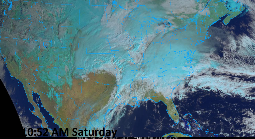
GOES-16 “natural” color satellite image of the US on Saturday morning; courtesy NOAA
Overview
A storm that has already been a news making event in the Southwest US for its unusual snowfall will undergo explosive intensification this weekend and continue to make news as it’ll have major ramifications across much of the rest of the nation. Low pressure is heading northeastward today from the southern Plains and towards the Great Lakes and it will generate blizzard conditions all along the way. This system has the potential to strengthen over a 36-hour period from around 999 millibars this morning to near 971 millibars by late Sunday and it can result in monthly record low pressure readings in parts of the Great Lakes region.

06Z GFS forecast map of upper-level energy which sets off the explosive intensification process on Saturday morning; courtesy NOAA/EMC, tropicaltidbits.com
Discussion
Low pressure is now strengthening and moving northeastward from the southern Plains and blizzard warnings have been posted by the NWS for many locations in the central US. This system has already been a news making event in the Southwest US as it has produced snow in many unusual low-elevation locations including Phoenix, AZ, the Los Angeles metro region (e.g., Pasadena, West Hollywood) and Las Vegas, Nevada where measurable snow actually occurred two days in a row. In addition, some higher elevation locations that are more used to snow had incredible amounts including Flagstaff, Arizona which endured its snowiest calendar day ever with 35.9 inches of snow on Thursday.

06Z GFS forecast map at the surface as of 7AM Saturday morning; courtesy NOAA/EMC, tropicaltidbits.com
As very strong upper-level energy moves on top of the surface low pressure system this morning, explosive intensification will begin. The upper-level low will take on a “negatively-tilted” trough axis orientation (i.e., northwest-to-southeast) and this will enable strong upward motion in the vicinity which will lead to rapid intensification of the surface low as it begins a push northeastward and towards the Great Lakes. Very warm and humid air on the southeast flank (warm sector) of the developing storm will flow northward into the Lower Mississippi and Tennessee Valley. This will result in an enhanced severe weather threat including possible tornadoes in the Lower Mississippi and Tennessee Valleys. In addition, heavy rainfall over those areas on top of already well-saturated grounds is resulting in serious flash flooding concerns.

06Z GFS forecast map at the surface as of 7PM Sunday evening; courtesy NOAA/EMC, tropicaltidbits.com
By tomorrow morning, a powerful surface low pressure system with a central pressure near 979 millibars will be situated over Upper Michigan and its intensification will not be over. In fact, the powerful storm will likely deepen to around 971 millibars by Sunday evening as it treks into southern Canada. The difference in pressure between this major storm and strong high pressure over the Northern Plains will create a very tight pressure gradient and damaging wind gusts for the Great Lakes/Upper Midwest to go along with heavy snowfall in areas to the north and west of the surface low (e.g., Minnesota, Wisconsin, Iowa, Upper Michigan).

Explosive intensification resulting in numerous lightning strikes on Saturday morning; especially, in the warm sector of the developing storm system where severe weather is a threat.
In the Mid-Atlantic region, this rapidly intensifying storm system will also have some important impacts. Rain is likely to arrive in the DC metro region this afternoon and overspread the rest of the I-95 corridor later this evening and it’ll turn into a real soaking rain event in the late night hours and early Sunday morning with a rumble or two of thunder possible. The rain will begin with quite chilly conditions and temperatures primarily in the 40’s in the Mid-Atlantic region, but temperatures could rise late tonight as milder air starts to push northward along the eastern seaboard. The rain will wind down in the DC-to-Philly-to-NYC corridor by mid-day on Sunday and the afternoon will feature increasingly strong winds and a spring tease as temperatures should spike to the 60’s. This warm up will be short-lived, however, and the winds will continue to intensify on Sunday night as a cold front sweeps through the region. There is the potential for wind gusts to reach the 50-60 mph range from late tomorrow into Monday afternoon and this certainly raises the chance for power outages in the Mid-Atlantic region; especially, given the well saturated grounds which can weaken tree root systems. The air mass itself that follows the cold frontal passage into the eastern US will be seasonably cold, but the powerful winds on Monday will make it feel much colder.
Meteorologist Paul Dorian
Perspecta, Inc.
perspectaweather.com