11:20 AM | *Gulf hurricane threat continues with possible Louisiana landfall by the early weekend…strong-to-severe thunderstorm threat this afternoon and tonight in the Mid-Atlantic/NE US*
Paul Dorian

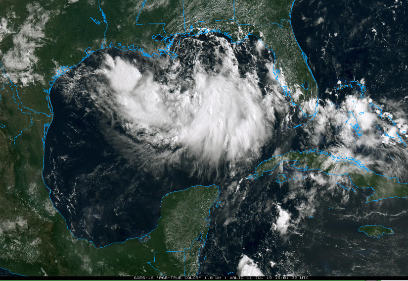
Latest satellite image shows a broad area of clouds over the Gulf of Mexico. Intensification later today and tonight should result in a more well defined center in what is likely to become “Barry”. Courtesy NOAA, College of DuPage
Overview
A broad area of low pressure is drifting westward this morning over the Gulf of Mexico and there is not yet a well-defined center of circulation. As atmospheric conditions become more favorable and the system moves over warmer-than-normal water, intensification will become more likely and tropical storm status could be attained by later tonight or early tomorrow and perhaps (weak) hurricane status can be reached by later tomorrow night. A turn to the northwest by the early part of the weekend could bring this tropical system into central Louisiana and it’ll likely remain a relatively slow-mover raising the chances for substantial amounts of rainfall across southern Louisiana and parts of Mississippi as well over the next few days. Elsewhere, there is a threat this afternoon and tonight in the I-95 corridor for strong-to-severe thunderstorms – any one of these storms can bring heavy downpours to an already-soaked part of the country.

Tremendous amount of rain can fall over the next few days as a result of the Gulf tropical system with a concentration in southern Louisiana; courtesy NOAA
Gulf hurricane threat
Latest satellite imagery shows a broad area of clouds over the Gulf of Mexico at mid-day with embedded showers and thunderstorms. This low pressure system will likely intensify over the next 12-24 hours as it drifts to the west - currently moving along at only 5 mph. With a strong ridge of high pressure building to the northwest across the Rockies and Central Plains, this system is quite likely to remain a slow mover even after it makes landfall likely during the early part of the weekend. As such, it’ll be quite a rain producer across Louisiana and parts of Mississippi over the next few days with some areas receiving as much or more rain before landfall than afterwards. One thing to note, the Mississippi River which flows into the Gulf of Mexico is already running at high levels following the heavy snows this winter upstream (and subsequent snow melt) and the heavy springtime rains throughout the Mississippi Valley. A foot or more of rainfall is possible over the next few days in parts of the central Gulf coastal region with the highest likelihood over southern Louisiana. One final note, there is a new tropical wave in the eastern Atlantic, but it should have a hard time intensifying in coming days as it will encounter lots of dry (Saharan Desert) air.
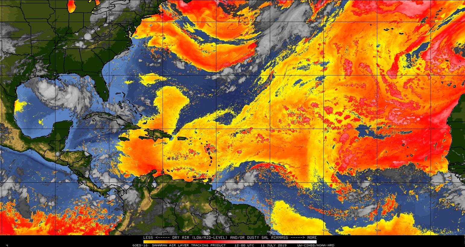
Dry (Saharan Desert) air dominates the scene in the tropical Atlantic and this will continue to be an inhibiting factor for tropical storm development in the eastern Atlantic; courtesy CIMSS/Wisconsin, NOAA
Severe thunderstorm threat in the Mid-Atlantic/NE US
A cold front will close in on the I-95 corridor later today and there are already some scattered showers and thunderstorms well ahead of it. Another couple of rounds of showers and thunderstorms are likely to reach the I-95 corridor from this afternoon into the evening hours and some of this activity can reach strong-to-severe levels with heavy downpours and potentially damaging wind gusts.
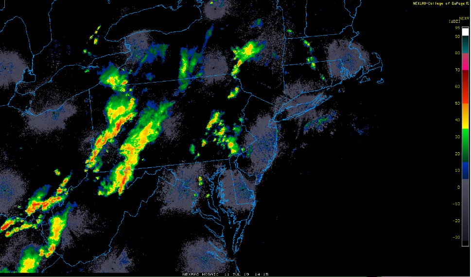
Showers and thunderstorms ahead of a strong cool front are moving from west-to-east in the Mid-Atlantic region; courtesy NOAA, College of DuPage
Any heavy rainfall can result in flash flooding as grounds are well saturated throughout the Mid-Atlantic region. The front slides off to the south and east on Friday paving the way for a decent weekend with plenty of sunshine each day and moderate humidity levels. Looking ahead, the remains of soon-to-be-called Barry may trek all the way to the Mid-Atlantic region in about a week or so following its encounter with the Gulf region and we’ll monitor that threat closely in coming days.
Meteorologist Paul Dorian
Perspecta, Inc.
perspectaweather.com
Video discussion: