1:00 PM | *Cold front inching its way through the region…tropical troubles with a possible hurricane off the east coast early next week*
Paul Dorian

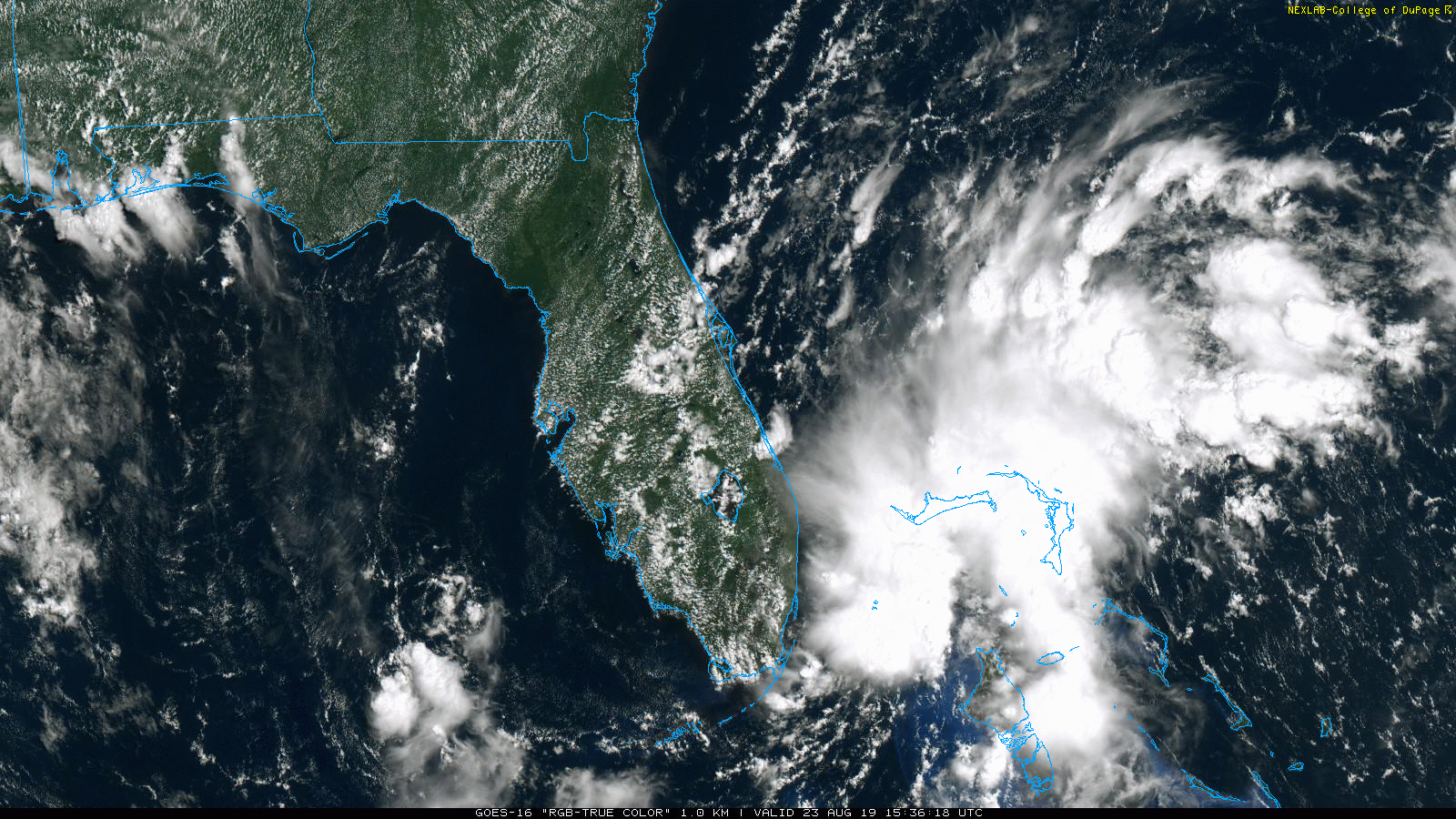
A large area of showers and thunderstorms off the east coast of Florida could ultimately result in a tropical storm by later this weekend or early next week; courtesy NOAA, College of DuPage
Overview
A refreshing air mass for this time of year has arrived and the cold front that ushered in this change it is only slowing grinding its way through the region. As a result, occasional showers will continue this afternoon in the DC-to-Philly-to-NYC corridor and some of the rain can come down hard at times. There can also be an embedded thunderstorm or two along the frontal boundary zone; primarily, to the south of the PA/MD border.
On the tropical scene, low pressure just east of the Upper Florida Keys at mid-day will slowly drift west over the next day or so which will move it over the Florida Peninsula and this should limit development. After that, this tropical system should push back to the northeast and over the western Atlantic where sea surface temperatures are running at warmer-than-normal levels. Consequently, this system should intensify later in the weekend and into the early part of next week - perhaps becoming the next named tropical storm or even a hurricane.
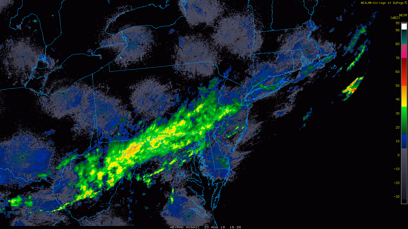
A cold front is only very slowly working its way through the Mid-Atlantic region at mid-day from northwest-to-southeast and this will result in additional rainfall for much of the day in DC, Philly and NYC. Courtesy NOAA, College of DuPage
Additional showers this afternoon as cold front grinds its way through the region
Much cooler air has arrived in the I-95 corridor and temperatures have dropped to near 70 degrees at mid-day in the DC-to-Philly-to-NYC corridor – a refreshing change from the recent heat and humidity. Showers will continue for much of the afternoon and some of the rain can come down hard at times. Thunderstorms will likely be limited to areas south of the PA/MD border as the cooler temperatures have actually made the atmosphere more stable in much of the Mid-Atlantic. Skies will gradually clear tonight and temperatures will drop to refreshingly cool levels by tomorrow morning in the upper 50’s in many spots. It’ll remain quite comfortable on Saturday and Sunday with strong high pressure to our north and west keeping this new air mass in place into the early part of next week.
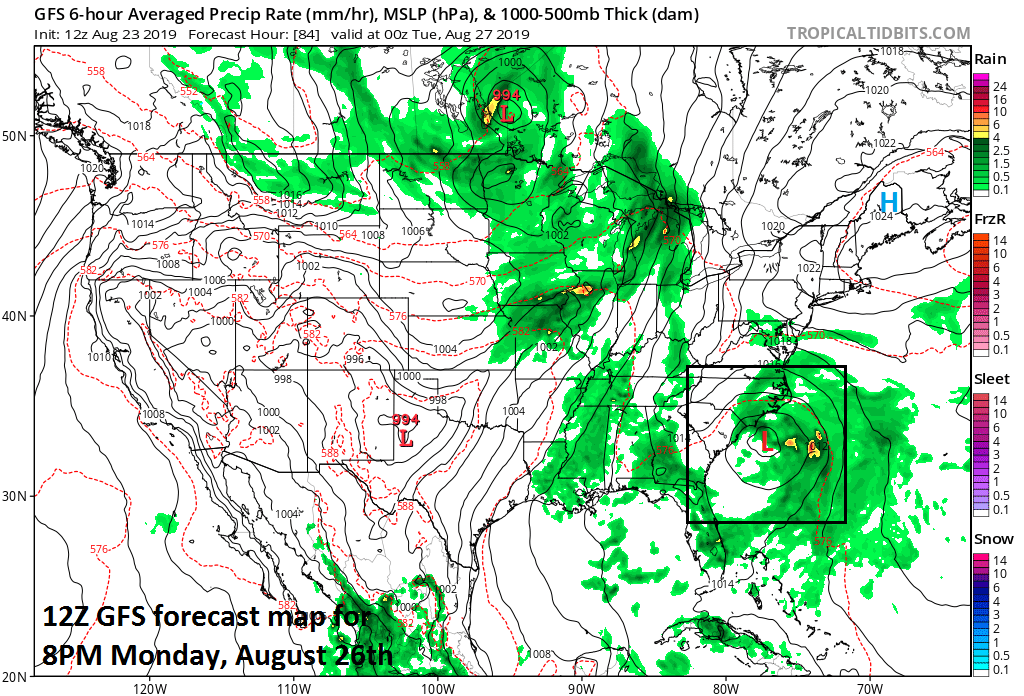
12Z GFS forecast map for Monday evening indicates low pressure off the Carolina coastline and this could be a named (‘Dorian’) tropical storm by this time; courtesy NOAA, tropicaltidbits.com
Tropical Troubles
Low pressure just off the southeast coast of Florida is associated with a large area of showers and thunderstorms at mid-day. This system will meander over the next day or so and likely push to a position right over Florida which will likely limit intensification in the near term. However, later this weekend this system will push back out over the warm waters of the western Atlantic and intensification will become more and more likely. By early next week, there is a chance this system reaches tropical storm status - perhaps even a hurricane - and it would be named ‘Dorian’ if that were to take place.

Warmer-than-normal waters in the western Atlantic will be favorable for tropical storm formation and intensification; courtesy NOAA, tropicaltidbits.com
Another tropical system is now located over the central Atlantic some 1400 miles east of the Windward Islands. This system is likely to undergo slow intensification over the next few days as it continues in a westward track. Meanwhile, Chantal remains categorized as a tropical depression way out over the open waters of the North Atlantic and is not threat to the US.
Stay tuned.
Meteorologist Paul Dorian
Perspecta, Inc.
perspectaweather.com
Video discussion: