10:30 AM (Wednesday) | *Big storm potential for the early part of the weekend in this colder, stormy weather pattern*
Paul Dorian

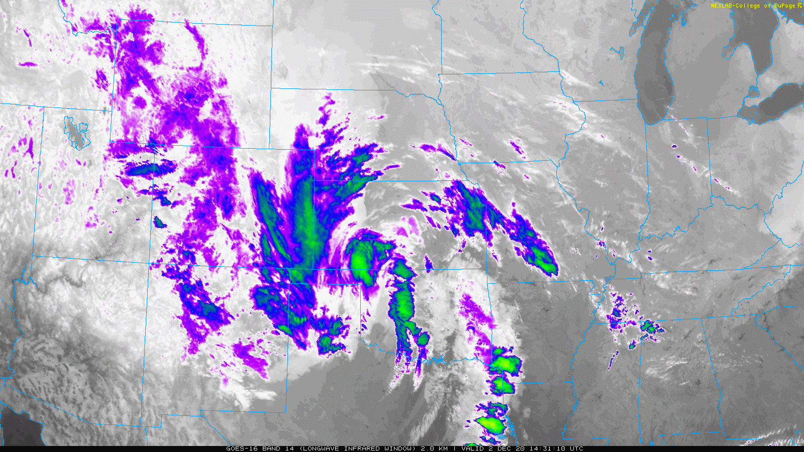
A “swirl” in the latest infrared satellite imagery loop shows the current position of an upper-level trough of low pressure that will play an important role in the development of a major storm system by the early part of the weekend. Satellite images courtesy College of DuPage, NOAA
Overview
The major storm system that began the week was the opening salvo in a colder and stormy weather pattern for the central and eastern US and another significant storm is in the offing for the early part of the weekend. Low pressure will likely pull out of the southern states at the end of the week and intensify as it arrives in the northeastern quadrant of the nation. Significant rain is in the cards from this potential storm in areas along the coast and back to the I-95 corridor; however, it may become cold enough for accumulating snow during the second half of the storm in higher elevation, interior locations of the Mid-Atlantic and Northeast US and inland sections of New England may end up with a major snowfall. In fact, there is an outside chance that it gets cold enough this weekend in portions of the immediate I-95 corridor for the rain to mix with or change to sleet and/or snow during the back end of the storm.

Teleconnection indices including the PNA, NAO and AO support the idea of a storm in the eastern US this weekend with some cold air around. Plots credited to NOAA
Details
The major storm that hit the Northeast US, Ohio Valley, Great Lakes and Mid-Atlantic region on Monday occurred on the front end of an overall pattern change that will bring more persistent cold weather to the central and eastern US and continued storminess as well. This early week storm system that brought heavy rain to the I-95 corridor and accumulating snow across the Ohio Valley, Tennessee Valley and interior Northeast US happened to coincide with the transition from November to December and it looks like we’ll see more frequent cold air outbreaks into the central and eastern US through at least the middle of the month. The hardest hit regions for accumulating snow on Monday night and Tuesday included northeastern Ohio, western PA and West Virginia where “lake effect” winds across Lake Erie boosted uplift in the atmosphere. Snowflakes were actually seen early yesterday all the way down to the far northern suburbs of Washington, D.C. and this morning featured the first trace of snow of the season in some of the Philly suburbs and other parts of eastern PA. In addition, the cold this morning reached all the way down into Florida where there were “window-scraping” conditions and many near record lows in the southeastern US.

Accumulating snow fell yesterday from the Northeast US/Ohio Valley to the Tennessee Valley. Map courtesy NOAA, Philly NWS
The next storm system of interest is already taking shape across the south-central states with a “swirl” seen in the latest infrared satellite imagery loop indicating the current position of an upper-level low pressure trough. This system will slide to the east-northeast over the next few days leaving a piece of energy behind and will possibly have an interaction with another wave of energy that will be moving across southeastern Canada by the end of the week. The interaction of these upper-level systems will ultimately dictate how strong the storm can get and what kind of a track it will undertake with the possibility of a position just off the Mid-Atlantic coastline by early Saturday. The trend of teleconnection indices in recent days, in my opinion, provides support to the idea of a significant storm system in the eastern US this weekend with the likelihood of cold air being involved (NAO, AO turning “negative”) and high pressure ridging to form along the west coast of the US and Canada (+PNA). [Often there is a downstream trough of low pressure that forms near the eastern seaboard when ridging pops up along the west coasts of the US and Canada].

“Window-scraping” cold this morning all the way down to Florida…many near record lows took place across the Southeast US. Map courtesy coolwx.com, NOAA
At this time, it appears that precipitation could be significant in the Mid-Atlantic region and Northeast US in the Friday night/Saturday time frame. As high pressure builds across southeastern Canada by the early part of the weekend, enough cold air may get wrapped into the storm system to generate a changeover from rain to accumulating snow across some interior, higher-elevation locations of the Mid-Atlantic/Northeast US including, for example, the Poconos (PA), Catskills (NY) and also across interior parts of New England where the snow may pile up – all good news for skiers. In fact, there is an outside chance that rain mixes with or changes to sleet and/or snow all the way into the immediate I-95 corridor on the back end of the weekend storm system. It is certainly more difficult to get snow in the immediate I-95 corridor and along coastal sections this time of year as compared with inland locations partly as a result of the still relatively warm sea surface temperatures in the western Atlantic where coldest conditions aren’t reached until late February or March. Looking ahead in this evolving interesting weather pattern, there are destined to be more significant cold air outbreaks that drop into the central and eastern US through at least the middle part of the month of December.

It is always more difficult - but not impossible - to get snow along the coast and in the immediate I-95 corridor this time of year as sea surface temperatures are still relatively warm in the western Atlantic. In fact, sea surface temperatures are currently above-normal in most portions of the western Atlantic. Map courtesy tropicaltidbits.com, NOAA
Stay tuned…still many questions to be ironed out on this upcoming storm system.
Meteorologist Paul Dorian
Perspecta, Inc.
perspectaweather.com
Follow us on Facebook, Twitter, YouTube
Video discussion: