11:30 AM (Thursday) | *Active weather pattern persists as cold air outbreaks continue into the central and eastern US...pattern to hold into early May…includes additional severe weather outbreaks*
Paul Dorian

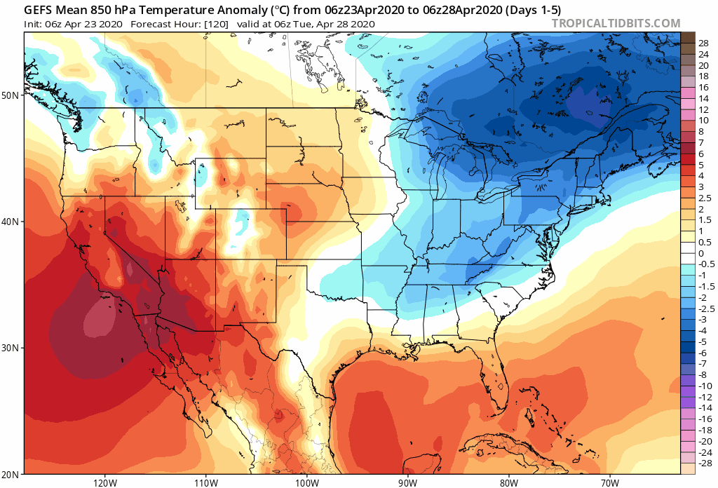
Cold air outbreaks will continue into the central and eastern US through at least the early part of May. Maps courtesy NOAA, tropicaltitdbits.com
Overview
A very active weather pattern will likely continue across the eastern half of the nation into the early part of May in large part due to a continuation of cold air outbreaks from Canada into the central and eastern US. These on-going cold air outbreaks are combining with increasingly warm and humid conditions across the southern US to help in the generation of storms and also has increased the chances for severe weather outbreaks; especially, across the southern states. In fact, tornadoes this year are running at above-normal levels and are the highest for the month of April since 2011. The next storm in a series of storms will impact the Mid-Atlantic region from today into late Friday and then another system arrives over the upcoming weekend and colder-than-normal conditions will persist through the period.

Tornadoes have been running at above-normal levels this year partly as a result of the continuation of cold air outbreaks this spring into the central and eastern US. Map courtesy NOAA
Details
Low pressure this morning over the Mississippi Valley is being aided by strong upper-level energy and it will slide east-to-northeast over the next 24 hours and reach the Mid-Atlantic coastline by mid-day Friday. An area of rain and embedded thunderstorms will push into the Mid-Atlantic region later today and continue through tonight and much of the day on Friday. Some of the rain later tonight in the Mid-Atlantic region can be heavy at times and the soaking rain will likely continue into much of the day on Friday. Given the recent soaking rainfall, the chances of localized flooding will be on the increase from later tonight into Friday. The low pressure system will then push away from the Mid-Atlantic coastline on Friday night and the weekend will actually begin with a rain-free “break in the action” – but that break won’t last long.

Tremendous moisture is feeding into today’s developing storm system from the Gulf of Mexico and it will help contribute to an increased chance of severe weather in the SE US and soaking rainfall tonight/Friday in the Mid-Atlantic region. Map courtesy NOAA
Meanwhile, in the Southeast US, the combination of this strong surface storm and a clash of chilly air to the north and very warm and humid air flowing northward from the Gulf of Mexico will likely result in severe weather later today from southern Alabama to southern Georgia. Tremendous moisture is flowing northward from the Gulf of Mexico into the developing storm system adding to the chances of severe weather and this threat includes hail and tornadoes.

Storm #1 (left) will impact the Mid-Atlantic region from today into late Friday and then another storm (right) will follow in the Saturday night/Sunday time frame. Maps courtesy WSI, Inc., ECMWF
Another storm will form on Saturday in a similar area as this first system, namely, over the Mississippi Valley and this too will be supported by vigorous energy in the upper atmosphere. The weekend storm will slide east-to-northeast and move right over the Mid-Atlantic region and likely produce more rain for the region later Saturday night and Sunday. Some of this rain is liable to be heavy at times and, given all the preceding rainfall, the concern for localized flooding will become even greater during the latter part of the upcoming weekend.

Total precipitation over the next seven days will be quite excessive in much of the eastern half of the nation as the very active weather pattern continues. Map courtesy NOAA
By late Sunday, this second storm will be located near the northern Mid-Atlantic coastline and it may be cold enough for some snow across interior sections of the NE US and cold air will follow into the Mid-Atlantic/NE US early next week. And to no one’s surprise, there very well can be another storm system to deal with by the middle of next week and more cold air for this time of year is liable to drop into the central and eastern US as this weather pattern just goes on and on and on.
Meteorologist Paul Dorian
Perspecta, Inc.
perspectaweather.com
Follow us on Facebook, Twitter, YouTube
Video discussion: