1:20 PM (Thursday) | *Potential for the first “official” tropical system of the 2020 Atlantic Basin tropical season*
Paul Dorian

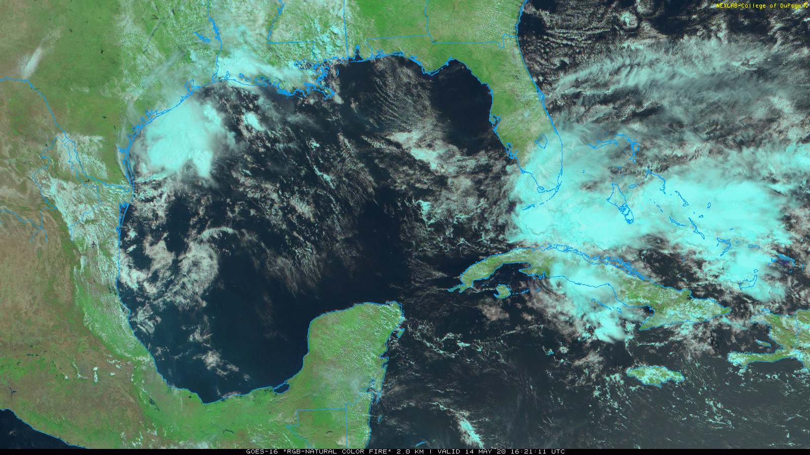
Low pressure is forming over the Florida Straits and it may become the first “official” tropical system of the 2020 Atlantic Basin tropical season. Images courtesy NOAA, College of DuPage
Overview
The east coast of the US will be an interesting area to monitor over the next week or so in terms of the weather as we’ll see a tropical system just east of Florida in the near term and then perhaps a coastal low by the end of next week which could impact the Mid-Atlantic. Low pressure is now forming over the Florida Straits and it’ll intensify over the next 24-48 hours as it makes a move to the northeast over the relatively warm waters of the southwestern Atlantic Ocean. This system may come uncomfortably close to the US east coast in coming days and may play a role in the development of a coastal low by the end of next week in the Mid-Atlantic region.

If this system now over the Florida Straits were to become the first “named” storm of the 2020 Atlantic Basin tropical season, it would be “Arthur”. Map courtesy NOAA/NHC
Details
High pressure over the western Atlantic Ocean will push much milder air into the Mid-Atlantic region on Friday with increasingly strong southwesterly winds and many spots will reach the 80 degree mark for highs for the first time this season. A cool front will approach the region later tomorrow night and early Saturday and there will be scattered showers and thunderstorms ahead of it in the warm and rather humid air mass. While Saturday promises to be another warm day in the Mid-Atlantic, the temperature trend will tend to be downward during the weekend and early part of next week as high pressure builds across southeastern Canada producing an east-to-northeast flow of air.

06Z GFS surface forecast map for early Saturday evening with low pressure off the east coast of Florida and high pressure nearing SE Canada. Map courtesy NOAA, tropicaltidbits.com
Meanwhile, low pressure that is currently forming over the Florida Straits is impacting the Florida Keys with “squally” showers and this should spread up the Florida Peninsula on Friday and Friday night. Some of the rain can be heavy at times across Florida over the next 36 hours or so and minor flooding is a possibility. This low pressure system will encounter an increasing favorable environment for intensification and it is likely to deepen over the southwestern Atlantic this weekend as it moves to the northeast. The low pressure system may become the first “official” tropical system of the Atlantic Basin tropical season and it may play a role in the formation of a coastal low by the late week in the Mid-Atlantic region. At the same time the low pushes northeastward over the southwestern Atlantic, strong high pressure will build across southeastern Canada and this will lead to an increasing east-to-northeast flow in the Mid-Atlantic region by the early part of next week.

06Z GFS surface forecast map for early Wednesday with low pressure near the Mid-Atlantic coastline and high pressure over northern New England. Map courtesy NOAA, tropicaltidbits.com
In fact, by the latter part of next week the surface weather map could feature high pressure across northern New England and low pressure near the Mid-Atlantic coastline which would promote a stiff easterly flow of moist and cool air for this time of year. Usually when the wind blows off the ocean into the Mid-Atlantic region in the spring months, the temperatures end up below-normal as a result of the still rather cold sea surface temperatures of the western Atlantic.
Stay tuned…it’s going to be quite an interesting week along the eastern seaboard.
Meteorologist Paul Dorian
Perspecta, Inc.
perspectaweather.com
Follow us on Facebook, Twitter, YouTube
Video discussion: