11:15 AM (Wed.) | ***An active tropical scene with a Gulf of Mexico system and a newly named tropical storm in the central Atlantic…strong-to-severe storms later today/tonight in the I-95 corridor***
Paul Dorian

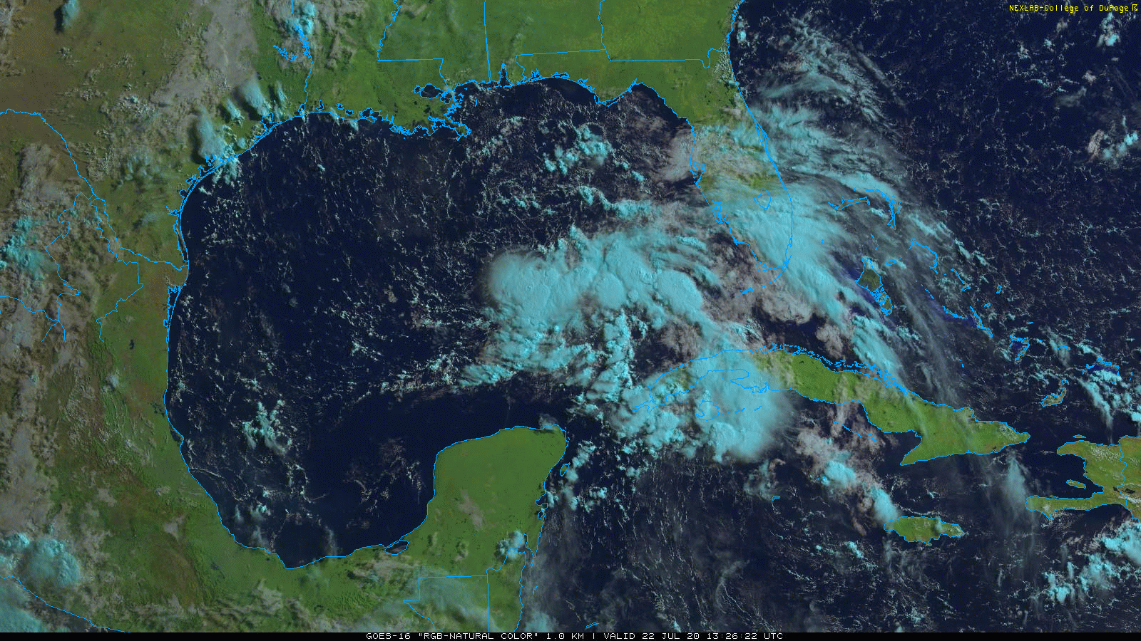
The latest GOES-16 satellite imagery loop (RGB “Natural Color” band) features a tropical wave over the eastern Gulf of Mexico. Satellite imagery courtesy College of DuPage, NOAA
Overview
The Atlantic Basin tropical scene has become quite active with an impressive system over the eastern Gulf of Mexico and also a newly named tropical storm over the central tropical Atlantic. The Gulf system has a chance to intensify into a named tropical storm over the next couple of days as it heads towards the northwestern part of the Gulf and Tropical Storm Gonzalo could very well climb to hurricane status over the next couple of days in the central Atlantic.
Elsewhere, a wave of energy in the upper part of the atmosphere is combining with a stalled out frontal boundary zone and plenty of moisture to spark some strong thunderstorm activity at mid-day in the western part of the Mid-Atlantic region and across the Ohio Valley. Some of these thunderstorm cells will make it into the I-95 corridor at day’s end and likely reach strong-to-severe levels with the potential of damaging wind gusts of up to 60 mph, hail, frequent lightning and heavy rainfall.

The latest GOES-16 satellite imagery loop (RGB “Natural Color” band) features Tropical Storm Gonzalo (lower, left) as well as other tropical waves over the eastern Atlantic (lower, middle) and Africa (middle, right). Satellite imagery courtesy College of DuPage, NOAA
An active Atlantic Basin tropical scene
Last week, there were multiple tropical waves drifting westward across northern Africa and some of this activity has energized the eastern and central tropical Atlantic. There are now two tropical systems in the Atlantic Basin that bear close watching in coming days. The first system is quite impressive-looking on satellite at mid-day and sits over the warm waters of the eastern Gulf of Mexico. This tropical system will drift west-to-northwest over the next couple of days and it could strengthen enough to become classified as a tropical storm (would be “Hanna”) by the time it reaches the northwestern Gulf of Mexico on late Thursday or Friday. Heavy rainfall is on the table at week’s end in at least parts of Texas and Louisiana as this system closes in on that part of the southern US - perhaps making landfall somewhere on the east coast of Texas.

NOAA’s National Hurricane Center (NHC) has classified the former TD 7 as Tropical Storm Gonzalo out over the central tropical Atlantic and there is a second tropical system (still unnamed) over the Gulf of Mexico.
Meanwhile, a second system over the central tropical Atlantic has intensified enough to become a named tropical storm – Gonzalo – now with maximum sustained winds of 50 mph. This system is moving westerly at 14 mph and it is likely to enter into the Caribbean Sea this upcoming weekend. Satellite imagery at mid-day shows a rather small, impressively symmetrical-looking system which usually is a sign of circulation that will lead to intensification. It is not all that unusual for a tropical system to start off rather compact in the lower latitudes of the Atlantic Ocean. There are some factors that may inhibit its chances for further intensification down the road including a possible encounter with some dry air; however, the near-term looks quite favorable for development as it continues to move over the warm water of the tropical Atlantic. I would not be surprised at all to see TS Gonzalo attain hurricane status in the next day or so.
Tropical Storm Gonzalo is the 7th named system in this still rather young 2020 Atlantic Basin tropical season. In fact, this is the earliest time in a tropical season that we have reached seven named storms - besting the 2005 record-breaking season by a few days. While the “number” of tropical systems is now at a record high for this early in the tropical season, the Accumulated Cyclone Energy (ACE) through the first six systems is actually only slightly above normal levels. ACE factors in both the strength and duration of a tropical system and it is probably a better overall measure of tropical activity compared to the total number of storms year-to-date. Most of the storms so far this season in the Atlantic Basin have been rather short in duration and none has been elevated to “hurricane” status. Looking ahead, additional tropical waves can be seen over the continent of Africa today and this pretty much assures an active Atlantic Basin tropical scene as we progress through the latter stages of the month of July. One other note of interest with respect to tropical activity, there is now a hurricane (named “Douglas”) over the eastern Pacific Ocean which is the first one of the season. In fact, the only years with later first eastern Pacific hurricane formations in the satellite era (since 1966) are as follows: 1987 (July 24), 1968 (August 8) and 2003 (August 24) (source: Philip Klotzbach, CSU).
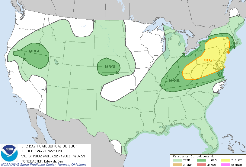
NOAA’s Storm Prediction Center (SPC) has the Mid-Atlantic region in a “slight risk” zone for severe weather later today.
Strong-to-severe thunderstorm threat for the I-95 corridor
Hot and humid conditions continue at mid-day in the Mid-Atlantic region with temperatures on their way to 90+ degrees and dew points are in the very uncomfortable low-to-middle 70’s. Showers and embedded thunderstorms associated with a remnant mesoscale-convective-system have already reached the central part of Pennsylvania, but these should weaken over the next couple of hours and are not the main concern for the I-95 corridor.

An initial batch of showers and embedded thunderstorms is already reaching central PA, but these will tend to weaken over the next couple of hours. New storms are firing up across SW PA and West Virginia and these are the cells to closely monitor over the next few hours. Map courtesy University of Wisconsin, NOAA
New storms, however, are firing up over southwestern PA and West Virginia as a result of upper-level energy moving overhead and these are the storms to closely monitor over the next few hours with respect to the severe weather threat that exists for the I-95 corridor later today and tonight. The energy aloft is interacting with moist and unstable air already in place in the Mid-Atlantic region and copious amounts of daytime heating is steepening low-level lapse rates (i.e., atmosphere is becoming more unstable). Some of these new thunderstorms will reach severe levels later today with the potential of damaging wind gusts of up to 60 mph, hail, frequent lightning and heavy rainfall in the DC-to-Philly-to-NYC corridor between the hours of 3 PM and 9 PM. Any heavy rainfall associated with these late day storms can produce flash flooding conditions and result in a quick few inch amounts. The overall activity at mid-day is moving along at a fairly rapid pace - generally in an easterly direction.
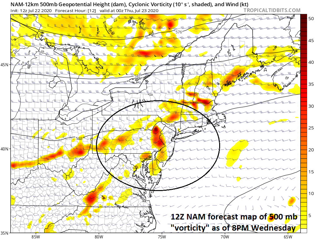
Upper-level energy will be situated over the I-95 corridor by early tonight contributing to the unstable atmosphere that will result in some strong-to-severe thunderstorm activity. Map courtesy NOAA, tropicaltidbits.com
Another in a series of upper-level short wave troughs will move into the Mid-Atlantic region on Thursday afternoon/evening and this is likely to combine with an approaching surface cool front to produce more shower and thunderstorm activity and some of these storms can also reach strong-to-severe levels. Some relief in the heat and humidity will arrive in the Mid-Atlantic region on Friday following the passage of this cool frontal system and it should remain rather comfortable on Saturday as well. As high pressure pushes off the east coast early next week into the familiar “Bermuda-high” position, the heat and humidity will likely build up once again in the Mid-Atlantic region as low-level flow becomes southwesterly on the backside of the anti-cyclone.
Meteorologist Paul Dorian
Perspecta, Inc.
perspectaweather.com
Follow us on Facebook, Twitter, YouTube
Video discussion: