
2:25 PM | *Tropical system headed towards the Louisiana coastline…could strengthen some after landfall ahead of advancing deep upper-level trough…severe weather threat Midwest-to-Ohio Valley-to-NE US*
Paul Dorian
The tropical system now over the southern Gulf of Mexico could make landfall later Friday night in the northern Gulf coastal region of southern Louisiana. It is likely to move to the northeast after landfall and could strengthen some over land by the time it reaches the Carolinas by late Sunday. Maps courtesy Weather Bell Analytics, ECMWF
Overview
An active weather pattern will grip much of the eastern two-thirds of the nation over the next several days that will include a tropical storm, a severe weather threat from the Upper Midwest-to-Ohio Valley-to-Northeast US and then a blast of unseasonably cool air for much of the northeastern quadrant of the nation. The tropical wave is now pushing over the southern Gulf of Mexico and is likely to maintain a northerly track and reach the northern Gulf coastal region of Louisiana by later Friday night. After landfall, this tropical system will then move to the northeast and there is a chance that it actually strengthens some over land which is somewhat contrary to normal trends with tropical cyclones. In addition to the tropical activity, a severe weather threat will begin later Thursday across the Upper Midwest and will shift east tomorrow to the Ohio Valley and then perhaps into the Mid-Atlantic/Northeast US by later Friday night and Saturday. All of this active weather will be swept eastward on Tuesday with the passage of a powerful cold front that will usher in another much cooler-than-normal air mass for the northeastern quadrant of the nation.

The tropical system now over the southern Gulf of Mexico should maintain a northerly track over the next 24 hours or so and likely reach the Louisiana coastline by later Friday night. Map courtesy NOAA/NHC
Tropical storm
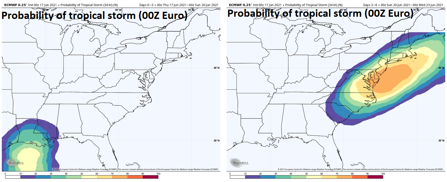
A tropical wave currently exists over the southern part of the Gulf of Mexico and is now producing a more organized area of showers and thunderstorms. This system will continue on a northward track over the next 24 hours – likely intensify enough to reach tropical storm status and, if so, it would become named “Claudette”. By later Friday night , the tropical storm is likely to reach the northern Gulf coastal region of Louisiana. It appears that the heaviest rainfall associated with this system will take place on its eastern side putting Alabama and the Florida Panhandle inline for a soaking rain event in addition to Louisiana and Mississippi.

The forecast map for early Saturday features a tropical system over Louisiana and some heavy rainfall over the Ohio Valley likely associated with upper-level energy and some strong-to-severe thunderstorm activity. Map courtesy NOAA, tropicaltidbits.com
After landfall, the remains of this tropical system are likely to push to the northeast and some heavy rainfall is possible from later Saturday into Sunday across the Tennessee Valley and Southeast US. There is even a chance that this storm intensifies some over land - contrary to the usual trend of tropical systems – and it could bring some heavy rainfall and gusty winds to the Carolinas by later Sunday into early Monday.
Severe weather threat
While the tropical system pushes to the north and then northeast in coming days, there will be a batch of strong-to-severe thunderstorms impacting the Upper Midwest, Ohio Valley and ultimately perhaps even the Mid-Atlantic and Northeast US. This general threat will come about as strong waves of energy aloft drop southeastward from Canada into the northern US over the next couple of days. The severe weather threat will be highest later Thursday and Thursday night across the Upper Midwest and then this threat zone should shift to the east later Friday to the Ohio Valley. Some of the strong-to-severe storms could even work their way into the Mid-Atlantic/Northeast US by later Friday night and Saturday as humidity levels will climb noticeably in that part of the nation.

Yet another much cooler-than-normal air mass will pour into the northeastern quadrant of the nation by later Tuesday and Wednesday with deep upper-level low dominating the scene. Maps courtesy NOAA, tropicaltidbits.com
Cool blast
By the early part of next week, a deep upper-level trough will be dropping southeastward across the Great Lakes region at about the same time the tropical system reaches the southern Mid-Atlantic coastline. A strong surface cold front will be associated with this incoming upper-level trough and it’ll push through the eastern states on Tuesday with additional showers and thunderstorms. The cold front should push off the eastern seaboard by late Tuesday and yet another cooler-than-normal air mass for this time of year will flood the region from the Upper Midwest/Great Lakes to the Mid-Atlantic/Northeast US.
Meteorologist Paul Dorian
Peraton
peratonweather.com
Follow us on Facebook, Twitter, YouTube
Video discussion: