2:10 PM | ***Strong storms and torrential rain a threat from later tonight into the weekend as the Mid-Atlantic transitions from high heat to noticeably cooler conditions…important tropical update***
Paul Dorian

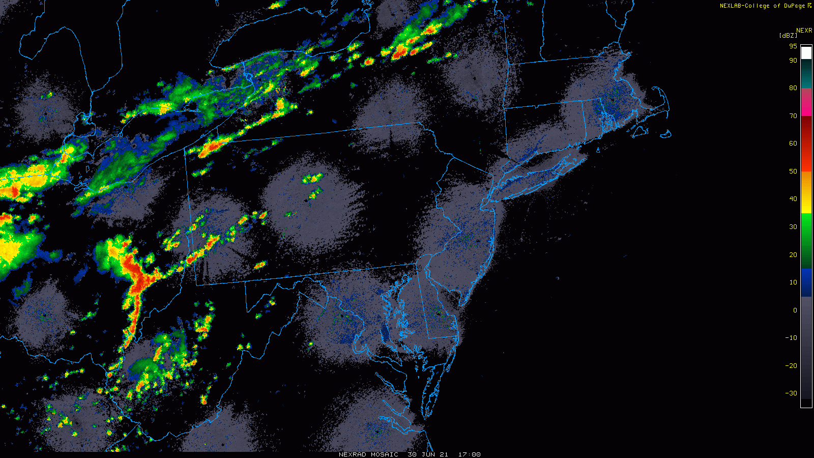
Thunderstorms are erupting across the western Mid-Atlantic and Northeast US…some of these strong storms can make it into the I-95 corridor later tonight…torrential rainfall is a threat on Thursday and Thursday night. Radar maps courtesy College of DuPage, NOAA
Overview
There was intense heat across the Pacific Northwest earlier in the week and also quite a hot spell in the Mid-Atlantic region with strong upper-level ridging the main culprit in both parts of the nation. The heat in the Mid-Atlantic will transition to much cooler conditions by the time we get to the end of the work week and early part of the holiday weekend. This change will come about with numerous strong-to-severe thunderstorms and torrential rainfall with localized flooding a real threat. The weekend will start off quite a bit cooler-than-normal in the Mid-Atlantic and also very unsettled with deep upper-level low pressure moving directly overhead, but improvement and warming will come later in the weekend.
Elsewhere, an impressive tropical wave exited off of the west coast of Africa last week and it is now churning over the central Atlantic. We certainly could be dealing with a “tropical storm” nearing the Caribbean Sea by the end of the week and this system will have to be closely monitored heading into the first full week of July.
Strong-to-severe storms/torrential rainfall a threat in the Mid-Atlantic
Temperatures have soared into the 90’s again today in the DC-to-Philly-to-NYC corridor and dew points remain at uncomfortable levels. Thunderstorms have formed across portions of eastern Ohio, West Virginia and western Pennsylvania and some of these storms are likely to reach the immediate DC-to-Philly-to-NYC corridor later tonight. Any rainfall later tonight can be heavy at times and any thunderstorm can be strong-to-severe with the greatest chance of damaging wind gusts north of the PA/MD border.

Cooler-than-normal conditions will extend early this weekend all the way from the south-central US to northern New England. Map courtesy NOAA, tropicaltidbits.com
A frontal system will inch its way across the region later Thursday and low pressure will form along this slow-moving boundary zone enhancing the chances of torrential rainfall in DC, Philly and NYC and possible strong-to-severe thunderstorm activity. Watch for localized flooding in the I-95 corridor region as some spots can receive two, three…even four inches of rain between later tonight and late tomorrow night. The threat for heavy rain will continue into Friday as well as an upper-level low begins to drop southeastward from the eastern Great Lakes and towards the Mid-Atlantic.

An upper-level low will position itself right over the Mid-Atlantic region on Saturday likely resulting in very unsettled conditions and cooler-than-normal temperatures. Map courtesy NOAA, tropicaltidbits.com
The heat wave will begin to breakdown on Thursday and then Friday and Saturday will feature well below-normal temperatures for early July in the Mid-Atlantic region. The upper-level low will begin pushing off to the north and east by Sunday and weather conditions should improve compared to the expected unsettled day on Saturday; however, showers cannot be ruled out for the 4th of July (Sunday). Much more improvement is likely by the time we get to the Monday (July 5th) holiday with plenty of sunshine returning and that will help to boost temperatures into the 80’s for highs after being confined to the 70’s on Saturday and Sunday.

The GFS computer forecast model has been quite “bullish” on this tropical system now over the central Atlantic. The 12Z GFS model run places the system just north of Cuba by the early part of next week. Map courtesy NOAA, tropicaltidbits.com
An important tropical update and a potential threat to the Gulf of Mexico/Southeast US
A tropical wave pushing slowly to the WNW over the central Atlantic Ocean is rather impressive looking considering it has traveled over some cooler-than-normal waters during the past few days. This system is quite likely to reach “tropical storm” status in the near term (would be named “Elsa”) as it continues to benefit from an atmosphere of low wind shear. This tropical system will likely come close to the island of Barbados by Friday and then enter the Caribbean Sea early this weekend where there are more favorable sea surface temperatures compared to the eastern Atlantic Ocean. This system could then reach the northwestern part of the Caribbean Sea by the early part of next week and all residents in the southeastern US should closely monitor it in coming days.

Sea surface temperatures will be quite favorable for development as the tropical system pushes into the central and western Caribbean Sea later in the weekend. Map courtesy NOAA, tropicaltidbits.com
Meteorologist Paul Dorian
Peraton
peratonweather.com
Follow us on Facebook, Twitter, YouTube
Video discussion: