11:55 AM | *Tropical Storm “Fred” nears Hispaniola…likely headed to the Florida Keys and then the eastern Gulf…could ride northward through the eastern states next week…2nd system in eastern Atlantic*
Paul Dorian

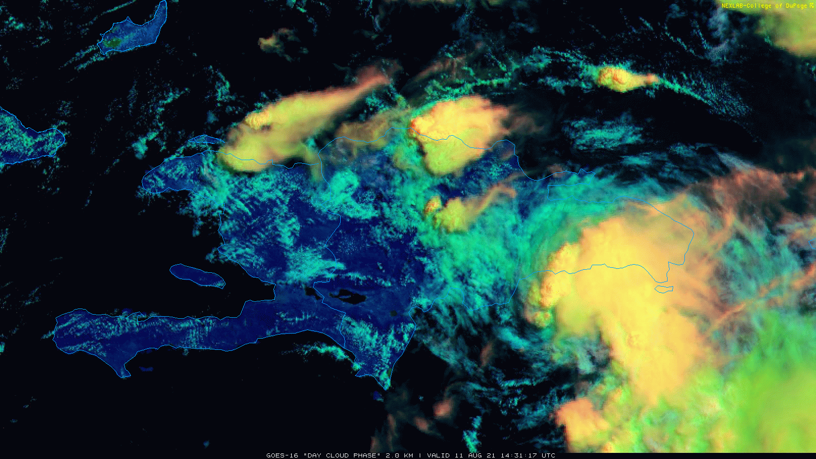
Tropical Storm “Fred” (lower, right) has intensified slightly in recent hours as it interacts with the Dominican Republic on the eastern side of the Caribbean island of Hispaniola. Images courtesy College of DuPage, NOAA
Overview
The Atlantic Basin tropical scene has become quite active with one named storm (“Fred”) just south of the Dominican Republic on the eastern side of the Caribbean island of Hispaniola and a second system intensifying in the eastern Atlantic. Tropical Storm “Fred” is likely headed to the Florida Keys by the early part of the weekend and then to the eastern part of the Gulf of Mexico where sea surface temperatures are generally warmer-than-normal. TS “Fred” could then reach the Panhandle region of western Florida by early next week and the remains may then push northward through the eastern states later in the week. Meanwhile, the second Atlantic tropical system could end up taking a similar track as “Fred” – perhaps impacting the same northern part of the Caribbean.

A key player in coming days will be intensifying high pressure ridging in the upper part of the atmosphere over southeastern Canada. This 06Z GEFS forecast map for one week from now (i.e., Wednesday, August 18th) features strong high pressure ridging at the 500 millibar level centered over southeastern Canada which is typically a favorable pattern for tropical systems to “undercut” and head from east-to-west and potentially towards Florida and the Gulf of Mexico. Map courtesy tropicaltidbits.com, NOAA
Details
It is not unusual for tropical activity in the Atlantic Basin to pick up during the month of August as sea surface temperatures typically climb towards their usual mid-September peak. Indeed, there are now two systems of note with the frontrunner now classified as a tropical storm (named “Fred”) and a second forming in the eastern Atlantic. The circulation of Tropical Storm “Fred” has become better defined in recent hours and its maximum sustained winds have increased slightly to around 45 mph. The movement of “Fred” is to the WNW at 16 mph and it should stay on this general path during the next couple of days.

Sea surface temperatures are plenty warm enough this time of year (and above-normal) to support a hurricane in the southwestern Atlantic or Gulf of Mexico. Map courtesy tropicaltidbits.com, NOAA
While sea surface temperatures are generally warmer-than-normal in the Caribbean Sea, intensification prospects for Tropical Storm “Fred” are somewhat limited in the near term as it interacts with the land mass of Hispaniola which does contain some high terrain. The mountainous region of Hispaniola often affect the general circulation pattern around a given tropical system inhibiting its chances for intensification – at least in the short-term. Once Tropical Storm “Fred” bypasses Hispaniola, some strengthening could occur and it is likely to reach the Florida Straits by the early part of the weekend.
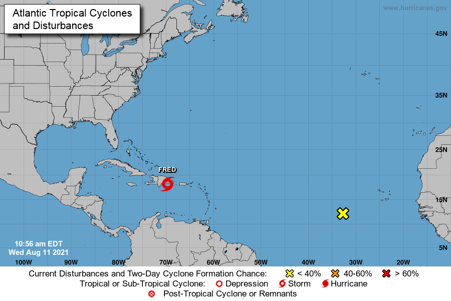
There are now two tropical systems of note in the Atlantic Basin with Tropical Storm “Fred” near the island of Hispaniola and a second system over the eastern Atlantic. Map courtesy NOAA/NHC
More strengthening is possible once Tropical Storm “Fred” moves over the eastern part of the Gulf of Mexico this weekend given the warmer-than-normal sea surface temperatures in combination with a potential decrease in wind shear. There is a risk that “Fred” reaches the western Panhandle region of Florida by the early part of next week and signs point to the possibility of its remains turning northward and pushing through the eastern states later in the week. Meanwhile, the trailing second system now located over the eastern Atlantic may ultimately take a similar track of “Fred” as high pressure intensifies to the north and east across southeastern Canada…stay tuned on what could become Tropical Storm “Grace”.
Meteorologist Paul Dorian
Peraton
peratonweather.com
Follow us on Facebook, Twitter, YouTube
Video discussion: