2:40 PM | *Scattered strong-to-severe storms in the Mid-Atlantic region on the final day of the oppressive heat and humidity…a tropical update on “Fred” and the soon-to-be “Grace”*
Paul Dorian
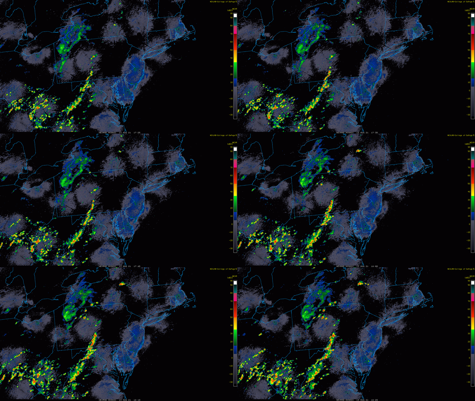
Another day of oppressive heat in the Mid-Atlantic (and the last day) and there are strong-to-severe thunderstorms forming in interior sections. Images courtesy College of DuPage, NOAA
Overview
The Mid-Atlantic region remains quite hot and humid today and there is a chance for scattered strong-to-severe thunderstorm activity from later in the day through early tonight. Today will be the last day of the oppressive heat and humidity in the Mid-Atlantic as a cool frontal system will usher in more comfortable air for the weekend; especially, by the time Sunday rolls around when afternoon temperatures will be in the low-to-mid 80’s and humidity will be much more bearable.
Meanwhile, the Atlantic Basin remains quite active with two systems to monitor. The first system that was at one time classified as Tropical Storm “Fred” is now a “depression”, but it is likely to regain storm status again in the near future. This system will push towards the Florida Keys by early tomorrow then likely to a position over the warm waters of the eastern Gulf of Mexico. After that, “Fred” will head towards the far western part of Florida’s Panhandle and it could intensify further before making a landfall sometime late Monday. A second system that is now over the central Atlantic is very likely to become Tropical Storm “Grace” and it is likely to take a more southerly track to its predecessor “Fred” and possibly end up in the southern/western Gulf of Mexico.
NOAA’ s Storm Prediction Center has a slight risk of severe weather in the Mid-Atlantic region.
Mid-Atlantic: severe weather threat and the end of the oppressive heat
The oppressive heat and humidity of the past couple of days in the Mid-Atlantic region will come to a noisy finish for some later today into early tonight with scattered strong-to-severe thunderstorm activity. While many spots will miss the approaching storms, the atmosphere is unstable enough for some to experience damaging wind gusts and heavy rainfall probably in the time period of 4-9pm. A cold front will slide slowly through the region on Saturday and the result will be a transition type of day in the Mid-Atlantic region with less heat and humidity compared to today, but still a lingering chance for scattered showers and storms. More comfortable air will become quite noticeable by Sunday with high temperatures generally in the low-to-mid 80’s across the DC-to-Philly-to-NYC corridor to go along with lower humidity levels…a nice day to finish the weekend.
The Atlantic Basin features two systems currently…”Fred” is the frontrunner and the second will soon become “Grace”. Image courtesy University of Wisconsin/SSEC, NOAA
Tropical Update: “Fred” and soon-to-be “Grace”
Tropical Storm “Fred” weakened a couple of days ago as it encountered the high terrain of the Caribbean island of Hispaniola, but it is now heading over open waters that are generally above-normal for mid-August. This system is likely to re-intensify back to tropical storm status as it heads towards the Florida Keys by early in the weekend. After that, “Fred” will move over the eastern part of the Gulf of Mexico and there it could undergo some additional intensification as it heads towards a late Monday landfall likely somewhere near the far western part of Florida’s Panhandle. Looking ahead, the remains of “Fred” are likely to result in some heavy rainfall during the first half of next week in the Southeast US and the Tennessee Valley.
Tropical system #7 is likely to follow a similar path to “Fred” and become named “Grace” after reaching tropical storm status. Map courtesy NOAA/NHC
Meanwhile, the trailing second tropical system now located over the central Atlantic may ultimately take a more southerly track compared to “Fred” as high pressure intensifies to the north and east across southeastern Canada. This system is likely to soon reach tropical storm status (and take on the name of “Grace”) and move over the northern part of the Caribbean early next week and then likely into the southern/western Gulf of Mexico by the middle or latter part of next week…stay tuned.
Meteorologist Paul Dorian
Peraton
peratonweather.com
Follow us on Facebook, Twitter, YouTube


