1:15 PM | *Tropical system nearing the Caribbean Sea…likely to become a named storm and could ultimately have an impact on southern Florida and then spill out over the eastern Gulf of Mexico*
Paul Dorian

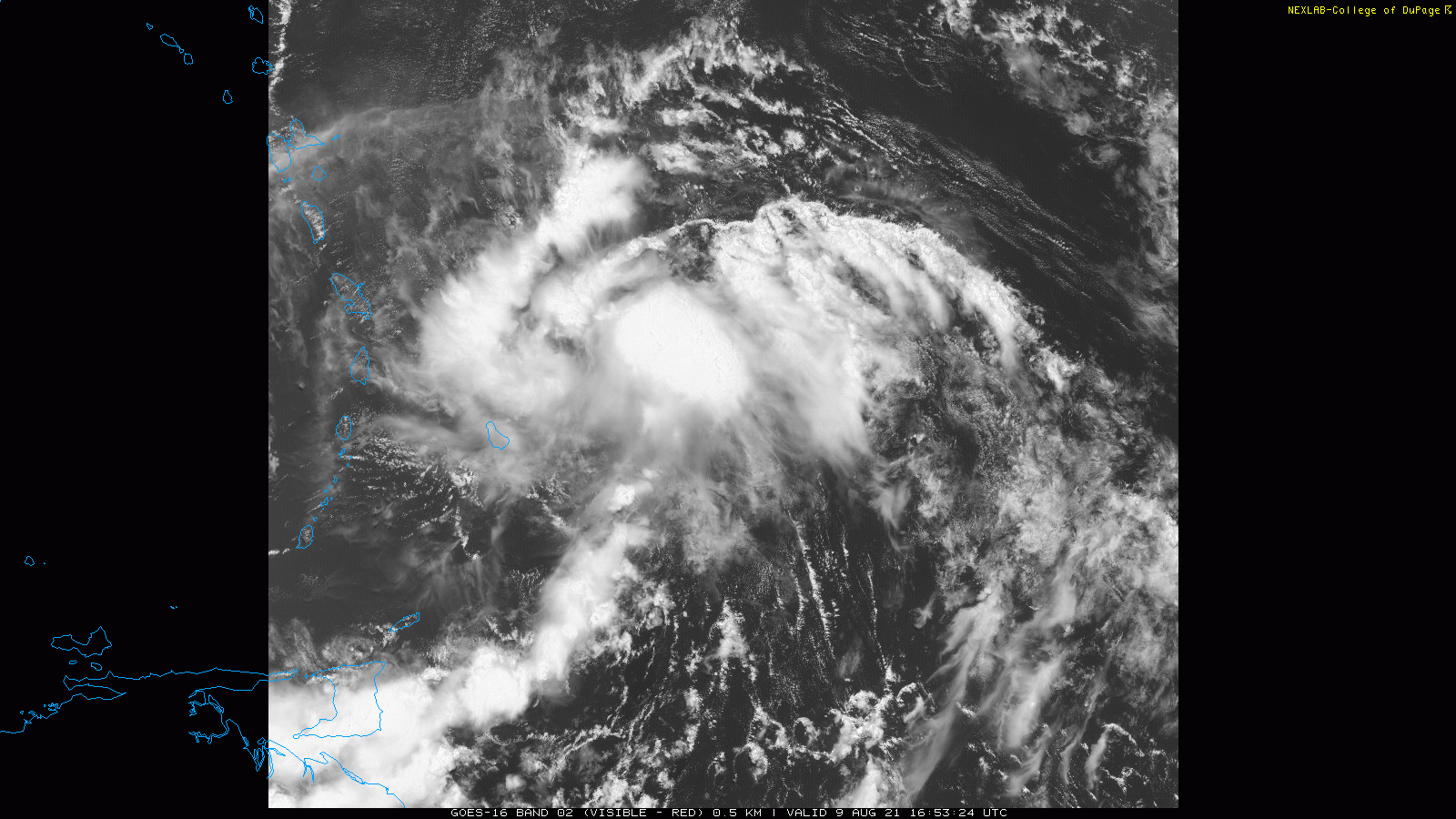
A better organized region of showers and thunderstorms could develop into a named tropical storm in coming days (would be “Fred”) as it enters the Caribbean Sea. Images courtesy College of DuPage, NOAA
Overview
After “Elsa” came ashore in northwestern Florida on July 7th, the tropical Atlantic experienced an extended quiet stretch of weather….that quiet stretch is now over. There are two tropical systems currently located in the central Atlantic and it is the frontrunner that is of increasing concern. This system is nearing the Caribbean Sea and it has a good chance of becoming a named (“Fred”) storm in coming days and could ultimately have an impact on southern Florida and then spill out over the eastern Gulf of Mexico.

The upper-air pattern will feature strong high pressure ridging over southeastern Canada as we progress to mid-month and this is favorable for the movement of central Atlantic systems from east-to-west - and potentially towards Florida and the Gulf of Mexico. Map courtesy NOAA
Details
The 2021 Atlantic Basin tropical season got off to a quick start in terms of the number of named tropical systems, but it has been rather quiet since the beginning of July. It is not unusual for tropical activity in the Atlantic Basin to pick up during the month of August as sea surface temperatures typically climb towards their usual mid-September peak. Indeed, there are now two systems located in the central Atlantic and the initial system is getting close to the Caribbean Sea. This front running system has a pretty concentrated area of showers and thunderstorms in association with a low pressure system about 100 miles or so east of Barbados. The disturbance is likely to reach tropical depression status later today or tonight as it continues to move on a WNW track around 10-15 mph. On its present track, this system is likely to reach the island of Hispaniola by the middle of the week and it is likely to become a named storm by that time (would become “Fred”).

There are two systems now being monitored in the central Atlantic, but it is the frontrunner that is of main concern for Florida and the Gulf of Mexico. Map courtesy NOAA/NHC
The overall upper-air pattern is evolving into one that features strong ridging over the southeastern part of Canada and this is often a “red flag” this time of year; especially, when considering sea surface temperatures are warm and climbing towards their September peak. Tropical systems that do form in the central Atlantic with high pressure ridging centered over SE Canada can “undercut” the ridge and push westwards towards the Southeast US and Gulf of Mexico and this is a concern here. The second system that is following closely behind is less likely to intensify during the next few days. All residents in Florida and the rest of the Gulf of Mexico region should begin to monitor the Atlantic Basin tropical scene closely as we heads towards the middle of the month.
Meteorologist Paul Dorian
Peraton
peratonweather.com
Follow us on Facebook, Twitter, YouTube
Video discussion: