12:45 PM | ***Arctic air grips the Mid-Atlantic/Northeast US…modification in temperatures on Wednesday/Thursday…stormy pattern begins this weekend with a significant threat for Sunday/Monday***
Paul Dorian

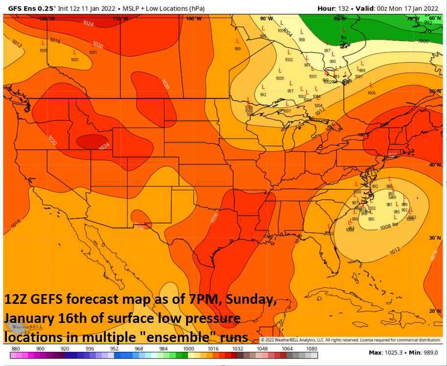
Low pressure is likely to push from the southeastern states later this weekend towards the Carolina coastline. This particular forecast map shows a distribution of surface low pressure locations for Sunday evening from various members of an “ensemble” model run. The all-important storm track will be better determined in coming days. Map courtesy NOAA, tropicaltidbits.com
Overview
An Arctic cold front pushed through the Mid-Atlantic/Northeast US on Monday night and the northeastern quadrant of the nation is suffering today as a result. Temperatures are way below-normal for this time of year despite some sunshine and a stiff NW breeze is pushing wind chill values down into single digits and, in some spots, to sub-zero levels. There will be some modification in temperatures on Wednesday and Thursday, but another cold air mass will arrive from the northwest at week’s end. Looking ahead, the overall weather pattern appears to be evolving into one that could feature multiple storm threats for the eastern US in coming days. A first system looks like it’ll stay far enough off the east coast on Thursday and Friday to have little or no impact in the Mid-Atlantic region, but it still needs to be monitored and could skirt eastern New England. A second storm threat could come in the Sunday/Monday time frame and this one has a much better chance at having a significant impact in the Mid-Atlantic/NE US.
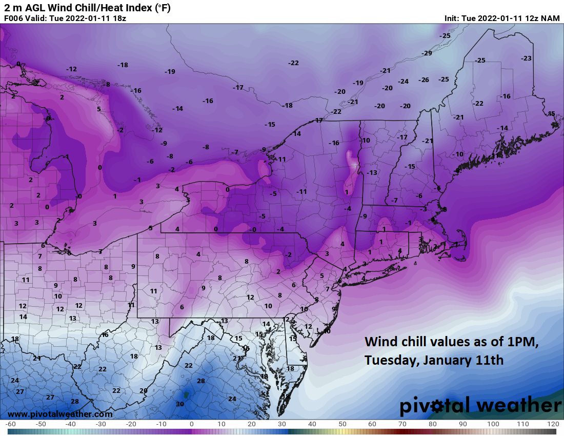
Wind chill values this afternoon will be in the single digits in many parts of the Mid-Atlantic/NE US as an Arctic air mass continues to grip the northeastern quadrant of the nation. Map courtesy NOAA, pivotall weather
Arctic cold through tonight…modification in temperatures on Wednesday/Thursday
Temperatures will do no better this afternoon than the low-to-mid 20’s in the DC-to-Philly-to-NYC corridor which is some 15 to 20 degrees below-normal for this time of the year. The winds are quite brisk from the NW and this is generating wind chills down in the single digits and in some areas, to sub-zero levels. After another very cold night, temperatures will moderate on Wednesday and Thursday, but another cold air mass will build into the region on Friday and Saturday as high pressure moves into southeastern Canada.
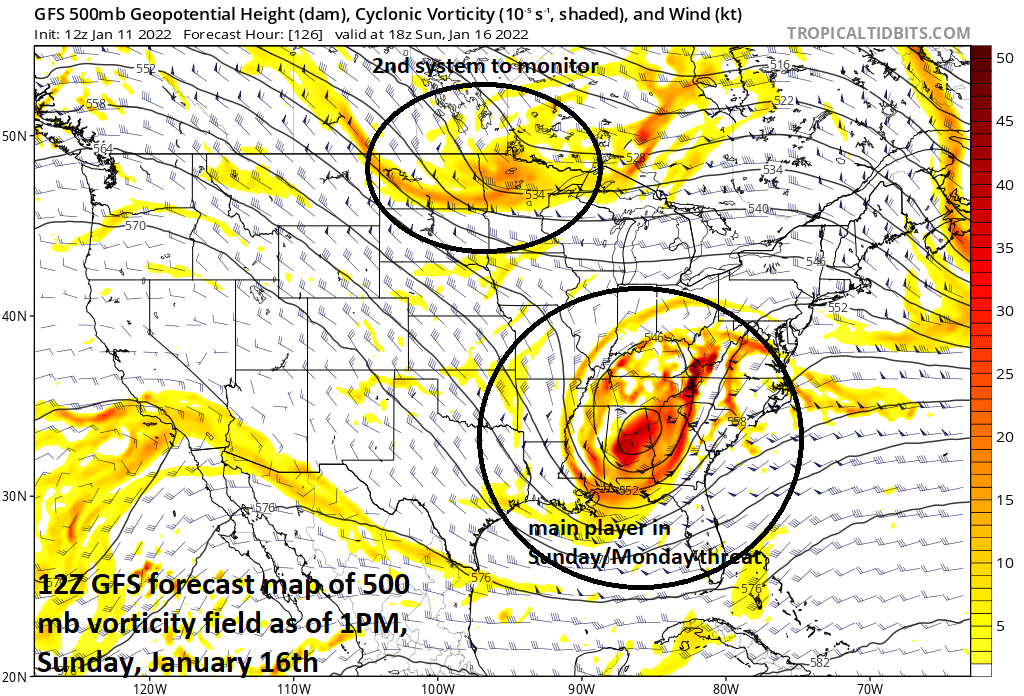
A main player in the Sunday/Monday storm threat will be a potent upper-level disturbance that should push into the southeastern states by later Sunday. A second wave in the northern branch of the jet stream could play a role as well. Map courtesy NOAA, tropicaltidbits.com
Storm threats
Low pressure will develop off the southeast coast on Thursday and intensify as it moves northeast to a position over the western Atlantic Ocean on Friday. This system is likely to have little to no impact in the Mid-Atlantic region, but could skirt the easternmost sections of New England at week’s end. It is still close enough to monitor, however, as it wouldn’t take too much of a change for a different outlook in the Mid-Atlantic region.
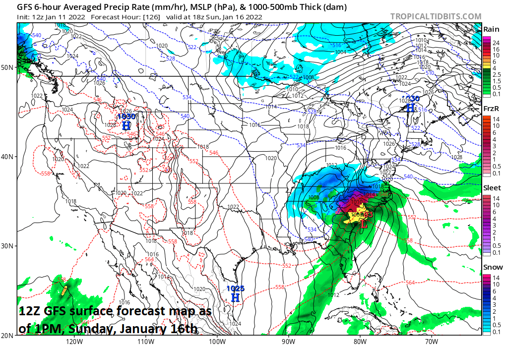
Surface forecast map as depicted by the operational run of the 12Z GFS for 1PM, Sunday, January 16th. Map courtesy NOAA, tropicaltidbits.com
Following right on the heels of this late week “ocean” storm, the overall pattern looks to evolve into one potentially much more threatening for the Mid-Atlantic/NE US. An upper-level disturbance will drop southward into the central Plains on Friday and then reach the Deep South by later Saturday. By early Sunday, this potent system will round the base of a broader upper-level trough and begin a turn to the north and east. Exactly how far north and east this system ultimately comes will be crucial in determining how much of an impact there can be in the Mid-Atlantic/NE US on Sunday/Monday. Also, a second upper-level disturbance may be dropping southeastward through the northern branch of the jet stream and towards the eastern US. Its interaction with the southern branch feature, if any, could become an important factor as well for the overall storm threat in the Mid-Atlantic/NE US on Sunday/Monday.
The snow mass across the Northern Hemisphere is above-normal as of Sunday, 09 January. Data courtesy Finnish Meteorological Institute
At the surface, low pressure will likely develop in the southeastern states later in the weekend as the upper-air support closes in from the northwest and this system will likely then take a turn to the northeast. In fact, there is a chance this surface low pressure system ends up producing quite a significant snowfall for inland, higher elevation sections of the Carolinas. After that, there is certainly a chance that this storm continues to push to the northeast along or just off the east coast which would potentially greatly impact the Mid-Atlantic/NE US with accumulating snow from later Sunday into Monday. However, there is also a chance that the system ends up pushing a bit farther inland which would bring warmer conditions to at least coastal sections of the Mid-Atlantic and perhaps also into the I-95 corridor. This possible outcome is something to watch in coming days and it would result in a mixed bag of precipitation.
There are still several days to go and many questions have to be answered, but an important threat is on the table for the Mid-Atlantic/NE US in the Sunday/Monday time frame…stay tuned.
Meteorologist Paul Dorian
Arcfield
arcfieldweather.com
Follow us on Facebook, Twitter, YouTube
Video discussion: