11:30 AM | ****Pounding continues with today’s storm from DC-to-Delmarva-to-southern NJ… power outages an increasing problem…next snow threat for the Mid-Atlantic comes Thursday night/Friday****
Paul Dorian

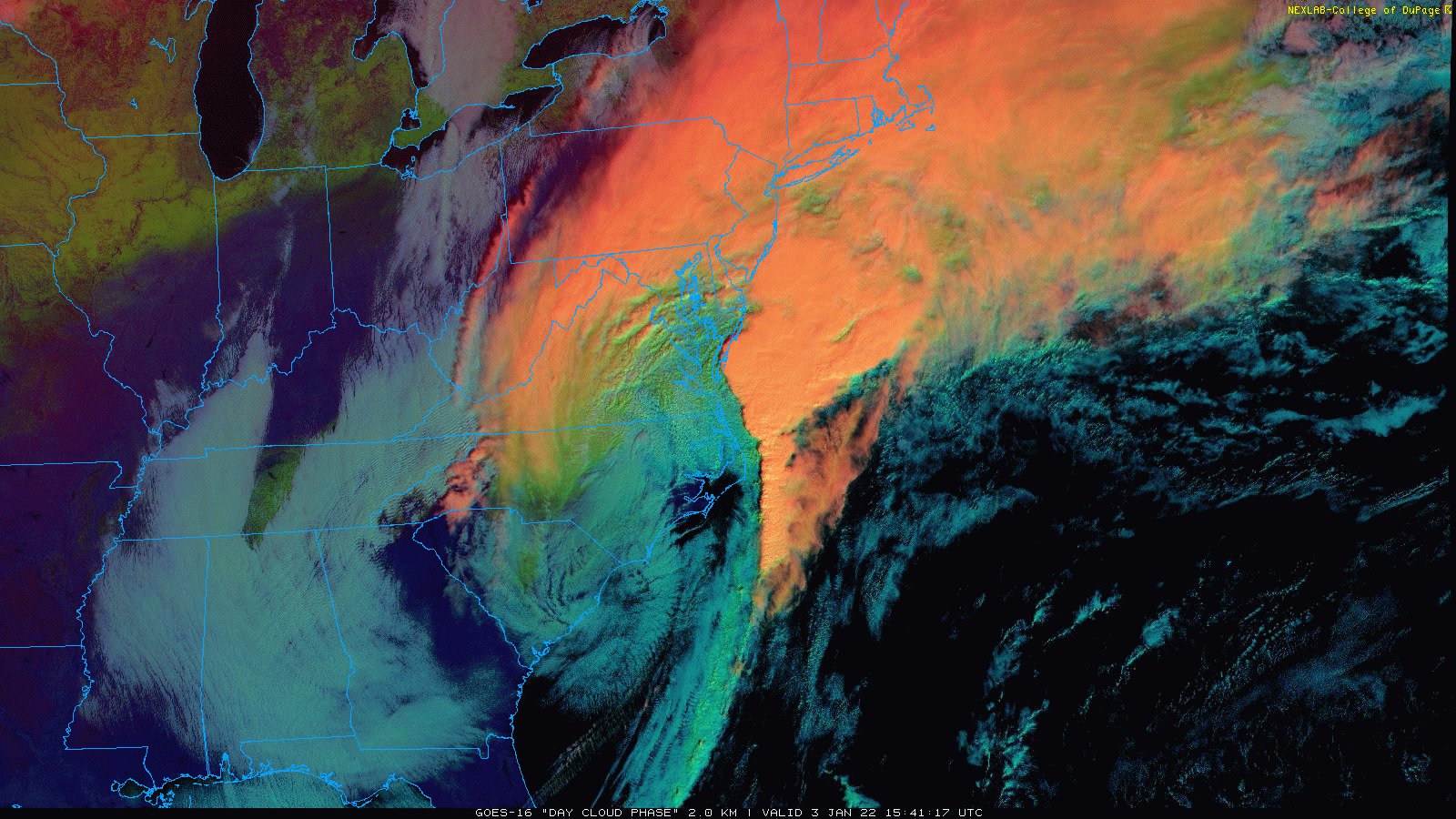
Low pressure will push away from the Mid-Atlantic coastline this afternoon and snow will end from west-to-east. images courtesy NOAA, College of DuPage
Overview
A new week, a new month, a new year, and a new weather pattern for the eastern US as winter has finally arrived. A significant snowfall continues at this hour in the region from DC-to-the-Delmarva Peninsula-to-southern New Jersey and the snow will wind down later this afternoon from west-to-east. Some snow is now being reported at Philly Airport, but for the most part, today’s storm will bypass the Philly and NYC metro regions as it slides just to their south and east. In addition to very poor road conditions in the hard hit areas, power outages have become an increasing problem given the strong winds and heavy, wet snowfall. Another threat for accumulating snow is likely to come in the Thursday night/early Friday time period and that threat could be for a more widespread part of the Mid-Atlantic region and Northeast US.
Details
There was no measurable snow during December in the DC, Philly and NYC metro regions and overall temperatures ended the month at well above-normal levels. Indeed, the new month of January started off with a couple of very mild days in the I-95 corridor with temperatures on Sunday reaching as high as 60 degrees in some spots. There were big changes, however, that came in the overnight hours as colder air poured in from the northwest following the passage of a strong cold front.

Next threat for snow in the Mid-Atlantic comes Thursday night/Friday with upper-level disturbance that will push eastward in coming days. Map courtesy Canadian Met Centre, tropicaltidbits.com
Low pressure formed along the frontal boundary zone – aided by a strong disturbance in the upper atmosphere – and it has resulted in a significant snowfall today from the DC metro region to the Delmarva Peninsula to the southern half of New Jersey. In fact, accumulations from this storm can reach 8-12 inches in the “bullseye” zone from the southern half of the DC metro region all the way to the Jersey Shore and don’t be surprised if there is some “thunder snow” mixed in. The Philly and NYC metro regions will only be sideswiped by this system with suburban areas to the north and west of these metro areas likely to experience little or no snow at all.
Despite the warm ground and mild temperatures on Sunday, the snow was able to overcome these obstacles and produce some significant accumulations given the influx of much colder air and the intensity of the snowfall. Indeed, the atmosphere can do some amazing things as was the case in Huntsville, Alabama this weekend where temperatures reached 79 degrees on Saturday and then snow accumulated 6 inches on Sunday from this same system now impacting parts of the Mid-Atlantic. The low pressure system will push away from the Mid-Atlantic coastline this afternoon and the snow should wind down from west-to-east, but the winds will continue at a strong levels and roads will be very slow to improve in those hard hits areas. In addition to the road problems, power outages have been increasing across Virginia over the past couple of hours given the heavy, wet snow combined with the high winds and this could become more of an issue during the next few hours in a wider area.
By tonight, high pressure will begin to take over and temperatures will drop to some of the lowest levels of the season; especially, in snow-covered areas where upper teens are likely. These kind of temperatures will ensure that icy road conditions will continue in many of those spots now with snow cover into the morning hours of Tuesday. After a bit of a milder day on Wednesday, another cold front will usher in colder air for the latter part of the week.

12Z GEM forecast map for Friday morning features a more widespread snowfall in the Mid-Atlantic region and Northeast US compared to today’s system. Map courtesy Canadian Met Centre, tropicaltidbits.com
By later Thursday, another strong disturbance in the upper atmosphere will slide eastward towards the eastern states. This system is likely to spawn low pressure in the southeastern states which is then likely to intensify as it heads towards the Mid-Atlantic coastline. As such, it’ll have the chance to produce more accumulating snow in the Mid-Atlantic region and Northeast US in the Thursday night and early Friday time period. This time, the Philly and NYC metro regions are more likely to get in on some of the action, but there are still some questions that remain on this next threat so stay tuned.
Meteorologist Paul Dorian
Arcfield
arcfieldweather.com
Follow us on Facebook, Twitter, YouTube
Video discussion: