1:15 PM | ***An impressive chill today in the Mid-Atlantic region and additional very chilly air masses are on the way***
Paul Dorian
It is especially chilly today in the Mid-Atlantic region and it looks like multiple additional chilly air masses will drop southeastward from Canada in coming weeks into the northeastern part of the nation. In fact, the next shot arrives just in time for the upcoming weekend. Maps courtesy NOAA, tropicaltidbits.com
Overview
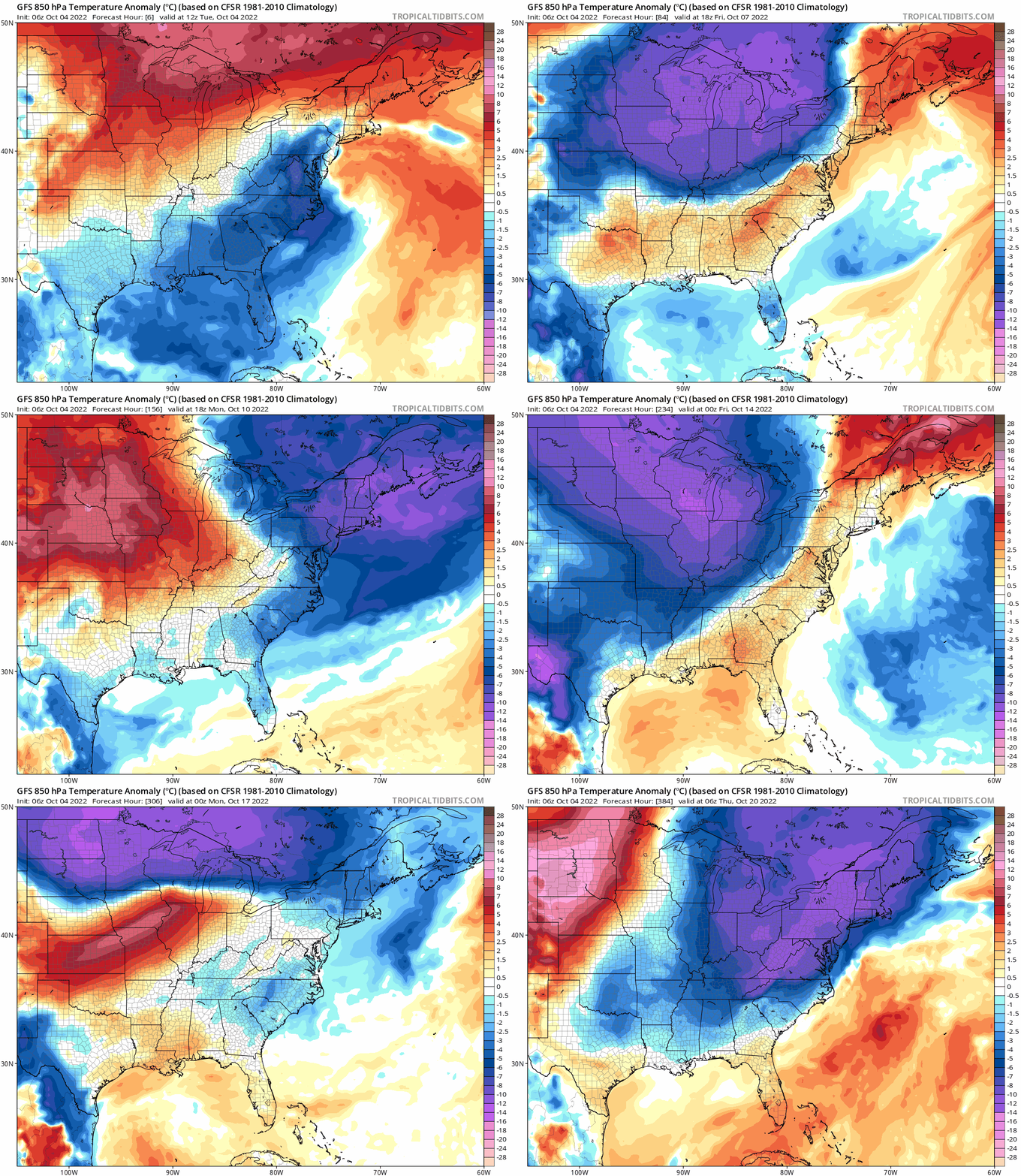
The noontime temperatures in the DC-to-Philly-to-NYC corridor were especially low for this time of year and several spots may indeed set “record low maximum” temperatures for the date. Stubborn surface low pressure continues to spin near the Mid-Atlantic coastline at mid-day and it is supported by a strong upper-level low. As a result, winds at the lower levels of the atmosphere have been strong and persistent from a north-northeast direction contributing to the unusual chill. Looking ahead, it looks like additional very chilly air masses are headed to the Great Lakes, Midwest and northeastern quadrant of the country in coming days and weeks with the next shot arriving for the upcoming weekend.
The current weather situation in the Mid-Atlantic region features a stubborn surface low pressure area near the coast which is supported by strong upper-level low at the 500 millibar level. These systems are contributing to the unusual chill today in the region. Map courtesy NOAA (GFS), Pivotal Weather
Discussion
Not only has it been quite wet and windy in recent days in the Mid-Atlantic region, it has also been unusually chilly for the early part of October. Climatological averages today for high temperatures in the I-95 corridor range from 70 degrees in Central Park in New York City to 72 degrees at Philly Intl Airport and 74 degrees at Reagan National Airport in Washington, D.C. We won’t come anywhere close to those averages later today with most places some 20 degrees below-normal for the 4th of October and several spots may record their “lowest maximum” temperature ever recorded for the date. For example, in Philly the lowest maximum temperature for October 4th is 55 degrees and noontime temperatures were only 50 degrees at PHL Intl Airport with little chance for much improvement this afternoon. Also at noontime, temperatures were way below-normal in Washington, D.C. and Central Park in New York City with readings of 52 degrees at both places and “record low maximums” are possible.
Looking ahead, it looks like additional very chilly air masses are destined to push from central Canada into the Great Lakes, Midwest and northeastern states as we progress through the month of October. The next shot of chilly air will arrive in the Mid-Atlantic region for the upcoming weekend following the passage of a strong cold front on Friday. Another chilly air mass could follow by the middle of the month and yet another shortly after that as upper-level troughing will be quite persistent in the northeastern states during the next few weeks.
Meteorologist Paul Dorian
Arcfield
arcfieldweather.com
Follow us on Facebook, Twitter, YouTube


