
11:15 AM | *Unsettled weather for the Mid-Atlantic region from later today through tomorrow night to include the chance of some heavy rain and strong thunderstorms…an early tropical threat*
Paul Dorian

There is a chance for strong thunderstorm activity in the Mid-Atlantic region from later today through tomorrow night. The best chance for strong storms later today and tonight will be north of the PA/MD border and this threat zone will shift southward tomorrow to near and south of the Mason-Dixon Line. Maps courtesy NOAA/SPC
Overview
The passage of a back door cool front has brought relief today to the New York City metro region, New Jersey and it’ll turn out to be a bit better in the Philly area as well as easterly low-level winds have developed during the past few hours. Unfortunately, there will be no relief today in the DC metro region with highs likely to again be in the 90’s. This weak frontal boundary zone and another front will cause unsettled weather in the Mid-Atlantic from later today through tomorrow night that will include the chance for heavy rain and strong thunderstorms. High pressure will take back control at the end of the week and the weekend is shaping up to be quite nice across the region.
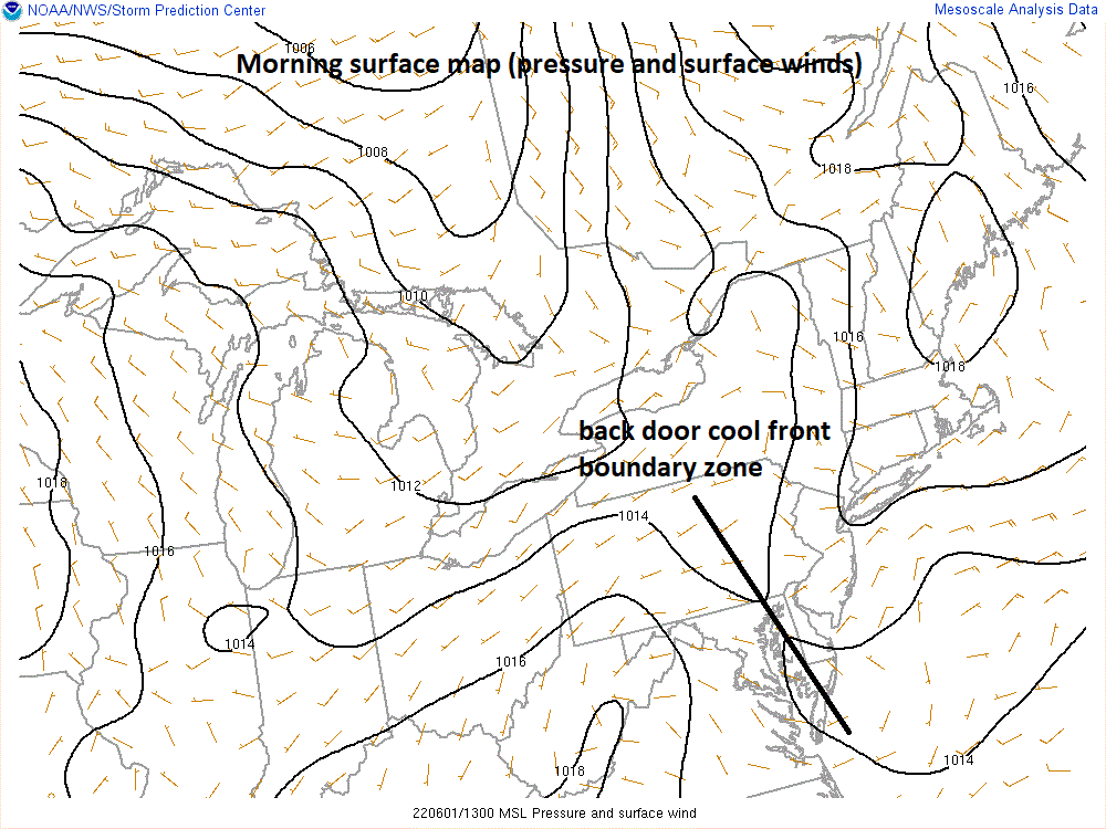
A back door cool front moved from east-to-west during the past 24 hours and its boundary zone is still in existence today and will add to some instability in the atmosphere. Map courtesy NOAA/WPC
Unsettled conditions in the Mid-Atlantic
The boundary zone associated with the back door cool front still exists today in the Mid-Atlantic region and it will contribute to some instability later in the day and tonight. As a result, the threat for showers and thunderstorms will increase later in the day and tonight; primarily, in areas to the north of the PA/MD border. In fact, the highest chance for strong-to-severe thunderstorm activity during this time will be in New York City and scattered strong storms can reach all the way down into the Philly metro region late today or tonight.
On Thursday, the highest threat for strong-to-severe thunderstorm activity will shift a bit to the south and will include the DC metro region. Low pressure will develop on Thursday along an incoming frontal boundary zone and this will enhance chances for rain in the Mid-Atlantic region; especially, to the south of the PA/MD border and some of the rain can be heavy. High pressure will resume control of the weather in the region at the end of the week and the weekend is shaping up to be quite nice with comfortably warm conditions likely on Saturday, Sunday and Monday.
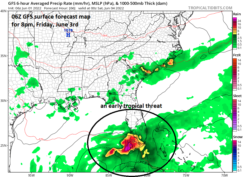
An early tropical threat in the 2022 Atlantic Basin season will likely result in some heavy rainfall on Friday and Saturday across southern Florida and the Florida Keys. Map courtesy NOAA, tropicaltidbits.com
An early tropical threat
The tropical season in the Atlantic Basin officially gets underway today and there will be an early threat for the Gulf of Mexico, Florida and the Bahamas. An area of showers and thunderstorms located over the northwestern Caribbean Sea will likely become better organized over the next few days as atmospheric conditions will become more favorable for intensification.
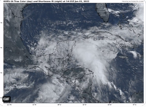
Tropical wave seen clearly this morning over the northwestern Caribbean Sea will likely intensify in coming days. Image courtesy NOAA, tropicaltidbits.com
This system can become the first named tropical storm of the season during the next several days and is very likely to bring some heavy rainfall to western Cuba, South Florida and the Florida Keys on Friday and Saturday. For more on the outlook for an active tropical season in the Atlantic Basin click here.
Meteorologist Paul Dorian
Arcfield
arcfieldweather.com