10:50 AM | *Cool blasts likely to continue in the Mid-Atlantic/Northeast US right into the early part of July*
Paul Dorian

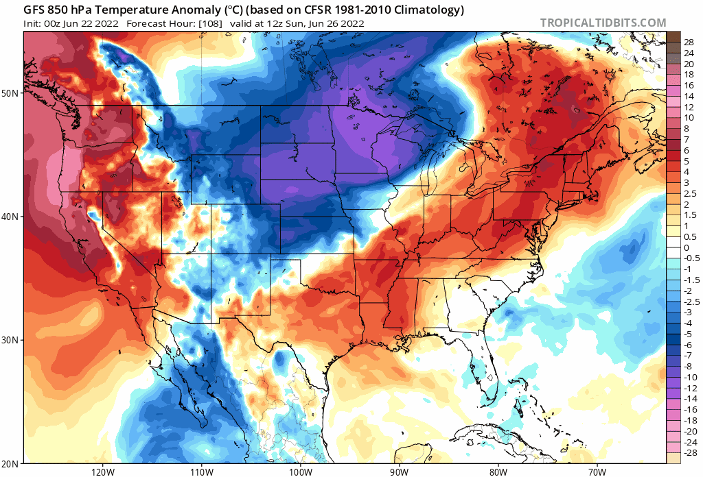
Another cool blast is destined to reach the Mid-Atlantic/Northeast US early next week and yet another is possible right around the 4th of July. This loop of 850 mb temperature anomalies from the 06Z GFS extend from Sunday, June 26th to Wednesday, July 6th. Maps courtesy NOAA, tropicaltidbits.com
Overview
This past Father’s Day weekend featured spectacular weather conditions in the Mid-Atlantic/Northeast US with comfortable temperatures for the middle of June and low humidity values. Indeed, the spring season as a whole has seen numerous cool air masses push into this part of the nation from Canada moving along in a general northwest-to-southeast fashion. In fact, almost all areas across the northern US have experienced near normal to below-normal temperatures back to the beginning of 2022. It appears that these cool blasts from Canada will continue across the northern states next week and beyond into at least the first part of the month of July.

This past Father’s Day weekend was considerably cooler-than-normal in the Mid-Atlantic/Northeast US and additional cool blasts are likely right into the early part of July. Map courtesy Weather Bell Analytics, NOAA
Details
The past weekend saw temperatures some 10-15 degrees below-normal in the Mid-Atlantic/Northeast US with persistent NW winds and a feeling of fall despite the calendar saying it’s the middle of June. While there certainly has been intense heat in recent days, it has generally been confined to the zone from the south-central US to the Southeast US with an occasional “northern incursion” into the Northern Plains and Upper Midwest. The rest of this week will see much of the same recent pattern in the Mid-Atlantic/Northeast US with sustained heat quite difficult to come.
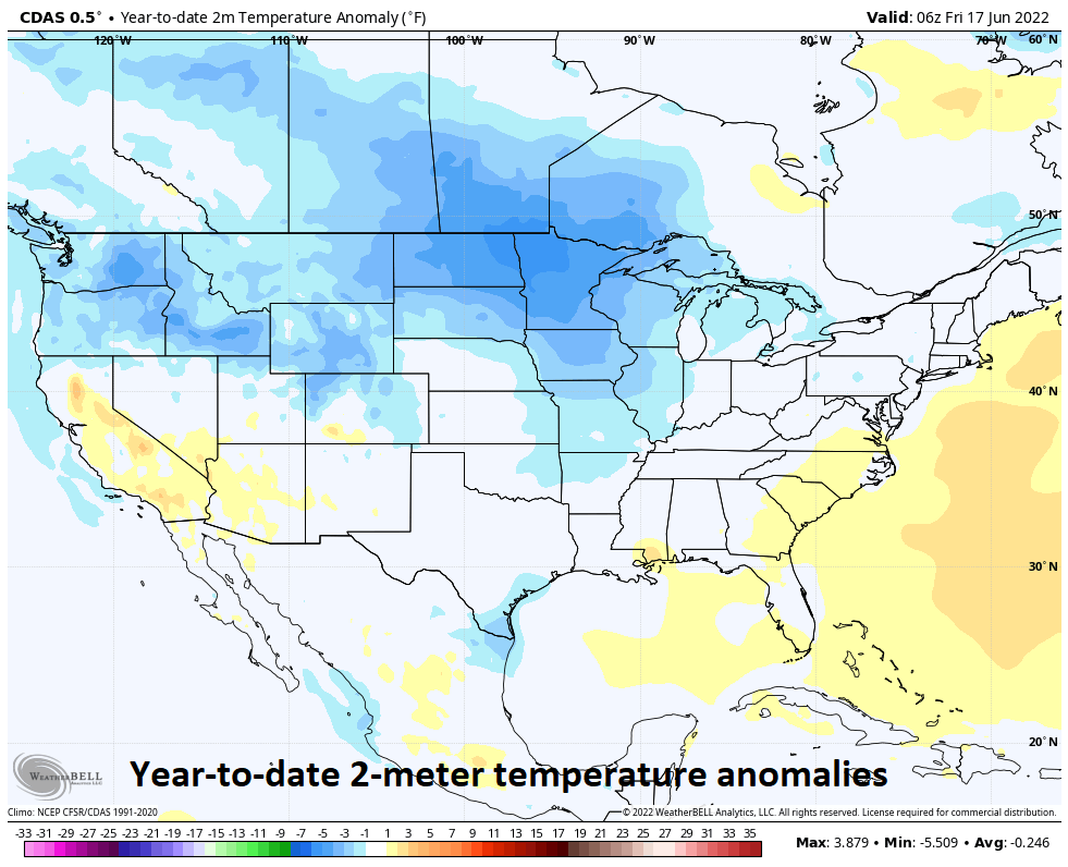
The “year-to-date” 2-meter temperature anomalies show near normal to below-normal conditions across a wide part of the northern US. Map courtesy Weather Bell Analytics, NOAA
An upper-level ridge of high pressure has been primarily centered over the middle of the nation in recent days and an occasional push to the northeast into the eastern Great Lakes. This kind of pattern has allowed for a fairly consistent north-to-northwesterly flow of air in the upper part of the atmosphere over the northeastern states. The result of this has been two-fold. First, it has kept the weather on the active side with numerous batches of showers and thunderstorms in recent weeks rotating around the outer periphery of the strong upper-level ridge from a NW-to-SE direction around here or even N-to-S. In fact, showers and thunderstorms are likely to move in this kind of direction from later today into Thursday in the Mid-Atlantic region with heavy rainfall on the table. Another impact on the persistent northwest flow aloft has been as an inhibiting factor in the sustainability of in places like Washington, D.C., Philly, New York City and Boston. As a matter of fact, there has been only one time this spring season with “back-to-back” days of 90 degrees or more in DC and Philadelphia and no such consecutive days in New York City. Boston has officially not even reached 90 degrees on a single occasion during the months of April, May or June.
The next several days are likely to see a continuation of this overall active weather pattern in this part of the nation with little chance of sustained heat. In fact, it appears as though another strong cold front will drop from northwest-to-southeast early next week paving the way for yet another cooler-than-normal air mass in the northeastern states as we end the month of June and a reinforcing shot is possible as we turn the calendar to July….perhaps around the for the 4th of July holiday weekend.
Meteorologist Paul Dorian
Arcfield
arcfieldweather.com
Follow us on Facebook, Twitter, YouTube
Today’s video discussion focuses on tonight’s heavy rain threat in the Mid-Atlantic region: