11:20 AM | **The latest on “major” Hurricane Fiona and a look ahead to the next tropical threat**
Paul Dorian
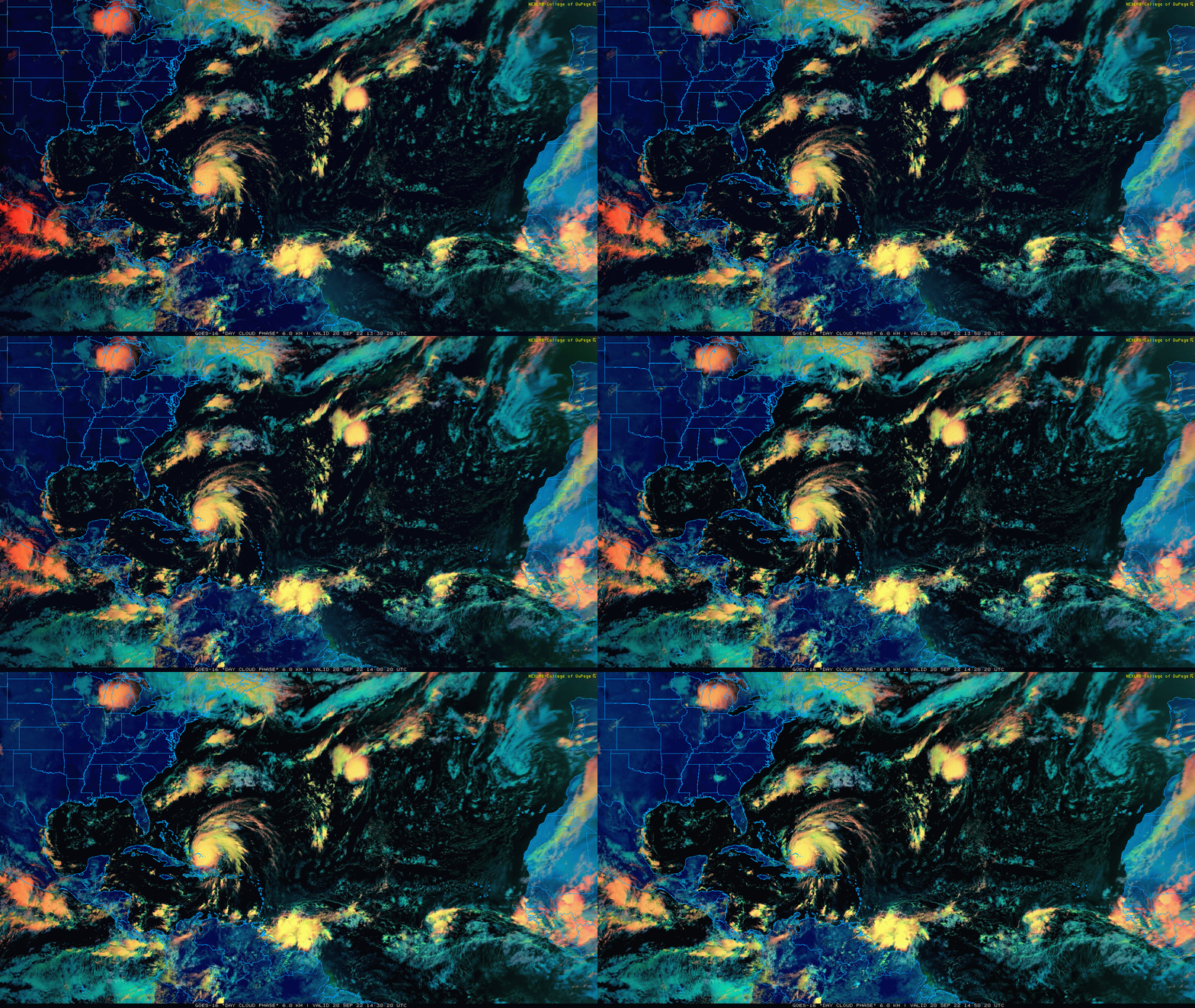
The Atlantic Basin is full of tropical activity at this the climatological peak time of the season with major Hurricane Fiona north of Hispaniola and another strong tropical wave to the east of the Windward Islands. It is this second tropical system than can have an impact on the Gulf of Mexico/SE US region by the middle or latter part of next week. Images courtesy College of DuPage, NOAA
Overview
After pounding Puerto Rico and the Dominican Republic on Monday, Hurricane Fiona has intensified into the season’s first “major” hurricane with category 3 classification and can attain category 4 status over the next few days as it gradually turns to the northeast. On this track, Hurricane Fiona will come close to Bermuda by early Friday and become increasingly influenced by an amplifying upper-level ridge over the northeastern US. This upper-level trough will result in the coolest air mass of the season so far in the Mid-Atlantic/Northeast US and ultimately could cause Fiona to pull back towards the Canadian Maritime Provinces this weekend with the potential of a direct impact. Meanwhile, another tropical system is organizing east of the Windward Islands and it has a chance of intensifying over the warm Caribbean Sea during the next several days and ultimately, could become a threat to the Gulf of Mexico region.
Hurricane Fiona will stay to the east of the US east coast; however, an intensifying upper-level trough over southeastern Canada/NE US can “pull” it back towards the Canadian Maritime provinces this weekend. At the same time, the coolest air of the season will push into the Mid-Atlantic/NE US. Map courtesy NOAA, tropicaltidbits.com
Update on Hurricane Fiona
Hurricane Fiona has sustained winds of 115 mph as of 8AM which classifies it as a “major” (category 3) hurricane which is the first of the 2022 Atlantic basin tropical season. After pounding away at Puerto Rico and Dominican Republic on Monday, Fiona has been impacting the Turks and Caicos islands with heavy rainfall and powerful winds and flooding continues on parts of Puerto Rico and Hispaniola. Hurricane Fiona has been rather steady in its magnitude in recent hours with some influence by west-southwest wind shear, but more favorable conditions later in the week can result in strengthening of Fiona to category 4 levels as it tracks to near Bermuda.
The coolest air so far this season will push into the Mid-Atlantic/Northeast US for Friday and Saturday. Map courtesy NOAA, tropicaltidbits.com
Later this week, Hurricane Fiona will become increasingly influenced by an amplifying upper-level trough over the northeastern states which will bring the coolest air mass of the season so far to the Mid-Atlantic/Northeast US. In fact, high temperatures on Friday will be confined to the 60’s in the urban areas along the I-95 corridor and there may be a stiff breeze as well. This same upper-level trough will act to “pull” Fiona back towards the northwest this weekend which may result in a direct impact on the Canadian Maritime provinces.
Next tropical threat
In addition to Hurricane Fiona, a strong tropical wave is intensifying over the south-central Atlantic. Currently, this system is several hundred miles to the east of the Windward Islands and is likely to develop into a tropical depression over the next few days as it continues on a west-northwest track. On this expected track, this next tropical system should travel over the warm Caribbean Sea and favorable conditions are likely to result in an intensification. Looking ahead, there are signs that this tropical system could very well become a threat to the Gulf of Mexico by the middle or latter part of next week, but it is still too early to know details such as whether it will take a track over Cuba or the Yucatan Peninsula or somewhere in between. By the latter part of next week, high pressure ridging may build into the northeastern US/southeastern Canada which is often a red flag for tropical system to potentially “undercut” and impact the SE US/Gulf of Mexico. Residents all along the Gulf of Mexico and SE US coastlines should monitor this system over the next several days.
Meteorologist Paul Dorian
Arcfield
arcfieldweather.com
Follow us on Facebook, Twitter, YouTube
Video discussion:


