1:00 PM | ***Major storm to impact much of the nation in coming days…excessive rainfall, significant snow, ice…and a possible severe weather outbreak***
Paul Dorian

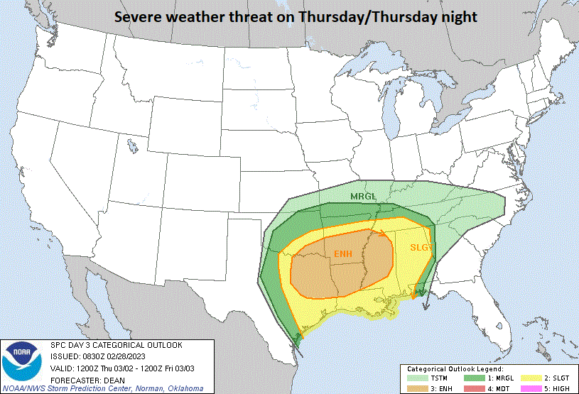
A severe weather outbreak is possible later this week as a powerful storm system moves from the south-central states to the northern Ohio Valley. Map courtesy NOAA/SPC
Overview
As one storm begins to exit off the Northeast US coastline, another one is already impacting northern California with rain in the lower elevations and snows in the mountains. This system will become a major storm and impact much of the nation in coming days with significant snow, ice and rain all the way from California-to-New England. There is also the threat of a severe weather outbreak later in the week across the Lower Mississippi and Tennessee Valleys.

Significant snow will fall in coming days with this major storm system across many places such as the Sierra Nevada Mountains of eastern California, parts of the Rocky Mountain States and Upper Midwest, and eventually, the Northeast US. Map courtesy NOAA, tropicaltidbits.com
Details
The snow has been immense in the Sierra Nevada Mountains of eastern California this winter season and given the fact that an active pattern is likely to continue into April, this could actually turn out to be one of the snowiest on record in that part of the Golden State. The Central Sierra Lab at Donner Pass (UC Berkeley) has received more than 100 inches of snow in just the past 7 days, more than 400 inches so far this year, and this is about 100 inches above the average for this time of year. This next powerful storm system is likely to bring an additional 6 or 7 feet to the Sierra Mountains by later tomorrow along with wind gusts of 70 mph and yet another storm could hit there this weekend. Across the state of California, the snowpack is almost twice the norm for the end of February and plenty more is on the way in the near term.
This storm system will next pound away at the Southwest US and the Rocky Mountain States from late tonight into the day on Thursday. Not only will snowfall be heavy in some of these higher elevation locations (e.g., northern Arizona, Wasatch Mountains (Utah)), the winds can be powerful as well during the next couple of days as this low pressure system heads from California to the middle of the country.

The Friday morning weather map will feature strong cold Canadian high pressure situated over southeastern Canada and a strong storm system over the Mississippi Valley region. Map courtesy NOAA, tropicaltidbits.com
By later Thursday, this storm will intensify over the south-central US and excessive and flooding type rainfall will become a serious threat in the Mississippi, Tennessee and Ohio Valleys - all situated in the warm sector of the strong surface low pressure system. On the cold side, significant snow is likely to develop late Thursday/Thursday night in the Upper Midwest where, for example, northern Illinois and Michigan can get hit hard (could be a big one for Chicago).

The interior Northeast US has the threat of a significant snowstorm by the end of the week. Map courtesy Canadian Met Centre, tropicaltidbits.com
As this storm system reaches the northern Ohio Valley, it’ll begin to feel the effects of strong high-latitude blocking over the northeastern part of Canada. As a result, there is very likely to be a transfer of energy from this primary (initial) storm to a secondary low pressure system that is likely to intensify by later Friday somewhere off the Mid-Atlantic coastline. In the Mid-Atlantic/Northeast US, the end of the week may feature conditions somewhat similar to yesterday’s storm with a wintry mix-to-rain scenario across southern Pennsylvania and accumulating (and potentially significant) snow and ice from central PA-to-New York State-to-northern New England.
Meteorologist Paul Dorian
Arcfield
arcfieldweather.com
Follow us on Facebook, Twitter, YouTube
Video discussion: