
10:45 AM (Wed) | ***Severe weather today extends from Texas to the Great Lakes…strong cold front reaches eastern seaboard later Thursday with a strong-to-severe thunderstorm threat***
Paul Dorian
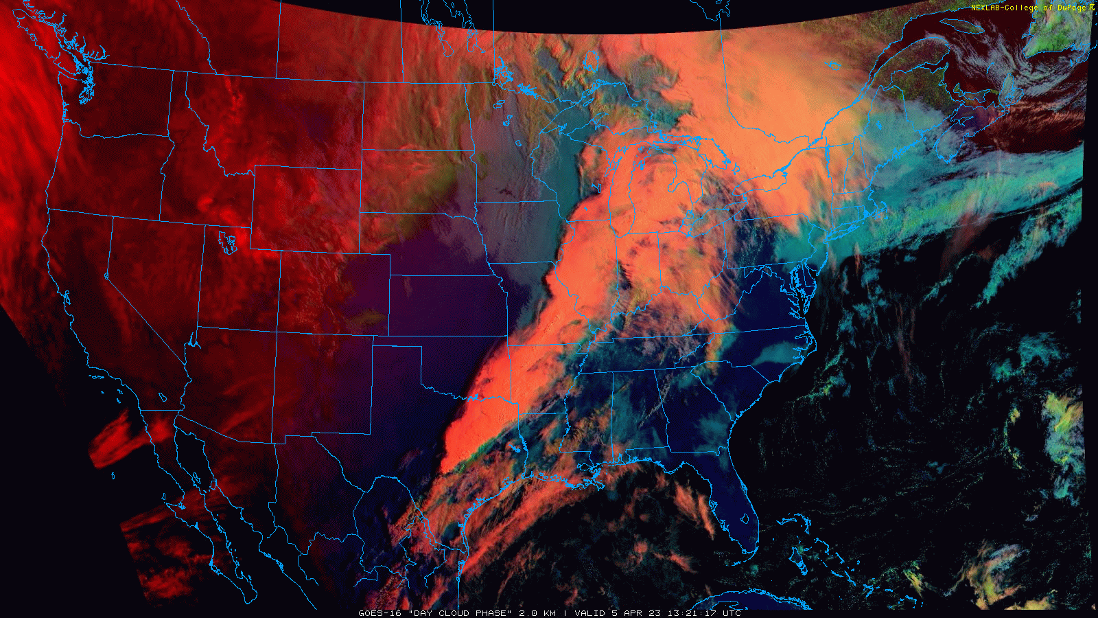
The severe weather threat today extends all the way from Texas to the Great Lakes as a strong cold front edges its way to the east. Images courtesy College of DuPage, NOAA
Overview
A line of thunderstorms extends this morning all the way from Texas to the central Great Lakes and tornado watches as issued by the National Weather Service encompass this entire zone. This severe weather outbreak represents just the latest in a series of recent “clashes” in the atmosphere between cold, dry air to the west charging into warm, humid air to the east. Strong surface low pressure over the northwestern Great Lakes is generating blizzard conditions across the Dakotas and a powerful surface cold front extends from the center all the way south into the northern Gulf region. This same cold front reaches the eastern seaboard later Thursday and while certainly not as widespread of a threat as today, there is the chance for some strong-to-severe thunderstorm activity near the coast. Following the passage of the cold front, a chilly Canadian-borne air mass will push into the Great Lakes/Northeast/Mid-Atlantic for the upcoming Easter weekend.
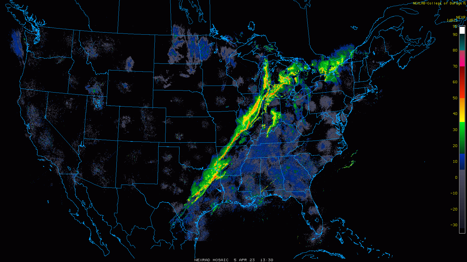
Thunderstorms are lined up this morning in the region from Texas to the Great Lakes and tornado watches have been issued in much of this region. Images courtesy College of DuPage, NOAA
Details
The latest severe weather outbreak has shifted slightly to the east in the overnight hours and the greatest chance today for severe weather including tornadoes will be in a large swath from Texas to the Great Lakes to include much of the Midwest and Ohio Valley. Storms are already lined up in a pretty solid fashion this morning from northeastern Texas to Michigan and some of these have reached severe levels - even before the main low-level heating of the day. Low pressure centered over the northwestern Great Lakes is producing heavy snow and strong winds in the Dakotas with temperatures there generally in the teens and a strong surface (Arctic) cold front extends from its center all the way south to the northern Gulf region. Meanwhile, a warm front is pushing northward through the Lower Great Lakes and warmer, more humid air on its heels is acting to destabilize the atmosphere and increasing the chances there for severe weather. As the surface cold front edges to the east later today, the threat for severe weather will shift from the Mississippi Valley to the Ohio/Tennessee Valleys and numerous tornadoes are certainly on the table.

Cold, dry air to the west is clashing with warm, humid air to the east and the result is a continuing threat of severe weather as the surface cold frontal system edges eastward. Map courtesy NOAA, tropicaltidbits.com
By early Thursday, the surface cold front will reach the central part of the Mid-Atlantic region on its north end while the southern portion of the frontal system will tend to stall out across the southern states from Alabama to Louisiana. Preceding the front, the atmosphere will destabilize in the Mid-Atlantic region by mid-day on Thursday with daytime heating boosting temperatures to warm levels and humidity will be sufficient to raise the chances for showers and thunderstorms. Scattered strong-to-severe thunderstorms will likely first form along the higher terrain of the interior Mid-Atlantic and then shift towards the east coast later tomorrow and early tomorrow night.
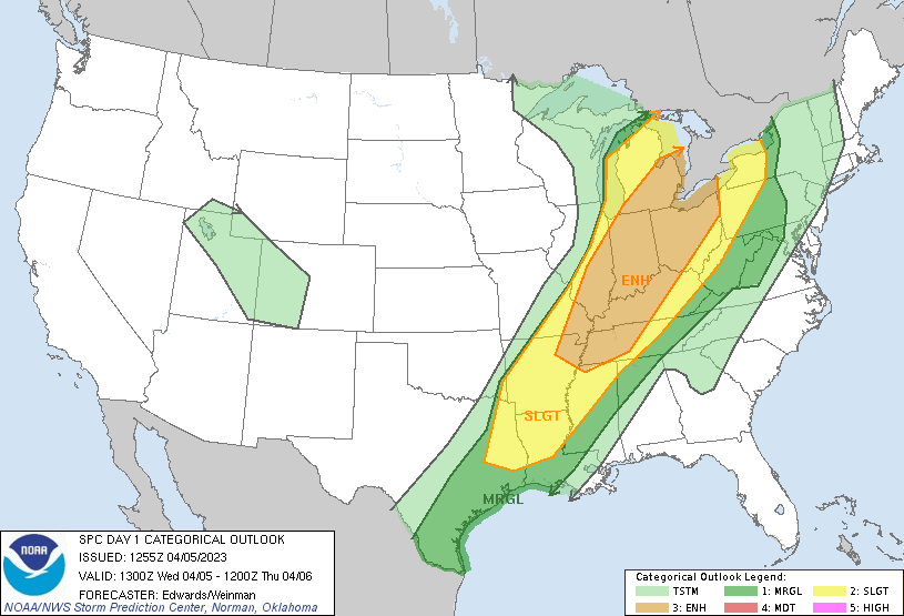
The threat of severe weather today is greatest over the Midwest/Great Lakes/Ohio Valley and extends southwestward to the northern Gulf region. Map courtesy NOAA/SPC
The timing of the cold frontal arrival in the I-95 corridor on Thursday is critical in terms of the threat for severe thunderstorm activity with a later arrival boosting chances as it would allow for greater heating in the lower part of the atmosphere. The greatest chance for strong-to-severe thunderstorm activity (damaging winds, hail) later tomorrow in the Mid-Atlantic region will likely be across central/southern New Jersey, Delmarva Peninsula, and westward from there to the DC metro and points to the south and east.
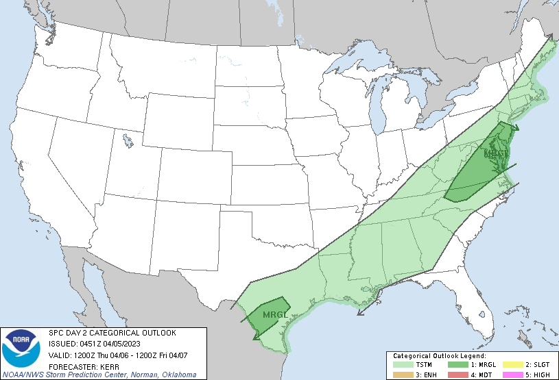
The surface cold front reaches the eastern seaboard later tomorrow and there will be a threat for some strong-to-severe thunderstorm activity. Map courtesy NOAA/SPC
Following the passage of the cold front, a Canadian-born air mass will push into the Great Lakes/Northeast US/Mid-Atlantic region for the Friday, Saturday, Sunday time period. While high pressure should allow for some sunshine on both weekend days helping to boost round-level temperatures, the air mass will feel quite chilly when in the shade and also during the nighttime hours.
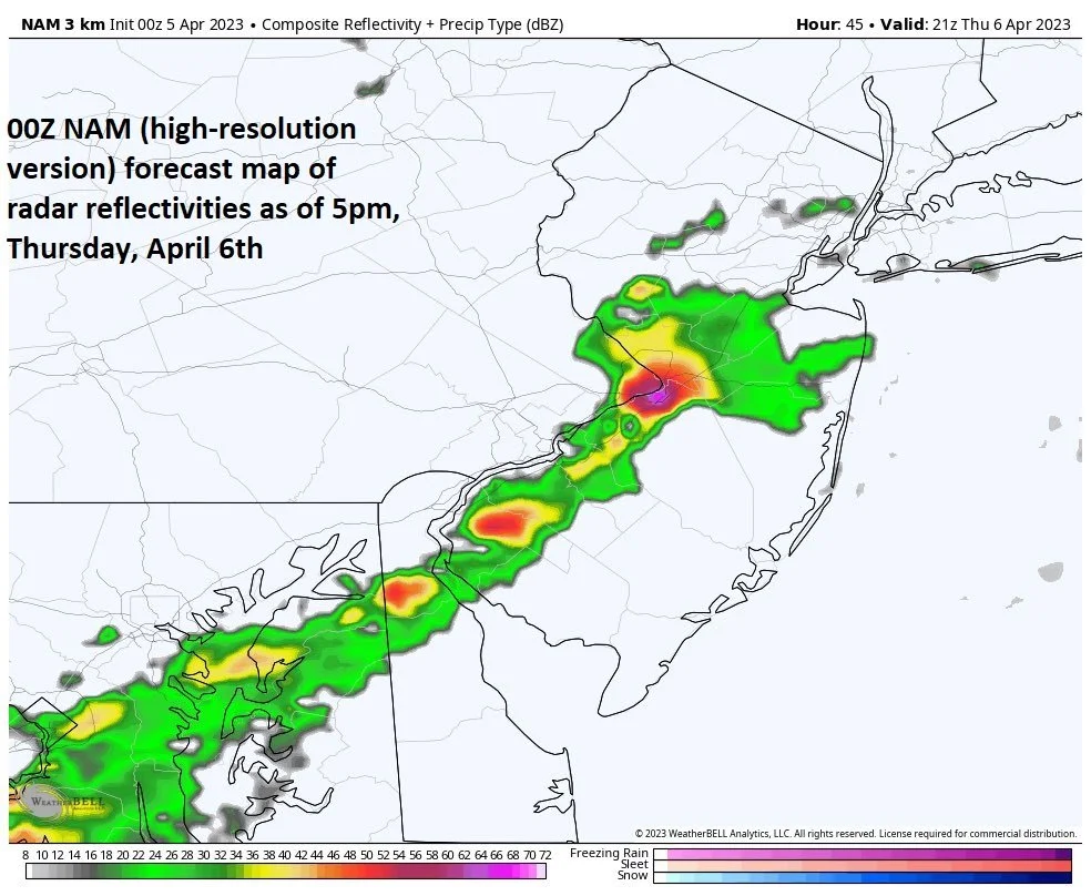
The highest chance for a strong-to-severe thunderstorm on Thursday in the Mid-Atlantic region is likely to be in the region extending southwestward from central/southern New Jersey-to-the Delmarva Peninsula-to-DC metro region (and points south and east); Map courtesy NOAA, Weather Bell Analytics
Meteorologist Paul Dorian
Arcfield
arcfieldweather.com
Follow us on Facebook, Twitter, YouTube
Video discussion: