
10:45 AM | ****Here we go again…active weather pattern to bring heavy downpours/flooding and strong-to-severe thunderstorms to the Mid-Atlantic/Northeast US****
Paul Dorian
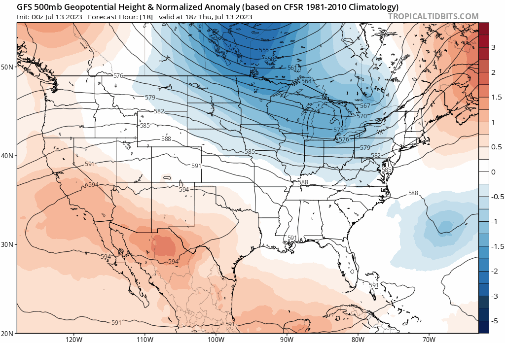
Deep upper-level trough of low pressure will spin around south-central Canada and the north-central US over the next several days. Waves of energy rotating through the base of this large-scale trough will keep unsettled conditions in much of the Great Lakes, Mid-Atlantic and Northeast US in coming days. Maps courtesy NOAA, tropicaltidbits.com
(4-day loop of 500 millibar height anomalies from the 00Z GFS in the period from mid-day Thursday, July 13th to mid-day Monday, July 17th)
Overview
Many parts of the Mid-Atlantic region and Northeast US were hit by downpours this past weekend and during the first part of this week and another extended period of unsettled weather is about to begin in these same areas. Similar to this last stretch, this upcoming unsettled weather period will include the chance of heavy downpours, localized flooding and strong-to-severe thunderstorms...something not particularly welcomed in many parts of the northeastern quadrant of the nation.

An extended period of unsettled weather in coming days will bring about a lot of rainfall to the eastern half of the nation. Map courtesy NOAA, tropicaltidbits.com
Details
While an upper-level ridge intensifies over the southwestern US during the next few days bringing excessive heat to that part of the US, an unseasonal and stubborn large-scale upper-level trough of low pressure will remain in place across south-central Canada. This large-scale trough will feature multiple waves of energy rotating through its base during the next several days and each one of these will create unstable weather conditions across the Great Lakes, Mid-Atlantic and Northeast US. Another contributing factor to this unfolding unstable weather pattern is the noticeable increase in low-level moisture that took place as high pressure pushed to the east of here. Air is now pushing into the Mid-Atlantic region and Northeast US with its origins over the Gulf of Mexico.

An intense ridge of high pressure aloft will bring a building heat wave to the southwestern states over the next five days. At the same time, deep upper-level low pressure centered over south-central Canada will result in below-normal temperatures across much of the north-central US. Map courtesy NOAA, tropicaltidbits.com
One wave of energy will trigger some convection later today across central and eastern Pennsylvania and then a second wave likely does the same thing later tonight…perhaps in areas farther to the south and east of the initial system. As a result, isolated-to-scattered strong-to-severe thunderstorms will be possible later this afternoon in parts of the Mid-Atlantic region and then again later tonight with the second system. Any shower or storm that forms later today and tonight can produce some heavy rainfall.
On Friday, another couple of shortwaves will impact the region raising the prospects for showers and thunderstorms. As is the case for later today and tonight, any storm that forms on Friday and Friday night can reach strong-to-severe levels and any rainfall can be on the heavy side.
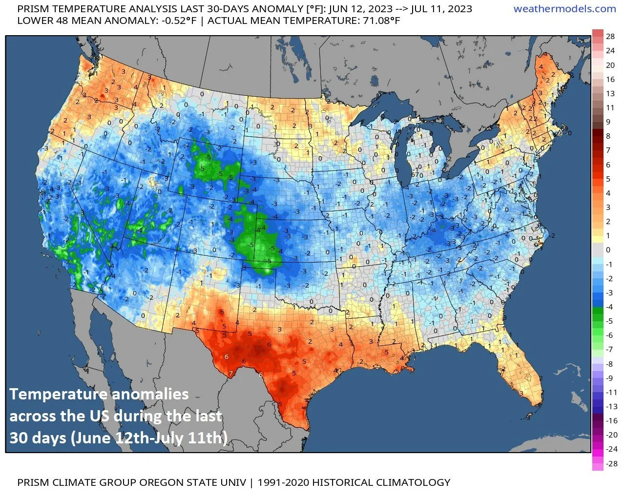
The 30-day period from June 12th-July 11th averaged about a half degree below-normal across the nation. While the south-central states featured warmer-than-normal weather, much of the rest of the nation averaged below-normal temperatures for the 30-day period. Map courtesy weathermodels.com, NOAA, PRISM/Oregon State University
Over the weekend, more systems will rotate through the Canadian large-scale upper-level trough and unsettled weather will continue in the Mid-Atlantic and Northeast US. The combination of a continuing moist low-level flow of air and enhanced upward motion from each shortwave will again result in shower and thunderstorm activity on each day of the weekend. The system destined to reach us Saturday night and Sunday looks especially potent with torrential rain the likely result. Clouds will be plentiful on Friday, Saturday and Sunday and this may help to suppress temperatures a bit, but it’ll still be quite warm and high humidity levels will keep it very uncomfortable. A weak frontal system may works its way through the Mid-Atlantic/NE US later in the week, but its passage is not likely to bring much in the way of relief to the warm and humid conditions.
Meteorologist Paul Dorian
Arcfield
arcfieldweather.com
Follow us on Facebook, Twitter, YouTube
Video discussion: