
***”Category 5” Hurricane Melissa reaches Jamaica with maximum sustained winds of 185 mph...to next pass over eastern Cuba, southeastern Bahamas, and then to Bermuda later this week***
Paul Dorian
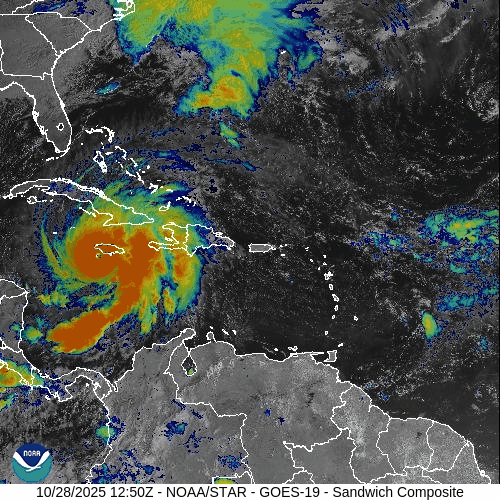
Hurricane Melissa has reached the island of Jamaica as a category 5 storm with maximum sustained winds of 185 mph. Images courtesy NOAA/GOES-East
Overview
Hurricane Melissa has reached the southwestern coast of Jamaica as a category 5 storm with maximum sustained winds of 185 mph. The hurricane has turned to the northeast and should continue on this path during the next few days with an accelerated motion. After hitting Jamaica, Hurricane Melissa will cross over eastern Cuba – likely as a major hurricane – and then to the southeastern part of the Bahama Island chain in the southwestern Atlantic Ocean. By late Thursday, Melissa could come very close to the island of Bermuda or move directly over as it picks up some forward speed and continues on a northeasterly direction...eventually bringing it out to the open waters of the North Atlantic by the upcoming weekend.
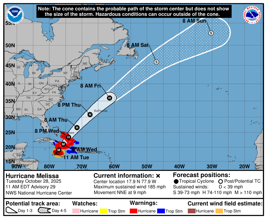
The path of Hurricane Melissa will be generally to the northeast during the next few days at an accelerated rate. This will bring the center of Melissa over eastern Cuba, southeastern Bahama Islands, and perhaps the island of Bermuda on its way to the open waters of the North Atlantic. Map courtesy NOAA/NHC
Details
Hurricane Melissa has reached the island of Jamaica with maximum sustained winds of 185 mph as it increased in strength during the past few hours. The central pressure of Melissa is down to 892 millibars (26.34 inches) matching it with the 1935 Labor Day hurricane for the third lowest pressure recorded for the Atlantic Basin. (Note – the central pressure of 1935 Labor Day hurricane was measured over land as there were no reconnaissance flights back in that time period).
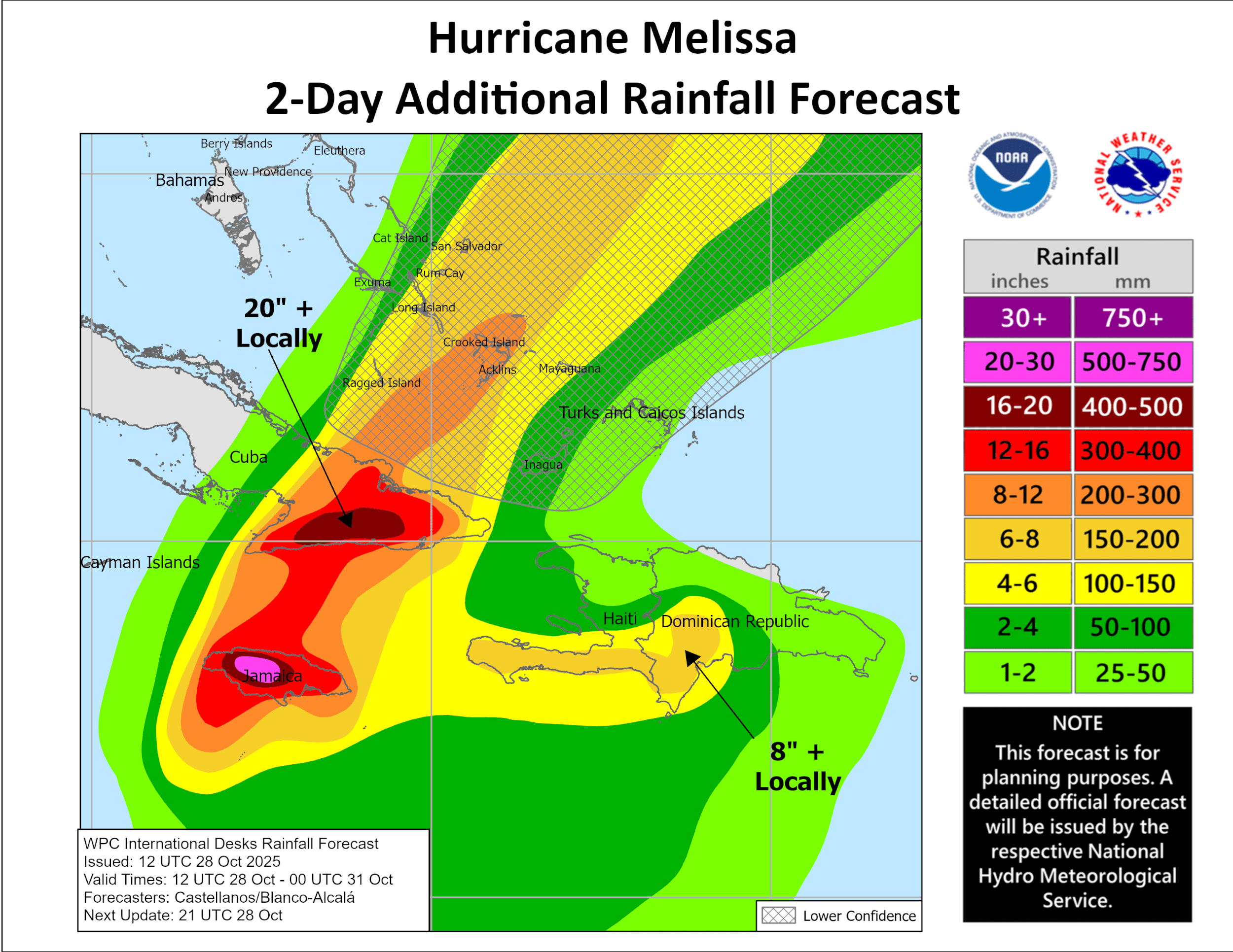
Rainfall amounts will be excessive across Jamaica due to Hurricane Melissa with as much as 30-50 inches in some spots when all is said and done. Map courtesy NOAA/NHC
The movement of Hurricane Melissa is now 7 mph to the north-northeast and it will continue to pick up speed during the next couple of days as it moves along in a general northeasterly direction. As such, Hurricane Melissa will likely cross over the eastern part of Cuba by later tonight/early Wednesday – still a “major” hurricane - and then push to a position over the southeastern Bahama Islands by later tomorrow. The intense hurricane is likely to produce as much as 30-50 inches of rainfall in Jamaica when all is said and done causing catastrophic flash flooding and landslides and impact will be high across eastern Cuba, Haiti and the Dominican Republic.
Meteorologist Paul Dorian
Arcfield
arcfieldweather.com
Follow us on Facebook, Twitter, YouTube
Video discussion: