
**Two tropical systems to dance with each other off the east coast in coming days...”Fujiwhara effect” makes for a challenging forecast**
Paul Dorian
Two tropical systems are likely to do a dance around each other later this weekend into early next week…this so called “Fujiwhara effect” makes for difficulty in forecasting both in terms of the eventual paths of the two storm and their and intensity levels. Forecast maps courtesy ECMWF, tropicaltidbits.com (loop extends from Saturday, September 27th to Sunday, October 6th)
Overview
The Atlantic Basin is quite active as we head towards the end of September with three tropical systems currently on the playing field including a “major” Hurricane Gabrielle which is now racing off to the east-northeast and is no threat to the US. In fact, Hurricane Gabrielle could impact the Azores Islands and Portugal down the road in a weakened state after crossing over the cooler waters of the North Atlantic.
Meanwhile, the other two tropical systems pose more of a challenge in terms of forecasting their eventual paths and magnitudes. It appears quite likely that both systems will reach named tropical storm classification and potentially, both may climb to hurricane status. It also appears quite likely that these two systems will end up doing some sort of a dance around each other for awhile (“Fujiwhara effect”) and at least one may come uncomfortably close to the US east coast and we may not know the end of the story until we get ten or so days out from now.

Hurricane Gabrielle can be seen at the top portion of this satellite imagery loop…another tropical system is visible over the northeastern Caribbean Sea, and a third is positioned not far off to its east. Images courtesy NOAA/GOES-East
Details
After a quiet stretch, Atlantic Basin tropical activity has picked up significantly during the past week or so with three different systems now on the weather maps. Hurricane Gabrielle is a “major” hurricane (category 3) with maximum sustained winds of 115 mph and is now racing off to the east-northeast at 25 mph. This system poses no threat to the US and could indeed affect the Azores Islands and Portugal down the road in a weakened state after crossing over the colder waters of the North Atlantic.
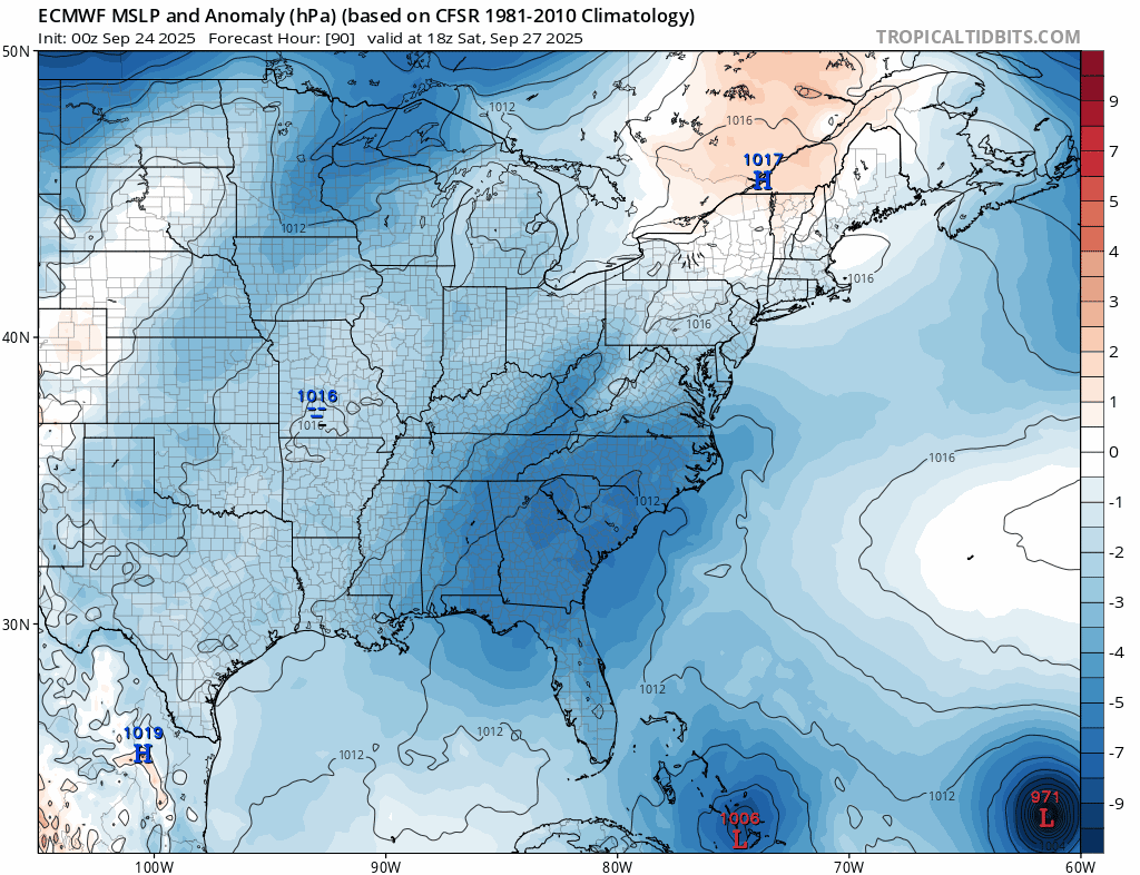
It is the other two tropical systems that pose a much more challenging forecast in terms of their eventual storm tracks and magnitudes. It appears these two systems will head in a general northwest direction over the next few days and begin to encounter more favorable atmospheric conditions for intensification. The frontrunning tropical wave is now causing a rather disorganized area of showers and thunderstorms over the northeastern Caribbean Sea and it is likely to take a longer time to intensify compared to the trailing system which is better organized and not far off to its east.

Hurricane Gabrielle is now racing off to the east-northeast at 25 mph and two other tropical systems are likely to intensify into named tropical storms in coming days and perhaps eventually both will reach hurricane classification. These two systems may do a dance around with each other from later this weekend into early next week somewhere over the western Atlantic Ocean. Map courtesy NOAA/NHC
By the latter part of the weekend, it is quite possible that there will be one tropical system near the Bahama Islands and a second one not far off to its east. The likelihood of both becoming named tropical storms is quite high (would become Humberto and Imelda) and eventually, each can attain hurricane status. It is also looking like these two systems will then do a dance around each other somewhere over the southwestern Atlantic from the latter part of the weekend into the early part of next week. This “dance” or “rotation” around each other is sometimes referred to as the “Fujiwhara” effect...named after the Japanese meteorologist Sakuhei Fujiwhara...and eventually the two systems can merge into a single, larger storm. The “Fujiwhara” effect no doubt adds complexity to overall weather forecasting in terms of the tracks and intensity levels of each storm as the interaction between the two introduces uncertainty.

One of the key players in the ultimate paths of these two tropical systems will be an upper-level trough of low pressure likely to be situated over the Southeast US by the middle of the upcoming weekend (circled region). Map courtesy NOAA/GFS, tropicaltidbits.com
At this point in time, odds (slightly) favor both systems staying just off the US east coast as they dance around each other; however, this is certainly not set in stone as to some of the reasons described above - namely that their interaction with each other cannot be clearly defined this far in advance. It is possible that one system becomes the dominant player and hangs around the western Atlantic for awhile while the other weakens and heads off to the central Atlantic. In fact, given the unfolding environmental setup, it is possible that we may be dealing with at least of these two tropical systems somewhere near the east coast as far out as ten days or so from now…stay tuned.
Meteorologist Paul Dorian
Arcfield
arcfieldweather.com
Follow us on Facebook, Twitter, YouTube
Video discussion: