
**An active tropical scene with Tropical Storm “Humberto” and the likely-to-be named “Imelda” which can impact the Bahamas this weekend and potentially the Southeast US**
Paul Dorian
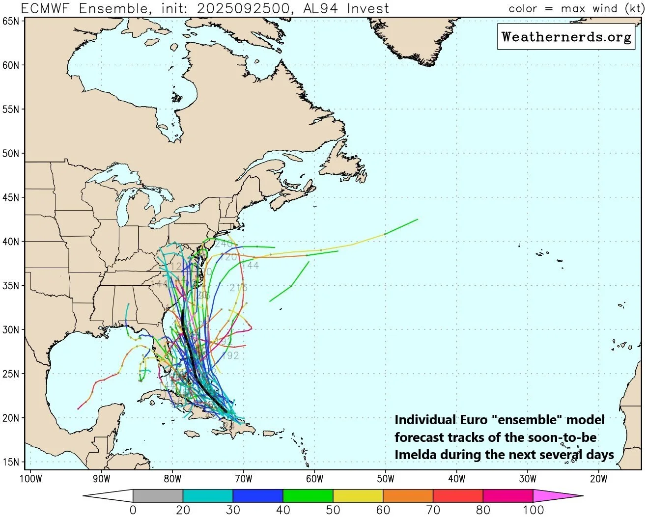
The 00Z Euro Ensemble forecast tracks of the individual members push soon-to-be Imelda to the Bahamas and then potentially into the Carolinas. Map courtesy ECMWF, weathernerds.org
Overview
The Atlantic Basin is quite active with three tropical systems of note as we head towards the end of September. There is a newly named Tropical Storm Humberto situated to the northeast of the Northern Leeward Islands, a likely-to-be named Imelda which is now located near the Dominican Republic, and a weakening Hurricane Gabrielle in the far eastern Atlantic Ocean. It is the likely-to-be named Imelda that may be of most concern at this point as it could threaten the Bahamas this weekend and potentially has a chance of impacting the Southeast US.

Details
After a quiet stretch, Atlantic Basin tropical activity has picked up significantly during the past week or so with three different systems now on the maps. Hurricane Gabrielle is weakening as it closes in on the Azores Islands in the far eastern Atlantic and newly named Tropical Storm Humberto is located to the northeast of the Northern Leeward Islands and moving in a northwesterly direction. A third tropical system is currently located right near the Dominican Republic part of the Caribbean Island of Hispaniola and it likely will become Tropical Storm Imelda sometime during the next several days.

One key player in the ultimate path of Humberto and Imelda will be an upper-level trough of low pressure that will be situated over the Southeast US during the upcoming weekend. Map courtesy Canadian Met Centre, tropicaltidbits.com
At this point - and it is a complex forecast situation with some surprises likely on the table - odds favor TS Humberto staying out over the open waters of the western Atlantic Ocean while the likely-to-be named Imelda heads towards the Bahama Island chain. (By the way, Humberto may climb to “major” hurricane status during the next several days). The likely-to-be named Imelda could reach the Bahamas this weekend as a tropical depression and then quickly strengthen into a tropical storm, and hurricane classification is certainly on the table for this system. The interaction between Humberto and Imelda will be critical in the ultimate path of both in coming days and a third impactful player on the field will be a strong upper-level trough over the southeastern states that can influence the storm tracks. There is the chance that Imelda pushes to the Bahamas this weekend and potentially to the Southeast US coastline by early next week with some heavy rainfall and strong winds.
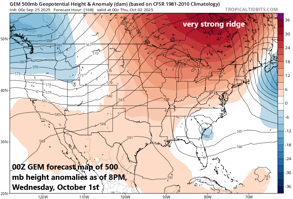
Another key player in the ultimate path of Humberto and Imelda will be an upper-level ridge of high pressure that builds into southeastern Canada by the middle of next week. Map courtesy Canadian Met Centre, tropicaltidbits.com
By the middle of next week, another important player on the field will be very strong high pressure building into southeastern Canada. If indeed Imelda ends up directly impacting the Southeast US, it may run into a roadblock in the atmosphere (very strong high pressure to the north) if it tries to advance northward into the Mid-Atlantic region. All of this look ahead is speculation at this point…we’ll have to wait and see how it all plays out this weekend with TS Humberto and the likely to be named Imelda.
Meteorologist Paul Dorian
Arcfield
arcfieldweather.com
Follow us on Facebook, Twitter, YouTube
Video discussion: