****A doubleheader of snow in the Mid-Atlantic region…Saturday system followed by a Sunday system…bitter cold this week and still seeing the threat of extreme cold...and more snow chances****
Paul Dorian

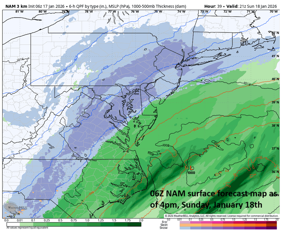
A coastal storm on Sunday can produce snow all along the DC-to-Philly-to-NYC corridor and eventually the snow will make its way to coastal sections. Map courtesy NOAA, Weather Bell
Overview
An active weather pattern is leading to a “doubleheader” of snow in the Mid-Atlantic region with snow from one system on Saturday and snow is likely from a second system on Sunday. The accumulations on Saturday with system number one will be be primarily from northern Maryland northward with lesser chances in the DC metro region. On Sunday, a coastal storm can bring accumulating snow all along the I-95 corridor and to coastal sections of the Mid-Atlantic. This overall pattern remains very cold with bitter cold conditions expected here on Monday night, Tuesday, and Tuesday night and the possibility still exists for some extreme cold during the last week of the month…and additional snow threats on the horizon.
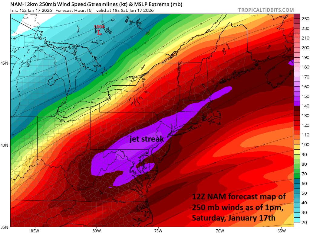
A strong jet streak is contributing to today’s precipitation in the Mid-Atlantic region as it rotates through a large-scale upper-level trough and there is accumulating snow in many locations. Map courtesy NOAA, tropicaltidbits.com
System 1
With a long-wave trough of low pressure in place across the eastern states, the atmosphere is quite unstable today in the Mid-Atlantic region with a strong jet streak aloft enhancing upward motion. As a result, precipitation has broken out in the form of snow across northern Maryland and Pennsylvania and a mixture of precipitation down in the DC metro region. The precipitation is likely to continue as all snow across northern MD and Pennsylvania and accumulations of a coating to a few inches are likely in the Baltimore and Philly metro regions. As much as 4 or 5 inches can fall a little farther to the north and west in places like Lancaster, PA and Allentown, PA. Snow accumulations will be limited in the DC metro region…perhaps a coating to an inch…due to the mixed nature of the precipitation at the start and the slightly above freezing temperatures. Travel conditions will be slippery through the mid-day hours in many areas, but should improve later in the afternoon as the precipitation winds down and temperatures climb above freezing (e.g., late day highs in downtown Philly near 40 degrees).
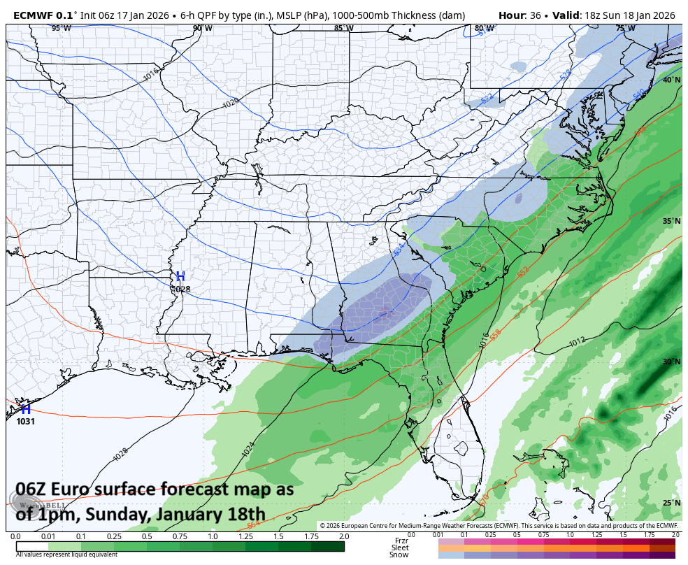
A coastal storm on Sunday can bring snow all the way down to the southeastern states…even some accumulations are possible in that part of the country. Map courtesy ECMWF, Weather Bell
System 2
On Sunday, a coastal low will ride up along the eastern seaboard, and this system has the potential for producing accumulating snow along the entire DC-to-Philly-to-NYC corridor and from there, points to the east coast where amounts may actually end up being highest. It will generally be slightly colder on Sunday, and this improve the chances of accumulating snow a bit farther to the south including in and around the DC metro region. Preliminary estimates of snow on Sunday in the I-95 corridor range from a coating to a couple of inches in and around DC and perhaps 3 or 4 inches from Philly-to-NYC…a slight shift to the northwest by this system can result in higher amounts in the I-95 corridor…something we’ll monitor during the next 24 hours. The snow may come in two different waves with one batch during the late night/early morning hours and then another batch from mid-to-late afternoon into the early evening hours. One other note, the Sunday coastal storm can bring snow to unusual places down across the southeastern states…even the possibility of accumulations in some of those spots.
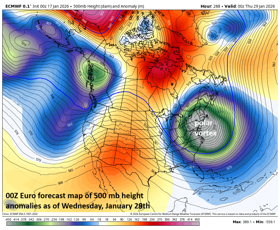
A displacement of the polar vortex can bring some extreme cold to the northern US during the last week of the month. Map courtesy ECMWF, Weather Bell
Bitter cold this week and maybe some extreme cold later in the month…additional snow threats
On the heels of the weekend “doubleheader”, very cold Arctic air will pour into the Mid-Atlantic region, and we’ll be in the deep freeze on Monday night, Tuesday and Tuesday night with the lowest temperatures of the season so far. And the “so far” may be the key phrase in that last sentence as there continue to be signs of extreme cold later in the month with a potential displacement of the polar vortex to the northeastern part of the US. In addition, the pattern remains quite active going forward with additional snow chances very likely as we progress through the remainder of the month…buckle up!
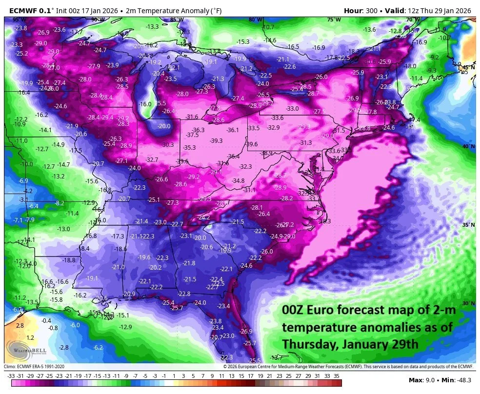
Temperature departures from normal could end up being quite extreme during the last week of the month in a period that is statistically the coldest time of the year. Map courtesy ECMWF, Weather Bell
Meteorologist Paul Dorian
Arcfield
arcfieldweather.com