
**Southern storm to produce widespread rain this weekend in the Deep south and a severe weather threat...Mid-Atlantic region on the northern fringes by late Sunday**
Paul Dorian
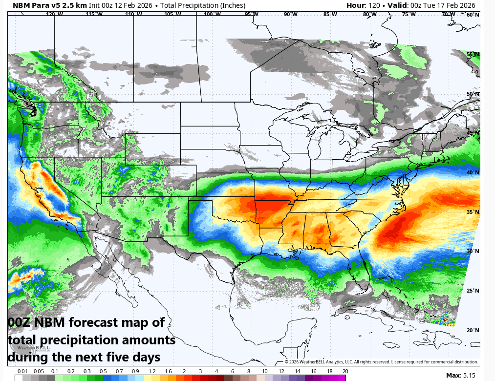
The next five days will feature decent amount of rainfall across the southern states and this will be quite welcomed as the overall pattern has been very dry in this part of the nation. Map courtesy NOAA, Weather Bell
Overview
A low pressure system that produced some beneficial rain and snow across California on Wednesday will ride along the newly activated sub-tropical jet stream and re-emerge over the south-central states early this weekend. Warm and humid air will flow northward into this system from the Gulf, and this will help to intensify and expand the storm’s precipitation shield...all good news for the Deep South where it has been quite dry in recent weeks. The influx of warm and humid air will also help to destabilize the atmosphere, leading to a severe weather threat by later Saturday and Saturday night in portions of the south-central US. This system will then push eastward and head towards the eastern seaboard on Sunday potentially bringing some mixed precipitation to the Mid-Atlantic region which will be on the northern fringes of its moisture field. Much milder weather will follow across the northeastern states by the middle of next week.
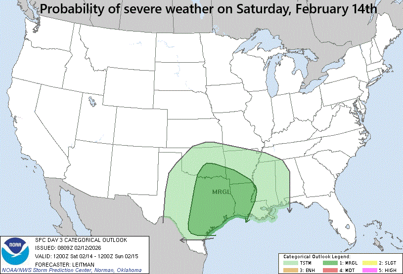
The chance of severe weather this weekend will rise across portions of the south-central states as warm, moist air flows northward from the Gulf, leading to a destabilization of the lower atmosphere. Map courtesy NOAA/SPC
Details
Low pressure pushed through California at mid-week and is now crossing Arizona and New Mexico and producing some beneficial rainfall. This system will continue to ride along the sub-tropical jet stream and re-emerge on Saturday over the south-central US. Moist and warm Gulf air will feed in on the eastern side of this system, generating an expansion of its moisture field and this will, in turn, pave the way for some beneficial rainfall across the Deep South where it has been quite dry in recent days. In addition, the influx of warm and humid air from the Gulf will help to destabilize the lower atmosphere and this will likely lead to some severe thunderstorm activity by late Saturday and Saturday night in much of eastern Texas and Louisiana and the southern portions of Arkansas and Oklahoma.
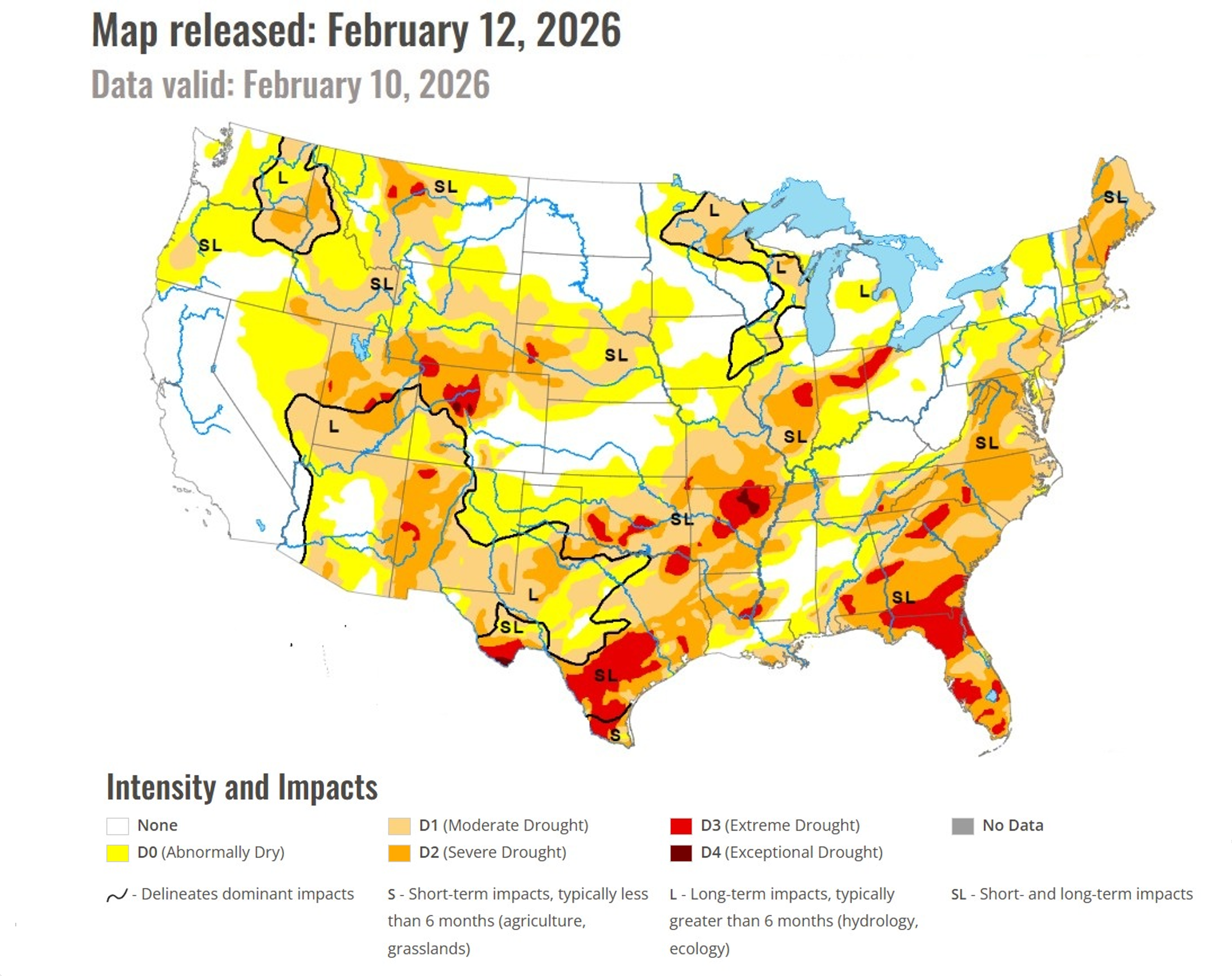
It has been very dry in recent weeks across much of the southern US and this weekend’s expected rainfall in the Deep South will be quite welcomed. Map courtesy NOAA
On Sunday, this low pressure system will continue to head in a general eastward direction - riding along the southern branch of the jet stream - and it’ll head towards the eastern seaboard. The Mid-Atlantic region will be on the northern fringes of the moisture field and with moderately cold air in place, there can be frozen precipitation in some areas…plain rain is most likely to fall south of the PA/MD border (e.g., in the D.C. metro area) although snow and/or ice can mix in at times across the northern suburbs…snow is likely to fall across southern PA (e.g., Philly metro area) or perhaps a mix of snow, ice and rain and small accumulations are possible.
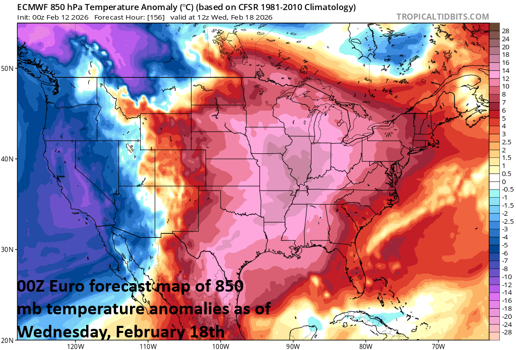
The changing weather pattern will allow for much milder air to make it all the way into the Mid-Atlantic region and Northeast US for the bulk of next week. Map courtesy ECMWF, tropicaltidbits.com
Once this late weekend/early next week system passes off the east coast, the door will be opened for much milder air to spread east from the nation’s mid-section and into the northeastern states. In recent weeks, it has been very difficult for warmer-than-normal air from the middle of the country to make it all the way into the Mid-Atlantic region and Northeast US; however, this time the odds are quite high…at least for a few days. Temperatures can climb to 50+ degrees by mid-week in Philly and NYC and potentially to the 60-degree mark in Washington, D.C. by Wednesday afternoon.
Meteorologist Paul Dorian
Arcfield
arcfieldweather.com
Follow us on Facebook, Twitter, YouTube
Video discussion: