*****Major winter storm to slam the Mid-Atlantic region from Sunday into Monday…all-out blizzard conditions in many areas*****
Paul Dorian

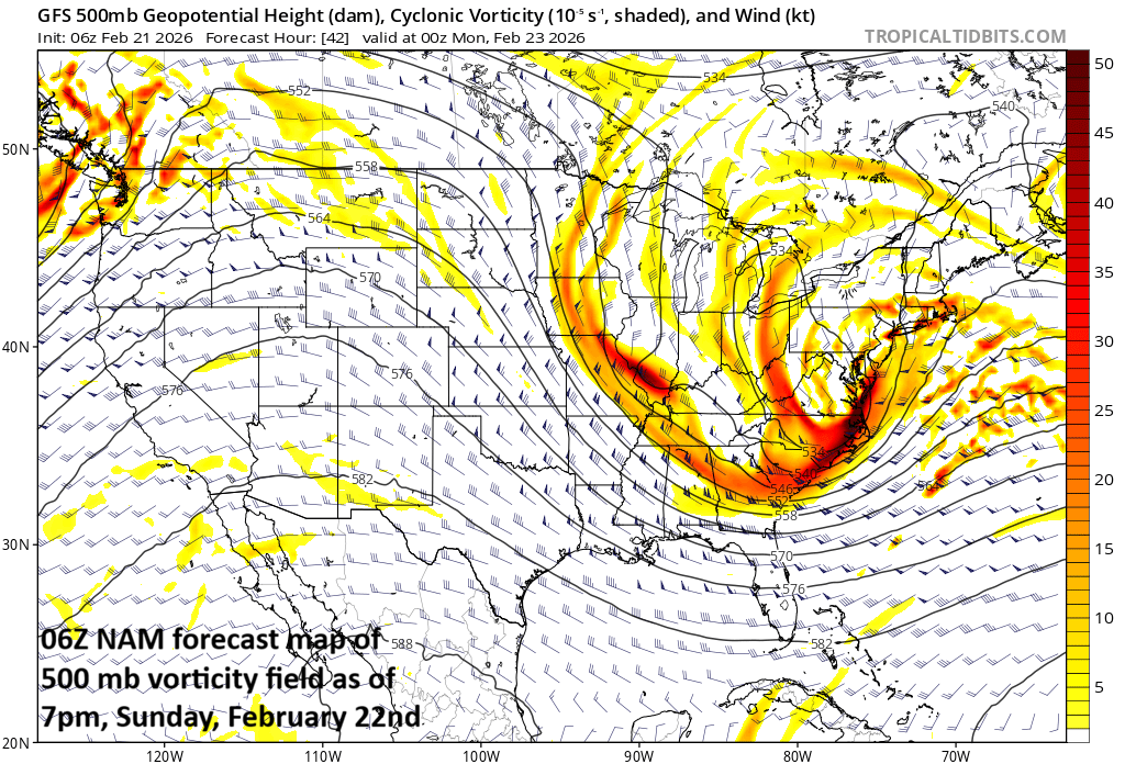
Strong support in the upper atmosphere will lead to rapid intensification of a storm system just off the Mid-Atlantic coastline from later tomorrow into tomorrow night. Map courtesy NOAA, tropicaltidbits.com
Overview
Major winter storm to slam the Mid-Atlantic region…
All-out blizzard conditions in many areas…
Low pressure will intensify rapidly later tomorrow as it pushes slowly northward just off the Mid-Atlantic coastline, and it is going to produce substantial snowfall in some areas and powerful winds as well especially along coastal sections. The precipitation in the DC-to-Philly-to-NYC corridor will begin on Sunday morning as plain rain in some areas, a mixture of rain and snow in others, but all areas will feature a changeover to snow by later Sunday. The snow will fall heavily at times from Sunday evening into mid-day Monday, leading to big-time travel disruptions for both of Monday’s commutes in many areas. On the heels of the storm, a very cold air mass will flood much of the eastern US during the early part of next week.
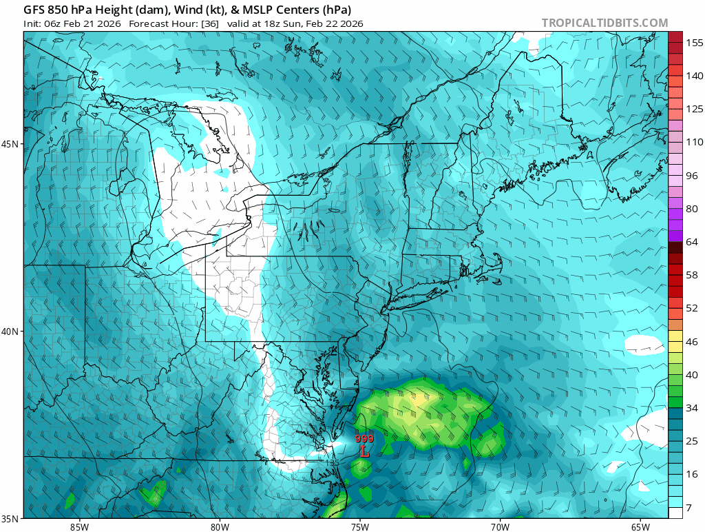
Blizzard conditions are likely during this major winter storm along coastal areas from Long Island to New Jersey to portions of the Delmarva Peninsula…gusts of 55 mph or so on the table. Maps courtesy NOAA
Details
Precipitation will expand in coverage by early Sunday morning throughout the Mid-Atlantic region as low pressure begins to develop near the Carolina coastline. Some areas in the I-95 corridor will begin with plain rain; especially, to the south of the PA/MD border and other areas will begin with a mixture of rain and snow. All areas should see a changeover to snow later tomorrow, and the snow will fall heavily at times from Sunday evening into Monday mid-day, leading to big-time travel disruptions for the Monday commutes.
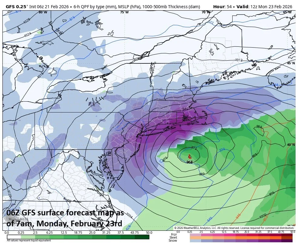
Surface forecast map from 00Z run of the GFS features snow on Monday morning continuing at a good clip across the eastern Mid-Atlantic and New England. Map courtesy NOAA, Weather Bell
Substantial snowfall amounts are likely in parts of the Mid-Atlantic region and winds will become a big factor as well with gusts to 45 mph across many inland areas and up to 55 mph or so along coastal sections from Long Island to New Jersey to the Delmarva Peninsula…blizzard conditions in many areas with blowing and drifting in the late stages of the storm.
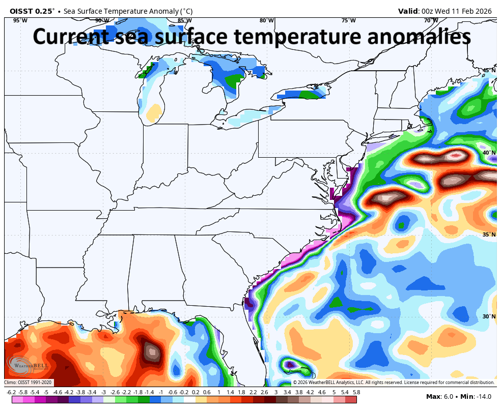
There are two “blobs” of warmer-than-normal water off the Mid-Atlantic coastline and the low pressure system will likely jump from the one off of Virginia to the one east of New Jersey. Map courtesy NOAA
Here is my current thinking on snowfall amounts for many areas of the Mid-Atlantic region:
DC metro: 4-8 inches
Philly metro: 8-16 inches
NYC metro: 12-20 inches
New Jersey: 12-20 inches
Delaware: 8-16 inches
The snow will likely be of the “heavy, wet variety” with surfaces temperatures not all that far below freezing in most areas. Heavy, wet snow is not a good thing as it adds to the weight on rooftops, tree limbs and is very difficult o shovel…power outages are a concern; especially, in blizzard prone areas (e.g., coastal sections) where winds can gust to 55 mph or so. One other note, widespread coastal flooding is on the table during Sunday night’s high tide cycle and those issues can continue on Monday as well.
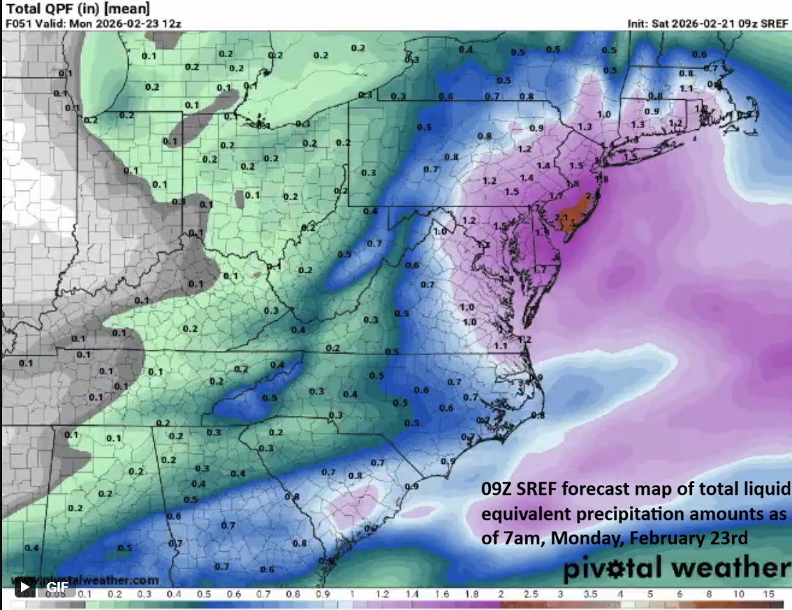
The total liquid equivalent precipitation amounts have continued to increase with this particular “short-range” computer forecast model (i.e., lots of snow and/or rain on the way). Map courtesy NOAA, Pivotal Weather
Following the storm, a much colder-than-normal air mass will flood the eastern states and temperatures will drop well below-normal all the way down to the state of Florida. In fact, the coldest core of this incoming air mass – relative to normal - will end up in the Tennessee Valley/Southeast US during the early part of next week.
Stay tuned to arcfieldweather.com for updates as this is still a fluid situation.
Meteorologist Paul Dorian
Arcfield
arcfieldweather.com
Follow us on Facebook, Twitter, YouTube
Video discussion: