2:00 PM (Friday) | ****Long duration winter weather event coming to the Mid-Atlantic region...begins Saturday night as ice/snow and ends late Monday with accumulating snow****
Paul Dorian

The upper-level low heads into the Northern Plains, but then is “forced” to the east-southeast and will end up generating low pressure off the Mid-Atlantic coastline by Monday; maps courtesy NOAA, tropicaltidbits.com
Overview
The major storm that slammed into the west coast a couple of days ago will result in a long duration winter weather event for the Mid-Atlantic region from later this weekend into early next week. This system now over the interior western US will head northeast towards the Northern Plains over the next day or so and will generate significant snow this weekend from the Northern Rockies to the Upper Midwest. It is at this point in time that this system will run into an “atmospheric roadblock” in the form of upper-level high pressure ridging over southern Canada and switch from a northeasterly direction to east-southeast. The end result will be a cold air mass in place in the Mid-Atlantic region when precipitation arrives later Saturday night and low pressure is likely to spin just off the coastline as late as late in the day on Monday. This long lasting winter weather event could feature some ice and/or snow accumulations at the front end for much of the Mid-Atlantic region – perhaps plain rain for awhile in the middle – and then potentially significant accumulating snow on the back end.

“High-latitude blocking” in the form of upper-level ridging will force the western low to ultimately wind up off the Mid-Atlantic coastline; map courtesy NOAA, tropicaltidbits.com
Details
The deep upper-level low associated with the western US storm will take a trek from the interior west to the Northern Plains over the next couple of days, but at that point in time, it’ll run into a “atmospheric roadblock” in the atmosphere as high pressure ridging expands across southern Canada and this will force a slide of the system to the east-southeast. The blocking to the north and the change in path to the east-southeast will be critical to the Mid-Atlantic region in two ways. First, the change in direction will allow for a cold air mass to maintain its position ahead of the arrival of the precipitation on Saturday night and second, it will result in an extended winter weather event that will feature intensifying low pressure spinning off the Mid-Atlantic coastline as late as late Monday night.

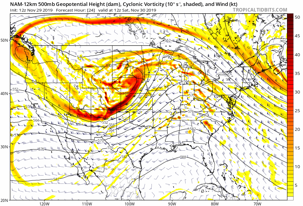
Low pressure off the coast on Monday could cause snow along much of the I-95 corridor with significant accumulations possible north of the PA/MD border; map courtesy NOAA (12Z NAM), tropicaltidbits.com
Precipitation is likely to arrive early tomorrow night across the DC metro region and then late at night in Philly and NYC. The air is likely to be cold enough for ice and perhaps snow for awhile and some front end ice and/or snow accumulations are possible; especially, north of the PA/MD border and to the northwest of I-95. A changeover to plain rain is likely during the day on Sunday especially, to the south of the PA/MD border and in the urban areas along I-95. However, this will not be the end of the threat for wintry precipitation. As low pressure heads to the Mid-Atlantic coastline, it’ll intensify from late Sunday night into Monday and a changeover to snow is likely on Monday; especially, north of the PA/MD border. There will likely be some accumulations of snow on Monday in parts of the Mid-Atlantic region as well as across the interior of the Northeast US before the system finally pulls away late on Monday night. In general, total snow and ice accumulations in the immediate I-95 corridor from this upcoming long lasting event will likely increase as one goes to the northeast with the most in Boston and the least in DC and they will be higher in the northern and western suburbs of any given metro region. Some more specific estimates in the DC-to-Philly-to-NYC corridor (and still quite preliminary) range from 3-6 inches of snow/ice in the area from the northern suburbs of Philly (e.g. Bucks County) to the northwest suburbs of NYC and only a coating to an inch or two of snow/ice in the DC metro region. In addition, there will likely be some mesoscale banding of heavier snow which can lead to much higher localized amounts; especially, across NE PA and NW NJ. One final note, travel conditions are likely to become quite difficult for the first time this season with ice/snow on the front end of this long duration winter weather event and potential significant accumulating snow on the back end.
Meteorologist Paul Dorian
Perspecta, Inc.
perspectaweather.com