1:45 PM (Tuesday) | ****Hurricane Dorian has resumed a slow movement to the northwest...now a category 2 storm****
Paul Dorian

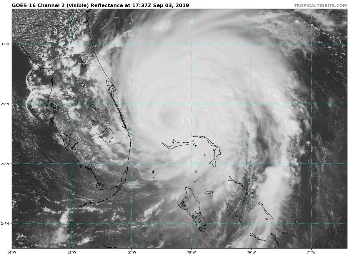
GOES-16 visible (channel 2) satellite image of Hurricane Dorian which has weakened over cooler waters to a category 2. Courtesy NOAA
Overview
Hurricane Dorian has finally resumed some movement today as the latest measurements have it moving to the northwest at 2 mph after being stationary for nearly 24 hours. From later today into Wednesday, Hurricane Dorian should turn north-northwest and run parallel to the east coast of Florida as it picks up some forward speed. It’ll then close in on the Carolina coastline by Thursday where it is not out of the question that it makes a landfall somewhere on its way to the Outer Banks (North Carolina). After that, Hurricane Dorian will likely pass well to the east of the Mid-Atlantic coastline from Thursday night into Friday with its greatest impact limited to coastal sections.
Hurricane Dorian has churned up the waters underneath its center over the past 24 hours or so as it has remained nearly stationary. This process of “upwelling” has resulted in cooler waters from deep to rise to the surface and sea surface temperatures have dropped noticeably contributing to a weakening of the system. Map courtesy Levi Cowan (Twitter), NOAA
Discussion
As Hurricane Dorian has been nearly stationary over the past day or so, “upwelling” increased underneath its center and this has brought cooler waters from deep down to the sea surface. In turn, the cooler sea surface temperatures have resulted in a weakening of the hurricane from category 5 to category 2 now with max sustained winds at 110 mph. As the center begins to move over fresher, warmer waters, there is the chance that some restrengthening takes place as it runs parallel to the east coast of Florida on its way towards the Carolina coastline over the next 24 hours or so.
Despite the fact that the max sustained winds of Hurricane Dorian have come down in the past 24 hours or so, there has been a broadening of the overall wind field which is not uncommon with a weakening tropical system. As a result, even though the center of Hurricane Dorian will not likely make landfall in Florida, the expanding wind field may result in hurricane force winds onshore along portions of the east coast of the state.

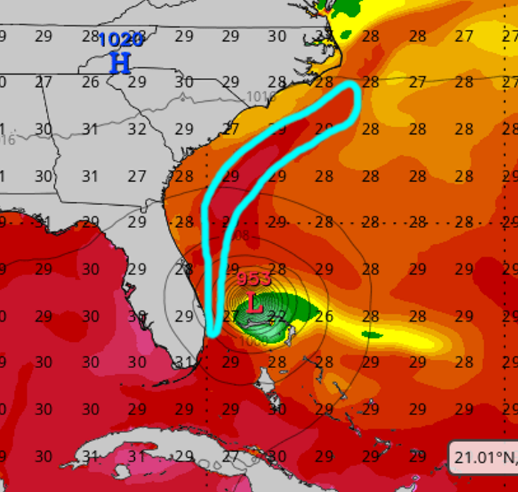
In response to an upper-level trough over the Great Lakes later this week, Hurricane Dorian should accelerate and turn northeastward and pass well to the east of the Mid-Atlantic region; courtesy NOAA, tropicaltidbits.com
By Thursday, Hurricane Dorian will run right along or just off the Carolina coastline on its way to a position over the Outer Banks of North Carolina and it is not out of the question that it makes a landfall just inland in South or North Carolina. After that, a shortwave trough is going to amplify a deep-layer trough along the east coast and this will help to accelerate Hurricane Dorian to the northeast and well to the east of the Mid-Atlantic region on Thursday night and Friday. Any important impact by Hurricane Dorian in this time frame will be limited to coastal sections from the Delmarva Peninsula to Long Island to southern New England. By the end of the week, Dorian will likely slam into Nova Scotia and Newfoundland in Canada on its way to the open waters of the North Atlantic.

The official storm track of Hurricane Dorian by NOAA’s National Hurricane Center (as of 11 AM).
Meanwhile, there are other tropical systems now being monitored as we close in on the climatological peak of the Atlantic Basin tropical season which is right around the middle of September. One tropical system off the coast of Africa is likely to become a tropical depression later today and tropical depression 7 has formed over the western Gulf of Mexico.
Meteorologist Paul Dorian
Perspecta, Inc.
perspectaweather.com
Video discussion: