9:30 AM (Wed.) | ***Sudden burst of summer to be accompanied by strong-to-severe storms…potential of heavy rain bands on Thursday…Tropical Storm Cristobal could impact the central Gulf coast***
Paul Dorian

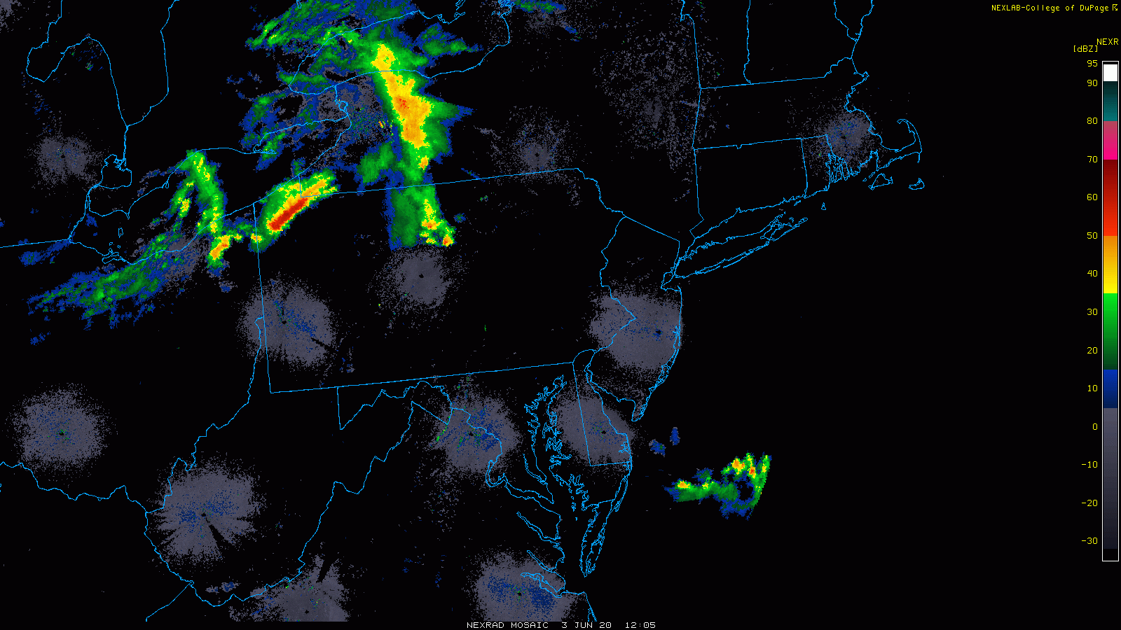
An area of thunderstorms is already taking place across upstate PA and it could impact the area from Philly-to-New York at mid-day. Courtesy NOAA, College of DuPage
Overview
There are two important weather stories here at mid-week with a sudden surge of summer-like conditions into the Mid-Atlantic region and the development of a tropical storm in the southwestern Gulf of Mexico. The surge of summer-like heat and humidity into the Mid-Atlantic region will be accompanied by some strong-to-severe thunderstorm activity in some spots later today and tonight as a cold front approaches from the northwest. The highest probability of the severe storm activity will be to the north of the PA/MD border with one shot around mid-day and then another shot from later this afternoon into tonight. This front stalls nearby on Thursday and this could result in some heavy rain bands tomorrow and tomorrow night in the Mid-Atlantic region.
Meanwhile, Tropical Storm Cristobal has intensified in the overnight hours, but it may very well weaken over the next couple of days as it moves inland over Mexico. However, by the end of the week, TS Cristobal is likely to move back out over the open waters of the Gulf of Mexico and take a turn to the north this weekend. There is a chance that Cristobal – the third tropical storm of this young tropical season – will close in on the central Gulf coastal region by the end of the weekend and all eyes should remained focused on this threat from the Panhandle of Florida to Texas.

Potential exists for heavy rainfall on Thursday and Thursday night as a front stalls out in the Mid-Atlantic region. Courtesy NOAA, tropicaltidbits.com
Mid-Atlantic’s surge of summer and severe weather threat
A warm front lifted northward through the Mid-Atlantic region last night and much warmer and more humid air is pushing in from the southern states. Temperatures should climb well into the 80’s this afternoon in areas north of the PA/MD border and into the 90’s south of the Mason-Dixon Line. Meanwhile, a cold front is pushing in this direction from our northwest and it’ll stall out by tomorrow and remain in this general vicinity through the rest of the work week. An area of strong thunderstorms is already occurring across upstate Pennsylvania and this could impact areas; primarily, from Philly north and east to the New York City metro region around mid-day (11AM - 2PM). The actual surface front arrives later in the afternoon and this could generate a second round of showers and thunderstorms from later today into tonight. Any storm that forms today and tonight can contain heavy rainfall, hail and damaging winds.
With the front stalled out in the area on Thursday and Thursday night, there is the chance for some heavy rain bands to form along the frontal boundary zone. It is a little unclear right now as to exactly where these narrow heavy rain bands may develop on Thursday, but the potential does exist for some spots to get significant rainfall in this very unsettled atmosphere. Another cold front will approach early this weekend continuing the threat of showers and thunderstorms on Saturday, but the weather should become more comfortable and rain-free on Sunday and Monday following its passage.

Tropical Storm Cristobal intensified in the overnight hours, but it may actually weaken some in the near-term as it heads inland over Mexico. Courtesy NOAA, tropicaltidbits.com
Tropical Storm Cristobal
Tropical Storm Cristobal – the third named storm of the young 2020 Atlantic Basin tropical season – intensified in the overnight hours and now has sustained winds around 60 mph. It is expected to make landfall on the coast of Mexico later today and this should result in some weakening of Cristobal over the next couple of days. After that, however, there are signs that TS Cristobal will push back out over the open waters of the Gulf of Mexico and then take a turn to the north this weekend. This type of track could put it on a course to directly impact the central Gulf of Mexico region late this weekend or early next week. All eyes should continue monitor TS Cristobal over the next several days from the Panhandle of Florida to Texas.
Meteorologist Paul Dorian
Perspecta, Inc.
perspectaweather.com
Follow us on Facebook, Twitter, YouTube