8:25 AM (Sunday) | ****”Isaias” edging towards the east coast of Florida with tropical storm conditions…excessive rainfall and high winds coming to the Carolinas, Mid-Atlantic and Northeast US****
Paul Dorian

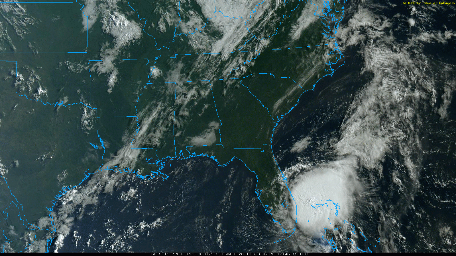
Tropical Storm “Isaias” is edging towards the east coast of Florida with maximum sustained winds of 65 mph. Images courtesy NOAA, College of DuPage
Overview
“Isaias” weakened slightly yesterday into “tropical storm” status and it remains so early Sunday morning despite a burst of deep convection in the overnight hours. That burst of thunderstorm activity has not resulted in any significant improvement in the overall structure of “Isaias” which is currently about 40 miles southeast of West Palm Beach, FL and it is not outside the realm of possibility that it regains enough strength later today to reach weak hurricane status. Nonetheless, “Isaias” will ride up to fairly close to the east-central coastline of Florida with some heavy rainfall and strong winds to last about 12 hours or so once they begin later this morning. On Monday, “Isaias” will begin to take a turn to the north and then northeast and likely make landfall somewhere in the Carolinas - perhaps as a hurricane. After that, “Isaias” will continue to ride up along the east coast and generate a major rain and wind event for the Mid-Atlantic and Northeast US - ultimately resulting in impact extending all the from Florida to Maine.
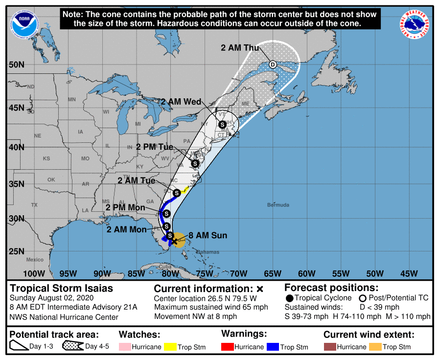
Tropical Storm “Isaias” will take a ride all the way up the eastern seaboard and accelerate as it does so. Map courtesy NOAA
Details
At 8 AM, “Isaias” was located just off the southeast coast of Florida with “tropical storm” status and maximum sustained winds of 65 mph. Its movement has slowed over the past 24 hours and it is currently moving to the NW at only 8 mph. Heavy rain and increasing winds have already spread across much of southern and eastern Florida as “Isaias” closes in on the east-central coastline.

Tropical Storm “Isaias” is now drifting over some very warm waters of the Gulf Stream with sea surface temperatures at or above 30 degrees (C). This could result in an intensification back to hurricane status by the time it makes a likely landfall late Monday somewhere in the Carolinas. Image courtesy weathermodels.com (Dr. Ryan Maue, Twitter), NOAA
Total rainfall amounts are expected to reach 2-4 inches across coastal counties of eastern Florida with wind gusts past 50 mph along the coastline. In addition to the rain and winds, there is the threat for isolated tornadoes as “Isaias” moves near the east-central Florida coastline sections later in the day.

A swath of heavy rain associated with “Isaias” will extend from Florida to Maine with the DC, Philly and NYC metro regions likely getting soaked on Tuesday. Map courtesy NOAA (5-day rain totals)
On Monday, “Isaias” will be push to near the Georgia coastline as it begins to make a gradual turn to the north and then northeast and then likely make landfall on Monday night somewhere in the Carolinas - perhaps as a hurricane; especially, if it spends all of its time over the warm water between now and then which is a strong possibility. As it climbs farther and farther to the north, Tropical Storm “Isaias” will accelerate and torrential rain and strong winds will likely arrive in the Mid-Atlantic’s I-95 corridor region by early Tuesday. In fact, at least a few inches of rain is possible on Tuesday/Tuesday night in the DC, Philly and NYC metro regions and there can be some damaging wind gusts; especially, along coastal sections. The heavy rain and strong winds from “Isaias” will reach the Northeast US by Tuesday night/early Wednesday and this tropical system could end up having an impact all the way from Florida to Maine.
Meteorologist Paul Dorian
Perspecta, Inc.
perspectaweather.com
Follow us on Facebook, Twitter, YouTube