
9:15 AM (Sunday) | *Tropical Storm Sally may reach hurricane status, slow down, and produce substantial rainfall amounts for the northern Gulf coast region from Southeast LA to the Florida Panhandle*
Paul Dorian
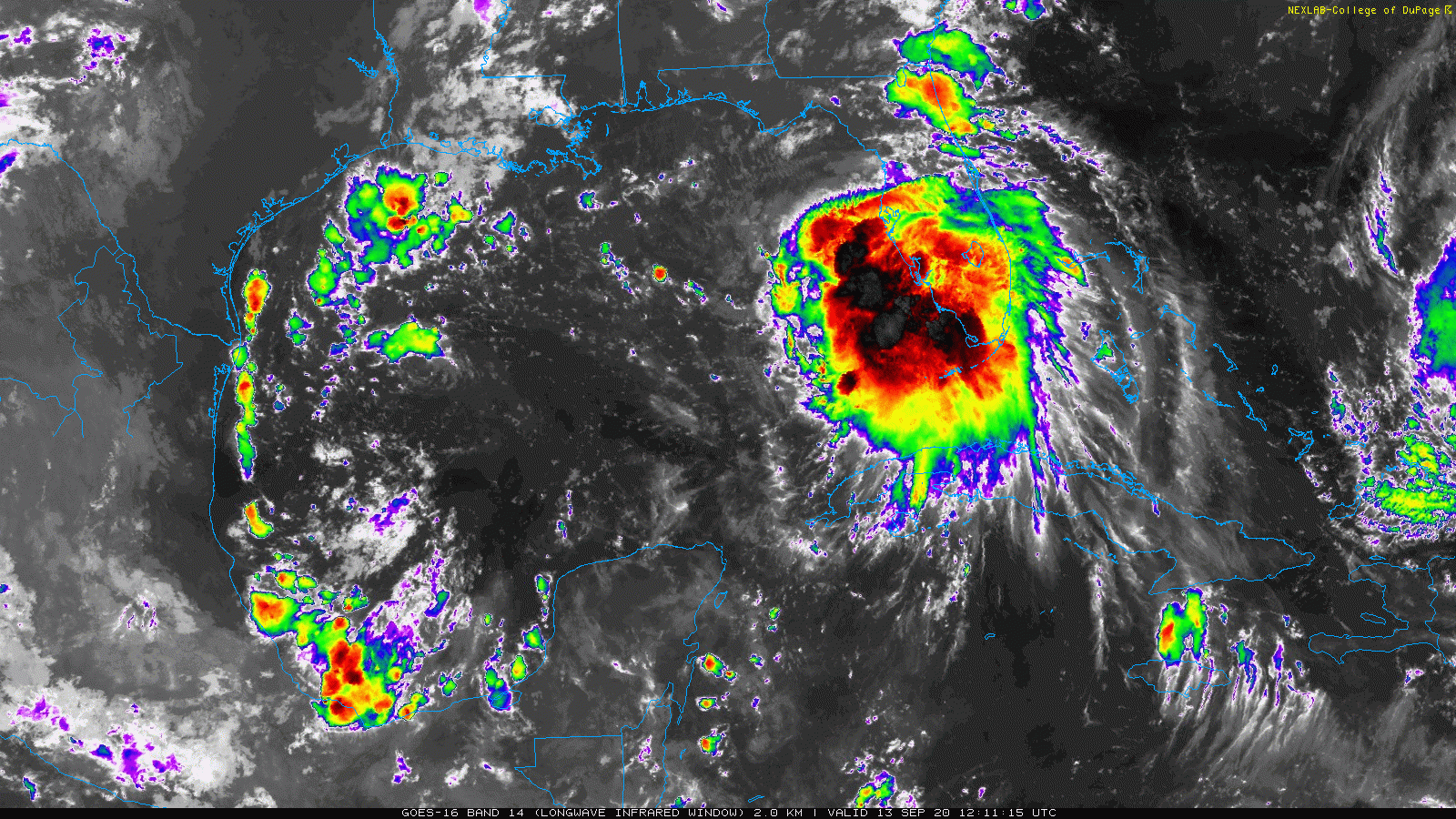
A healthy looking inner core this morning associated with Tropical Storm Sally over the warm waters of the eastern Gulf of Mexico. Images courtesy NOAA/College of DuPage
Overview
The very active 2020 Atlantic Basin tropical season continues as we reach the middle part of September with multiple systems on the scene extending from the western Gulf of Mexico to the eastern Atlantic Ocean. One of these systems is currently categorized as a hurricane, “Paulette”, and it is likely to impact Bermuda in the near-term. There are two tropical storms in the mix including “Rene” in the central part of the tropical Atlantic and “Sally” now over the eastern Gulf of Mexico. Tropical Storm Sally is of great concern to the northern Gulf coast region as it could slow down near and after landfall - potentially resulting in substantial rainfall amounts of more than a foot by the middle of the week. The remnants of Tropical Storm Sally are likely to push inland at mid-week bringing significant rains to the south-central states and then into the Carolinas.

Tropical Storm Sally can bring substantial rainfall amounts of a foot or more to the region extending from southeastern Louisiana to the western part of the Florida Panhandle. Map courtesy NOAA
Tropical Storm Sally
Tropical Storm Sally looks quite healthy this morning as it pushes to the west-northwest over the eastern Gulf of Mexico with maximum sustained winds of 50 mph. There has been some northwesterly wind shear in the region of Tropical Storm Sally recently; however, this is likely to weaken later today allowing for some intensification. In fact, there is a decent chance that Sally intensifies into hurricane status as it continues on a track towards the northern Gulf coast. The overall wind field is likely to weaken as Tropical Storm Sally nears landfall on Tuesday – likely somewhere in southeastern Louisiana, and the slow movement may continue for awhile after landfall. As a consequence, the potential exists for a substantial amount of rainfall from southeastern Louisiana to the western part of the Florida Panhandle – perhaps on the order of one to two feet of total rainfall amounts.

Sea surface temperatures are warmer-than-normal in the Gulf of Mexico for the middle of September. Map courtesy NOAA, tropicaltidbits.com
After landfall, Sally is likely to push to the north and east bringing significant rainfall to the south-central US including the Tennessee Valley at mid-week. At the same time, strong high pressure will be pushing over the southern part of Canadian anchoring a chilly air mass for this time of year. At the leading edge of this chilly air mass will be a strong cold front that will be barreling to the southeast and towards the eastern US. There is a slight chance that the remnants of Tropical Storm Sally get intertwined with this cold front bringing some rain as far north as the Mid-Atlantic; however, it is more likely to turn to the east later in the week and dump heavy rainfall on the Carolinas. A chilly air mass will follow this frontal passage into the Mid-Atlantic/Northeast US this weekend and it should result in some of the lowest temperatures so far this season.
Meteorologist Paul Dorian
Perspecta, Inc.
perspectaweather.com
Follow us on Facebook, Twitter, YouTube