10:05 AM (Wednesday) | *Hurricane Sally inches its way inland and continues to produce tremendous rainfall amounts on the northern Gulf coastal region*
Paul Dorian
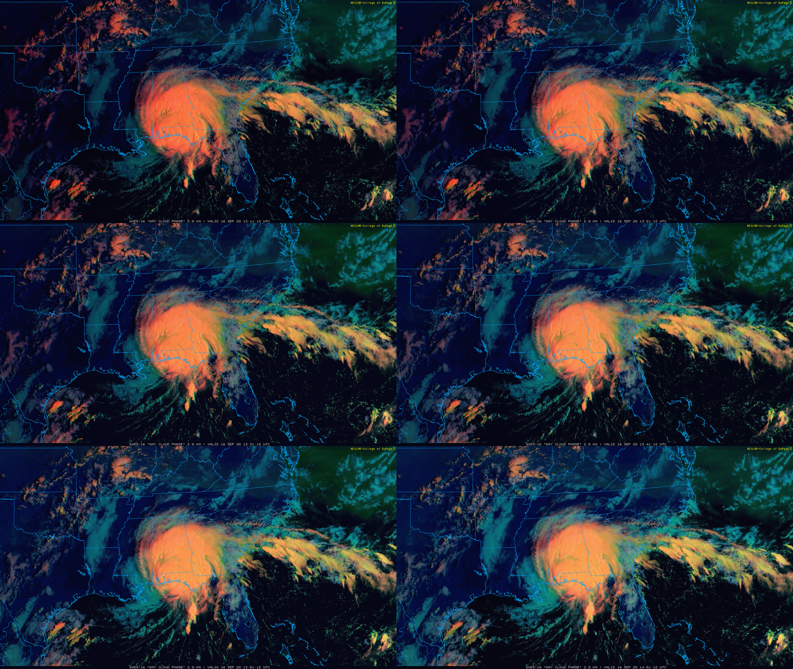
Hurricane Sally is now inching its way inland in the northern Gulf coastal region. Images courtesy NOAA, College of DuPage
Overview
The Atlantic Basin remains full of activity today with three hurricanes, Sally, Paulette and Teddy, and each one of them is currently categorized as category 2 storms with maximum sustained winds of 100 mph. Hurricane Sally continues to move painfully slowly in the northern Gulf region after making landfall around Gulf Shores, Alabama and will likely end up producing more than two feet of rain in some spots before finally pushing away later tonight and Thursday. Hurricane Paulette continues to move rapidly away from the US in an east-to-northeast direction while Hurricane Teddy likely heads towards Bermuda and it could soon reach “major” hurricane status. In fact, Hurricane Teddy will have to be closely monitored in coming days as a strong blocking high pressure system develops over southeastern Canada/NW Atlantic which may force this system to the northwest after passing over Bermuda (i.e., perhaps in the direction of northern New England). In addition, a strong tropical wave now spinning over the southwestern Gulf of Mexico has a good chance of intensifying over the next day or so; especially, after Hurricane Sally pushes farther inland, and it is likely to ominously meander around the warm Gulf for awhile.
Three hurricanes on the map this morning in the Atlantic Basin and all three are currently classified as category 2 with maximum sustained winds of 100 mph. The tropical waves in the southwestern Gulf of Mexico and eastern Atlantic (marked by orange “X”) are quite likely to intensify into tropical depression or storm status in the near term. Map courtesy NOAA/NHC
Hurricane Sally
Hurricane Sally made landfall today as a category 2 storm with maximum sustained winds of 100 mph and continues to move at a snail’s pace (3 mph). Later today, it will begin a slow push across southern Alabama and will then cross Georgia on Thursday and likely reach the Carolinas by late Friday. The slow movement of Hurricane Sally combined with an abundance of moisture in the atmosphere will allow for rainfall amounts to pile up during this event to some incredible amounts in some cases exceeding two feet. The region ending up with the highest rainfall amounts from Hurricane Sally will likely extend from just west of Tallahassee, Florida to Mobile Bay, Alabama.
Computer forecast map for later today indicates smoke from western wildfires will extend across much of the northern US and western Atlantic. Map courtesy NOAA
Mid-Atlantic/Northeast US
In the Mid-Atlantic region, temperatures this morning dropped to the 40’s again in many suburban locations along the I-95 corridor and struggled to reach the 70 degree mark for highs on Tuesday. And while there is plenty of sunshine today to go along with the cool conditions, the sun continues to be dimmed by an upper-level (20,000-25,000 feet) layer of smoke that originated from the wildfires in the western states. The smoky layer aloft has resulted in very brilliant orange/red sunrises and sunsets in the Mid-Atlantic region.
A chilly air mass for this time of year makes it into the Great Lakes/Mid-Atlantic/Northeast US by the weekend. Map courtesy NOAA, tropicaltidbits.com
An even cooler air mass will arrive in the Mid-Atlantic region and Northeast US on Friday following the passage of a strong cold front and afternoon highs may be confined to the 60’s from Friday through Monday in many spots – a real taste of fall and well below-normal temperatures for this time of year. The smoky layer in the upper part of the atmosphere should get pushed out on Friday by the incoming cooler-than-normal Canadian air mass. In terms of rainfall from the remnants of Sally, it continues to look like the heaviest amounts will make it as far north as southeastern Virginia and perhaps the southern tip of the Delmarva Peninsula – likely staying just to the south and east of the DC-to-Philly-to-NYC corridor.
Meteorologist Paul Dorian
Perspecta, Inc.
perspectaweather.com
Follow us on Facebook, Twitter, YouTube
Video discussion:


