8:30 AM (Sunday) | *****"Major" Hurricane Ida closing in on Louisiana…rapid intensification has brought it to near Category 5…post-landfall track brings heavy rain to TN Valley/Mid-Atlantic/NE US*****
Paul Dorian

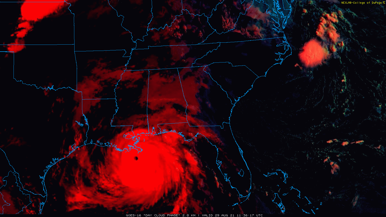
A well-defined eye is visible early today as Hurricane Ida closes in on the Louisiana coastline. Images courtesy College of DuPage, NOAA
Overview
Hurricane Ida is making a run at Category 5 status in the remaining few hours before landfall along the southeastern Louisiana coastline. The latest observations of Ida include a well-defined eye, max sustained winds at 150 mph after rapid intensification of this system in the past 24 hours, and a northwest movement towards the Louisiana coastline. After landfall later today, Hurricane Ida will remain quite strong as it moves inland and it will gradually turn to the north in the nighttime hours and then take a turn to the northeast by mid-week. The post-landfall track will bring significant rainfall to the Tennessee Valley and then to the Mid-Atlantic region/Northeast US in the Wednesday/Thursday time period.

Hurricane Ida is now a strong Category 4 storm and not far away from attaining Category 5 status as it approaches the Louisiana coastline. Table courtesy NOAA
Discussion
The combination of a favorable upper-air pattern and very warm sea surface temperatures has resulted in rapid intensification of Hurricane Ida just as feared and it is now not far away from attaining Category 5 status as it closes in on the southeastern Louisiana coastline. Preliminary reports have a drop in the central pressure of Hurricane Ida of 40 millibars in a 12-hour period which puts it on par with the explosive development of two other Gulf systems: Hurricane Allen in 1980 and Hurricane Rita in 2005 (source: Philip Klotzbach, Twitter, NOAA/NHC). Hurricane Ida will remain over these warm waters with high oceanic heat content for another few hours and there can be some additional strengthening until landfall. After landfall, rapid weakening will take place due to the interaction with land and an increase in westerly vertical wind shear. While the weakening will bring a reduction in the winds, heavy rain will continue during the next few days along the path of the remnants of Hurricane Ida – first into the Tennessee Valley and then into the Mid-Atlantic region/Northeast US at mid-week.

After causing tremendous rainfall amounts along the Gulf coast in the near-term, Hurricane Ida will push significant rainfall to the Tennessee Valley, Mid-Atlantic and Northeast US during the next few days. Map courtesy NOAA
At 8 AM, Hurricane Ida has reached strong Category 4 status and is just a stone’s throw away from Category 5, with max sustained winds of 150 mph, central pressure of 27.55 inches (933 millibars), and a movement to the NW at 15 mph. Landfall is expected across the Louisiana coastline during the late morning or early afternoon hours. Hurricane-force winds extend outward some 50 miles from the center and tropical-storm winds extend outward about 140 miles.

00Z Euro model forecast map for Thursday morning features heavy rainfall from the remnants of Hurricane Ida all the way into the Mid-Atlantic region and Northeast US. Map courtesy ECMWF, WSI, Inc.
After landfall, the remnants of Ida will push to the north initially and slow down some and then take a turn to the northeast by mid-week. This kind of a post-landfall track will bring significant rainfall to the Tennessee Valley – where they don’t need it – and then to the Mid-Atlantic region at mid-week with several inches of rain on the table.
Meteorologist Paul Dorian
Peraton
peratonweather.com