10:15 AM Sunday | ***Accumulating snow and ice on the way with an impactful storm…rain, high winds, coastal flooding as well…another storm threat next weekend***
Paul Dorian

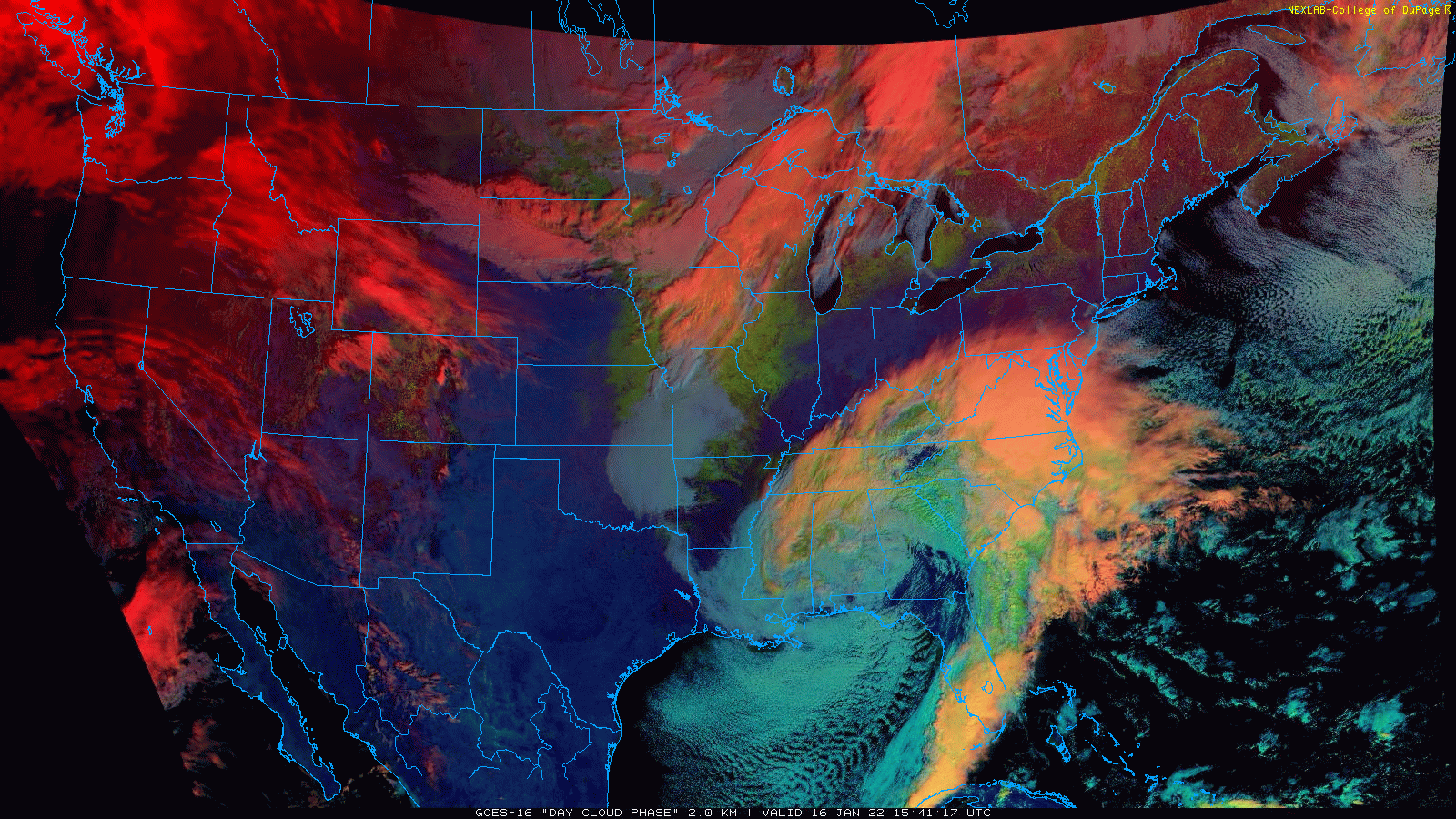
Low pressure strengthening in the southeastern US will have a big impact on the entire eastern US over the next 24-36 hours. Images courtesy College of DuPage, NOAA
Overview
Very cold, dry and dense Arctic air is well established this morning in the Mid-Atlantic/Northeast US at the same time low pressure and its associated moisture field are now pushing to the north from the southeastern states...not a good combination. A significant ice and snow event is now unfolding for the interior sections of Georgia and the Carolinas and snow will push into the Mid-Atlantic region later in the day and early tonight with front-end accumulations in the DC-to-Philly-to-NYC corridor. With an influx of milder air from the ocean, a transition will take place in the I-95 corridor from snow to sleet to freezing rain and ultimately to plain rain in some areas. In addition to the wide range of precipitation types, this storm will bring high and potentially damaging winds and coastal flooding to the Mid-Atlantic region and Northeast US. Looking ahead, another storm could very well threaten the same part of the country next weekend.

Lots of colors on this surface forecast map for early this evening with a range of precipitation from “ordinary” rain (green), heavy rain (yellow, orange), snow (blue) and sleet/freezing rain (purple/pink). Map courtesy NOAA, tropicaltidbits.com
Details
Temperatures dropped into the single digits and teens this morning parts of the DC-to-Philly-to-NYC corridor and dew points (a measure of total moisture content of the air) remained at very dry levels indicative of a true Arctic air mass. Low pressure is gathering strength over the southeastern states and snow and ice have already broken out across upstate Georgia, the Carolinas, and even parts of Virginia. In fact, the interior sections of Georgia and the Carolinas are in store for quite a winter storm with serious icing in some areas and significant snow of 6-12 inches in some of the highest elevation, interior locations. There can actually be some small snow accumulations from this storm system all the way down into northern Alabama (e.g., Huntsville).

A low-level jet streak will play a role in this upcoming event with high and potentially damaging winds possible; especially, along coastal sections of the Mid-Atlantic/Northeast US. Map courtesy NOAA, tropicaltidbits.com
The moisture field will push steadily to the north over the next few hours and snow should arrive in the DC metro region during the early-to-mid afternoon hours then mid-to-late afternoon in Philly, and by early evening in NYC. As the surface low pressure system moves northward later today, it’ll take on an inland track near or over Route I-95 in the southern Mid-Atlantic and then likely end up over the south-central part of Pennsylvania by early Monday. This kind of path will allow for milder air to push in from the western Atlantic Ocean riding in on east-to-southeast low-level winds in the lower levels of the atmosphere. As a result, the DC-to-Philly-to-NYC corridor will see the snow transition to sleet and then to freezing rain and eventually to plain rain in many areas with above-freezing temperatures by early Monday. On Monday morning, enough colder air may wrap back around the storm system after it pushes to the north for a change back of the precipitation to all snow in parts of the region.

High winds will be a big factor during the upcoming storm with the potential of damaging gusts along coastal sections from Maine-to-Virginia. Map courtesy NOAA/NCEP
A word of caution about tonight’s icing, the freezing rain can last for an extended period of time in some of the normally colder far northern and western suburbs of the big cities as the cold, dry, dense Arctic air will be reluctant to give up its ground to allow for above-freezing temperatures. Also, the rain that falls later tonight can actually become heavy at times; especially, along and to the south and east of Route I-95 and a thunderstorm is not out of the question in some spots. The heaviest snowfall amounts from this storm are likely to take place in the zone extending from eastern Ohio/West Virginia/far western Virginia northward to western/central PA and into western/central NY and interior New England.
In terms of snowfall amounts for the immediate DC-to-Philly-to-NYC corridor during the front-end of the storm, here are the latest estimates which remain the same as projected on Saturday:
DC metro region: 2-5 inches with the higher amounts in that range across the nearby western/southwestern suburbs (e.g., Chantilly, VA, Springfield, VA) and the lower amounts to the south and east of the District; some of the far western and northwestern suburbs could see as much as 6 inches of snow on the front-end of the storm before the mixing develops (e.g., Culpeper, VA, Frederick, MD)
Philly metro region: 1-4 inches with the higher amounts in the far northwestern suburbs of Philly (e.g., Pottstown, PA, Gilbertsville, PA) and the lower amounts in the city and nearby spots just to the south and east of there
NYC metro region: coating to 3 inches with highest amounts in the far northwestern suburbs of the city
Coastal sections of New Jersey and the Delaware Peninsula: little or no snow accumulations are expected.
Another important factor with this unfolding storm will be the expected high and potentially damaging winds. A strong low-level jet will develop just a couple thousand feet off of ground-level as this storm reaches its full potential from later today through the day on Monday. As a result, there can be high winds gusts of 40-50 mph during the storm’s peak from later today through the day on Monday in the Mid-Atlantic/Northeast US and even higher gusts are possible along coastal sections from Maine to Virginia. The strongest winds on the front side of the storm later today/early tonight will be from an east-to-southeast direction and then strong west-to-northwest winds will follow on Monday with the passage of the storm to the north. Given the expected strong onshore winds for awhile on the front-side of the storm and the approaching full moon, coastal flooding will become a serious threat on Sunday night and Monday at times of high tide. This threat of coastal flooding will not only be along the Atlantic coastline (e.g., New Jersey, Delaware), but also around the Delaware and Chesapeake Bays (e.g., Annapolis, MD).

The overall weather pattern remains active and cold for the next couple of weeks in the eastern states. The 500 mb pattern is quite conducive for a storm next weekend with a deep upper-level low overhead…something to closely monitor this week. Map courtesy NOAA, Weather Bell Analytics
Looking ahead
The weather pattern looks to remain quite a bit colder-than-normal during the remainder of the month of January across the eastern US. In fact, the potential exists for some extreme cold during the last full week of the month beginning in about a week or so. Furthermore, the pattern looks to remain active with multiple storm threats likely as we progress through the next couple of weeks. Indeed, there is the potential for a serious storm threat next weekend in the Mid-Atlantic/NE US…stay tuned…it could be a wild ride.
Meteorologist Paul Dorian
Arcfield
arcfieldweather.com