
7:15 AM | *California-to-Texas heat to intensify and expand eastward next week to Southeast US...revisiting the brutally hot summer of 1980...hard-pressed to match that one*
Paul Dorian

Overview
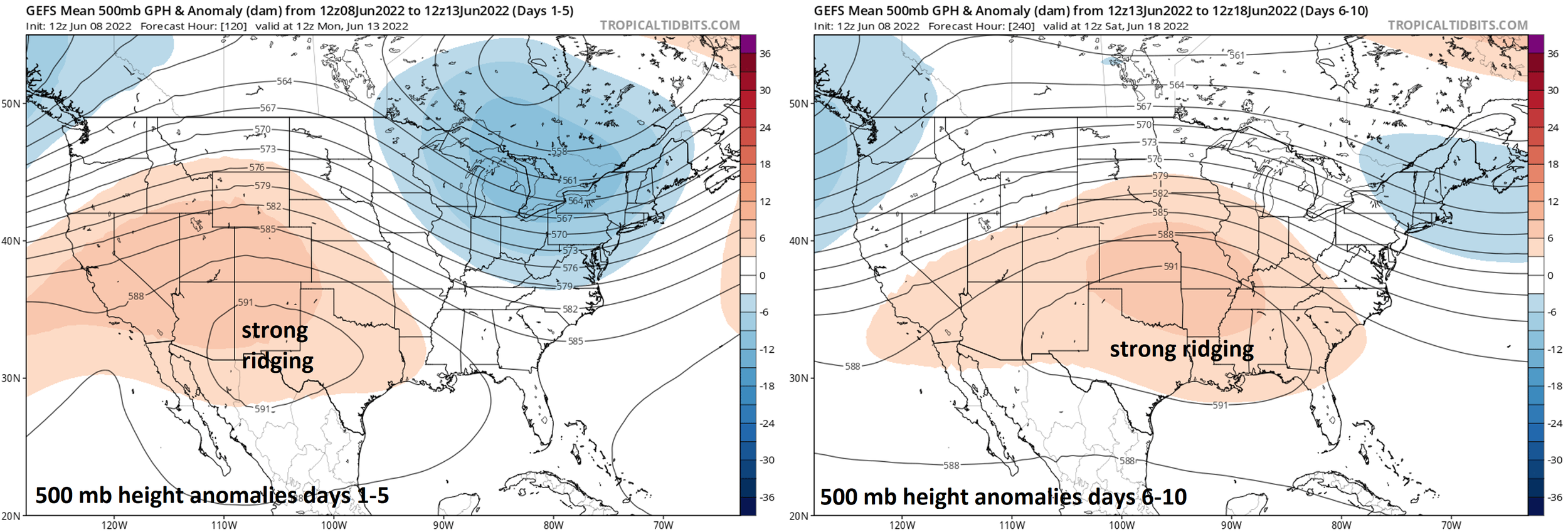
Highs temperatures on Friday are likely to reach 100 degrees in Dallas, Texas and this could begin an impressive string of days at or above the century mark in that particular location. High pressure ridging has been quite strong recently in the region from California-to-Texas and it will intensify over the next few days and then build eastward next week all the way to the Southeast US coastline. It is not unprecedented to see this kind of June heat in Texas or other parts of the southern states and Dallas will have a tough time matching the sustained and extreme heat of the summer of 1980.

Details
Temperatures today will climb to the middle 90’s in Dallas, Texas and quite likely reach or slightly surpass the century mark on Friday. In fact, tomorrow could be the beginning of an impressive stretch of weather in northern Texas with high temperatures at or above 100 degrees as upper-level high pressure ridging intensifies in the region from California-to-Texas. By the early part of next week, this strong high pressure ridging across the southwestern states will expand eastward bringing hot weather all the way to the southeastern states and northward to the northern Mississippi and Ohio Valley regions.
This kind of heat during the month of June is not unprecedented for Dallas or other sections of the southern US. The summer of 1980 was, in fact, quite amazing for its persistent and very strong high pressure ridging that focused its wrath over the south-central states leading to unrelenting heat throughout much of June, July and August. Indeed, the daily high temperatures in Dallas during the period from June 23rd to July 3rd of 1980 were very impressive as follows: 104, 106, 109, 113, 113, 112, 108, 107, 109, 110, and 109 (credit Meteorologist Dr. Ryan Maue, Twitter). The upcoming heat wave in the south-central states will certainly have a difficult time in matching the brutally hot summer of 1980.

The heat wave will expand eastward early next week reaching all the way to the eastern seaboard. Map courtesy NOAA
Looking ahead, there are a few signs that the strong high pressure ridging that sets up across the south-central US early next week may shift northward later this month…just too far away to be certain. Finally, while the southern states from the west coast-to-the east coast experience this upcoming hot weather pattern, the Pacific Northwest and Northeast US will continue to have pretty comfortable weather conditions…at least for the next several days.
Meteorologist Paul Dorian
Arcfield
arcfieldweather.com
Follow us on Facebook, Twitter, YouTube
Video discussion: